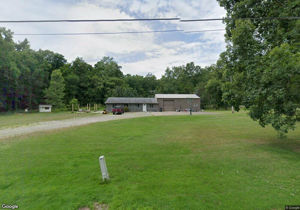
604 State Route 511 Ashland, OH 44805
Estimated Value: $142,000 - $195,000
1
Bed
1
Bath
1,144
Sq Ft
$146/Sq Ft
Est. Value
About This Home
This home is located at 604 State Route 511, Ashland, OH 44805 and is currently estimated at $167,126, approximately $146 per square foot. 604 State Route 511 is a home located in Ashland County with nearby schools including Mapleton Elementary School, Mapleton Middle School, and Mapleton High School.
Ownership History
Date
Name
Owned For
Owner Type
Purchase Details
Closed on
Jun 3, 2022
Sold by
Simone Joseph D
Bought by
Sheehan David Matthew and Sheehan Michaela Marie
Current Estimated Value
Home Financials for this Owner
Home Financials are based on the most recent Mortgage that was taken out on this home.
Original Mortgage
$145,500
Outstanding Balance
$130,706
Interest Rate
5.11%
Mortgage Type
New Conventional
Estimated Equity
$36,420
Purchase Details
Closed on
Jun 22, 2010
Bought by
Simone Joseph D
Purchase Details
Closed on
Jan 2, 1998
Sold by
Simonson Robert M
Purchase Details
Closed on
Jan 1, 1990
Bought by
Simonson Robert M
Create a Home Valuation Report for This Property
The Home Valuation Report is an in-depth analysis detailing your home's value as well as a comparison with similar homes in the area
Home Values in the Area
Average Home Value in this Area
Purchase History
| Date | Buyer | Sale Price | Title Company |
|---|---|---|---|
| Sheehan David Matthew | $37,500,000 | None Listed On Document | |
| Sheehan David Matthew | $150,000 | None Listed On Document | |
| Simone Joseph D | $45,000 | -- | |
| -- | $67,500 | -- | |
| Simonson Robert M | -- | -- |
Source: Public Records
Mortgage History
| Date | Status | Borrower | Loan Amount |
|---|---|---|---|
| Open | Sheehan David Matthew | $145,500 | |
| Closed | Sheehan David Matthew | $145,500 |
Source: Public Records
Tax History Compared to Growth
Tax History
| Year | Tax Paid | Tax Assessment Tax Assessment Total Assessment is a certain percentage of the fair market value that is determined by local assessors to be the total taxable value of land and additions on the property. | Land | Improvement |
|---|---|---|---|---|
| 2024 | $1,119 | $33,890 | $6,910 | $26,980 |
| 2023 | $1,119 | $33,890 | $6,910 | $26,980 |
| 2022 | $1,032 | $27,110 | $5,530 | $21,580 |
| 2021 | $1,034 | $27,110 | $5,530 | $21,580 |
| 2020 | $962 | $27,110 | $5,530 | $21,580 |
| 2019 | $849 | $23,230 | $5,500 | $17,730 |
| 2018 | $891 | $23,230 | $5,500 | $17,730 |
| 2017 | $814 | $23,230 | $5,500 | $17,730 |
| 2016 | $814 | $21,110 | $4,990 | $16,120 |
| 2015 | $785 | $21,110 | $4,990 | $16,120 |
| 2013 | $902 | $23,260 | $4,980 | $18,280 |
Source: Public Records
Map
Nearby Homes
- 582 County Road 801
- V/L State Route 511
- 829 County Road 801
- 810 Township Road 1101 Unit 22
- 810 Township Road 1101
- 1315 Lake Dr
- 89 Hickey St
- 79 Hickey St
- 821 Main St
- 885 State Route 58
- 341 B State Route 511
- 504 Ohio 89
- 1293 Us Rt 224
- 1293 Us Highway 224
- 443 Township Road 462
- 439 N Main St
- 732 Ohio 89
- 3025 Cinnamon Dr W
- 3027 Cinnamon Dr W
- 1404 Township Road 956
- 604 State Route 511
- 604 Ohio 511
- 603 State Route 511
- 930 County Road 620
- 936 County Road 620
- 932 County Road 620
- 926 County Road 620
- 982 County Road 620
- 924 County Road 620
- 918 County Road 620
- 933 County Road 620
- 925 County Road 620
- 921 County Road 620
- 640 State Route 511
- 916 County Road 620
- 929 County Road 620
- 0 Co Road 620
- 912 County Road 620
- 915 County Road 620
- 560 State Route 511