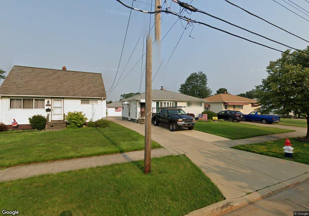
6040 Michael Dr Brookpark, OH 44142
Estimated Value: $193,602 - $228,000
3
Beds
2
Baths
936
Sq Ft
$229/Sq Ft
Est. Value
About This Home
This home is located at 6040 Michael Dr, Brookpark, OH 44142 and is currently estimated at $214,151, approximately $228 per square foot. 6040 Michael Dr is a home located in Cuyahoga County with nearby schools including Berea-Midpark Middle School, Berea-Midpark High School, and Huber Heights Preparatory Academy Parma Academy.
Ownership History
Date
Name
Owned For
Owner Type
Purchase Details
Closed on
May 21, 2012
Sold by
Estate Of Ethel Furin Lucas
Bought by
Kalinski Ann M and Lucas Thomas E
Current Estimated Value
Purchase Details
Closed on
Nov 17, 2011
Sold by
Kalinski Ann M and Lucas Thomas E
Bought by
Lucas Ethel
Purchase Details
Closed on
Sep 30, 2003
Sold by
Lucas Ethel and Lucas Ethel F
Bought by
Lucas Ethel
Purchase Details
Closed on
Jun 26, 1991
Sold by
Lucas John E and Lucas Ethel F
Bought by
Lucas Ethel F
Purchase Details
Closed on
Jan 1, 1975
Bought by
Lucas John E and Lucas Ethel F
Create a Home Valuation Report for This Property
The Home Valuation Report is an in-depth analysis detailing your home's value as well as a comparison with similar homes in the area
Home Values in the Area
Average Home Value in this Area
Purchase History
| Date | Buyer | Sale Price | Title Company |
|---|---|---|---|
| Kalinski Ann M | -- | None Available | |
| Lucas Ethel | -- | Attorney | |
| Lucas Ethel | -- | -- | |
| Lucas Ethel F | -- | -- | |
| Lucas John E | -- | -- |
Source: Public Records
Tax History
| Year | Tax Paid | Tax Assessment Tax Assessment Total Assessment is a certain percentage of the fair market value that is determined by local assessors to be the total taxable value of land and additions on the property. | Land | Improvement |
|---|---|---|---|---|
| 2025 | $2,854 | $55,685 | $12,215 | $43,470 |
| 2024 | $2,871 | $55,685 | $12,215 | $43,470 |
| 2023 | $3,036 | $48,760 | $9,350 | $39,410 |
| 2022 | $3,015 | $48,760 | $9,350 | $39,410 |
| 2021 | $2,999 | $48,760 | $9,350 | $39,410 |
| 2020 | $2,706 | $38,710 | $7,420 | $31,290 |
| 2019 | $2,627 | $110,600 | $21,200 | $89,400 |
| 2018 | $2,469 | $38,710 | $7,420 | $31,290 |
| 2017 | $2,510 | $34,300 | $6,930 | $27,370 |
| 2016 | $2,490 | $34,300 | $6,930 | $27,370 |
| 2015 | $2,341 | $34,300 | $6,930 | $27,370 |
| 2014 | $2,341 | $34,300 | $6,930 | $27,370 |
Source: Public Records
Map
Nearby Homes
- 6095 Stark Dr
- 6103 Westbrook Dr
- 6024 Brook Ct
- 6014 Westbrook Dr
- 6065 Mercer Dr
- 14761 Larkfield Dr
- 14801 Larkfield Dr
- 14242 Holland Rd
- 14024 Donald Dr
- 14396 Park Dr
- 13442 Havendale Dr
- 13670 Middlebrook Blvd
- 13602 Holland Rd
- 5952 Delores Blvd
- 15995 Paulding Blvd
- 6330 Sandfield Dr
- 6386 Sandfield Dr
- 6330 Ledgebrook Dr
- 6377 Ledgebrook Dr
- 6330 Stonecrest Dr
- 6046 Michael Dr
- 6034 Michael Dr
- 6052 Michael Dr
- 6028 Michael Dr
- 6022 Michael Dr
- 6058 Michael Dr
- 6041 Morrow Dr
- 6035 Morrow Dr
- 6047 Morrow Dr
- 6053 Morrow Dr
- 6029 Morrow Dr
- 6064 Michael Dr
- 6016 Michael Dr
- 6041 Michael Dr
- 6035 Michael Dr
- 6059 Morrow Dr
- 6023 Morrow Dr
- 6047 Michael Dr
- 6029 Michael Dr
- 6053 Michael Dr
Your Personal Tour Guide
Ask me questions while you tour the home.