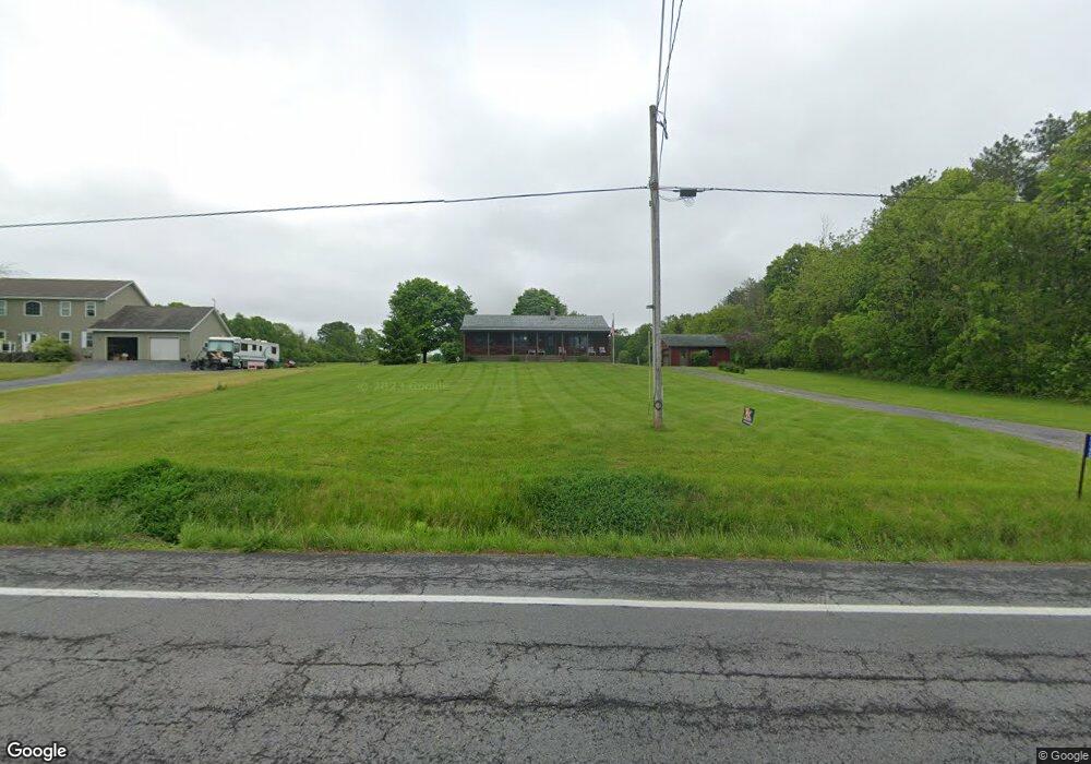
6040 State Route 90 N Cayuga, NY 13034
Estimated Value: $269,957 - $319,000
3
Beds
2
Baths
1,440
Sq Ft
$203/Sq Ft
Est. Value
About This Home
This home is located at 6040 State Route 90 N, Cayuga, NY 13034 and is currently estimated at $292,489, approximately $203 per square foot. 6040 State Route 90 N is a home with nearby schools including Andrew J. Smith Elementary School, Union Springs Middle School, and Union Springs Middle/High School.
Ownership History
Date
Name
Owned For
Owner Type
Purchase Details
Closed on
Apr 23, 2024
Sold by
Irrevocable Byron H and Irrevocable Ann
Bought by
Brooks Mathew R
Current Estimated Value
Home Financials for this Owner
Home Financials are based on the most recent Mortgage that was taken out on this home.
Original Mortgage
$190,000
Outstanding Balance
$183,344
Interest Rate
6.79%
Mortgage Type
New Conventional
Estimated Equity
$109,145
Create a Home Valuation Report for This Property
The Home Valuation Report is an in-depth analysis detailing your home's value as well as a comparison with similar homes in the area
Home Values in the Area
Average Home Value in this Area
Purchase History
| Date | Buyer | Sale Price | Title Company |
|---|---|---|---|
| Brooks Mathew R | $244,000 | Stewart Title |
Source: Public Records
Mortgage History
| Date | Status | Borrower | Loan Amount |
|---|---|---|---|
| Open | Brooks Mathew R | $190,000 |
Source: Public Records
Tax History Compared to Growth
Tax History
| Year | Tax Paid | Tax Assessment Tax Assessment Total Assessment is a certain percentage of the fair market value that is determined by local assessors to be the total taxable value of land and additions on the property. | Land | Improvement |
|---|---|---|---|---|
| 2024 | $4,513 | $177,000 | $26,100 | $150,900 |
| 2023 | $4,499 | $177,000 | $26,100 | $150,900 |
| 2022 | $4,596 | $177,000 | $26,100 | $150,900 |
| 2021 | $4,521 | $131,400 | $26,100 | $105,300 |
| 2020 | $3,593 | $131,400 | $26,100 | $105,300 |
| 2019 | $2,449 | $131,400 | $26,100 | $105,300 |
| 2018 | $4,950 | $131,400 | $26,100 | $105,300 |
| 2017 | $3,849 | $131,400 | $26,100 | $105,300 |
| 2016 | $3,043 | $131,400 | $26,100 | $105,300 |
| 2015 | -- | $131,400 | $26,100 | $105,300 |
| 2014 | -- | $131,400 | $26,100 | $105,300 |
Source: Public Records
Map
Nearby Homes
- 253 Wheat St
- 6176+6193 Lake - Center St
- 6176 Lake St
- 6198 Lake St
- 5849 State Route 90 N
- 2341 Lower Lake Rd
- 2342 Lower Lake Rd
- 2403 State Route 89
- 2138 New York 89
- 3092 E Bayard Street Extension
- 6689 State Route 90 N
- 2976 State Route 89
- 3066 State Route 89
- 6863 Baldwin Rd
- 6 Courtney Dr
- 6939 State Route 90 N
- 892 Clark Street Rd
- 91 E Bayard St
- 3266 State Route 89
- 7023 River Rd
- 6046 State Route 90 N
- 6039 State Route 90 N
- 6035 State Route 90 N
- 6022 State Route 90 N
- 6055 State Route 90 N
- 219 Manitau Rd
- 222 Manitau Rd
- 6000 State Route 90 N
- 6058 State Route 90 N
- 215 Manitau Rd
- 208 Manitau Rd
- 200 Manitau Rd
- 207 Manitau Rd
- 6124 Court St
- 201 Manitau Rd
- 6030 Lake St
- 6022 Lake St
- 5994 Lake St
- 5990 Lake St
- 5974 State Route 90 N