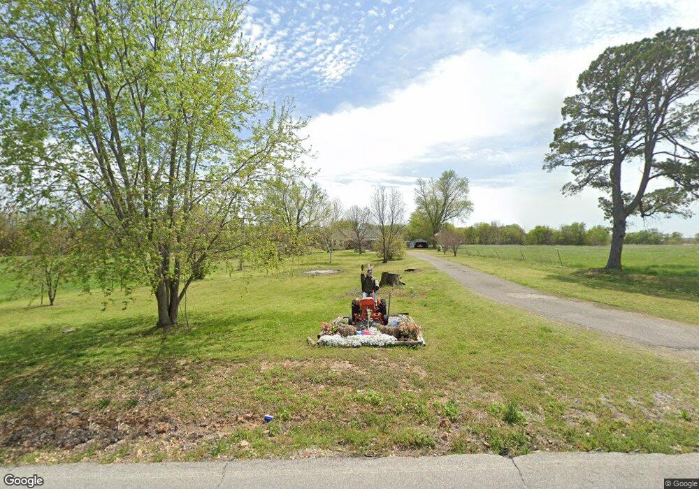
60401 E 190 Rd Fairland, OK 74343
Estimated Value: $146,939 - $237,000
3
Beds
2
Baths
1,125
Sq Ft
$160/Sq Ft
Est. Value
About This Home
This home is located at 60401 E 190 Rd, Fairland, OK 74343 and is currently estimated at $179,646, approximately $159 per square foot. 60401 E 190 Rd is a home located in Ottawa County with nearby schools including Fairland Elementary School and Fairland High School.
Ownership History
Date
Name
Owned For
Owner Type
Purchase Details
Closed on
Jul 22, 2024
Sold by
Panter Howard M and Panter Glenda S
Bought by
Gideon David L and Gideon Anita G
Current Estimated Value
Purchase Details
Closed on
Jan 26, 2023
Sold by
Earls Russell A and Earls Sandra K
Bought by
Stone Hedge Llc
Purchase Details
Closed on
Aug 25, 2004
Bought by
Gideon David L and Gideon Anita G
Purchase Details
Closed on
Mar 25, 2004
Bought by
Anderson Bill and Anderson Brad
Purchase Details
Closed on
Nov 26, 2003
Bought by
The Provident Bank
Create a Home Valuation Report for This Property
The Home Valuation Report is an in-depth analysis detailing your home's value as well as a comparison with similar homes in the area
Home Values in the Area
Average Home Value in this Area
Purchase History
| Date | Buyer | Sale Price | Title Company |
|---|---|---|---|
| Gideon David L | -- | None Listed On Document | |
| Stone Hedge Llc | -- | -- | |
| Gideon David L | $55,000 | -- | |
| Anderson Bill | $13,000 | -- | |
| Tcif Llc | -- | -- | |
| The Provident Bank | -- | -- |
Source: Public Records
Tax History Compared to Growth
Tax History
| Year | Tax Paid | Tax Assessment Tax Assessment Total Assessment is a certain percentage of the fair market value that is determined by local assessors to be the total taxable value of land and additions on the property. | Land | Improvement |
|---|---|---|---|---|
| 2025 | $508 | $6,151 | $1,343 | $4,808 |
| 2024 | $508 | $6,916 | $1,343 | $5,573 |
| 2023 | $508 | $8,094 | $1,343 | $6,751 |
| 2022 | $631 | $8,007 | $1,343 | $6,664 |
| 2021 | $582 | $7,773 | $1,343 | $6,430 |
| 2020 | $520 | $7,547 | $1,343 | $6,204 |
| 2019 | $534 | $7,632 | $1,154 | $6,478 |
| 2018 | $522 | $7,409 | $1,014 | $6,395 |
| 2017 | $507 | $7,193 | $878 | $6,315 |
| 2016 | $495 | $6,985 | $747 | $6,238 |
| 2015 | $486 | $6,270 | $674 | $5,596 |
| 2014 | $470 | $6,584 | $708 | $5,876 |
Source: Public Records
Map
Nearby Homes
- 61215 E 194 Rd
- 0 Tbd E 200 Rd
- 60780 E 198 Rd
- 0 E 198 Unit 2540584
- 0 E 198 Unit 2502236
- 19250 S 625 Rd
- 0 Hwy 60 Unit 2536880
- 19500 S 580 Rd
- 59300 E 170 Rd
- 20750 S 580 Rd
- 301 E Church Ave
- 60661 U S 60
- 16 E Church Ave
- 0 W Unit 25-1855
- 303 W Market Ave
- 63501 E 190 Rd
- 304 W Market Ave
- 324 Stauffer St
- 62400 E 220 Rd
- 56550 E Highway 60
- 60400 E 190 Rd
- 60500 E 190 Rd
- 60615 E 190 Rd
- 19201 S 604 Rd
- 60800 E 190 Rd
- 19500 S 605 Rd
- 60205 E 190 Rd
- 60521 E 190 Rd
- 19380 S 609 Rd
- 19051 S 609 Rd
- 19511 S 605 Rd
- 19514 S 605 Rd
- 19520 S 605 Rd
- 19540 S605 Rd
- 60201 E 185 Rd
- 60925 E 190 Rd
- 19530 S 605 Rd
- 60701 E 185 Rd
- 19540 S 605 Rd
- 0 S 610 Rd Unit 24-1130
