Estimated Value: $133,000 - $176,000
3
Beds
1
Bath
1,267
Sq Ft
$127/Sq Ft
Est. Value
About This Home
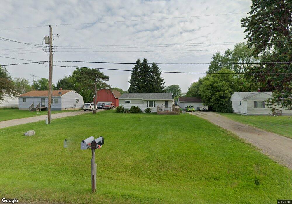
This home is located at 6043 E Pierson Rd, Flint, MI 48506 and is currently estimated at $160,441, approximately $126 per square foot. 6043 E Pierson Rd is a home located in Genesee County with nearby schools including Weston Elementary School, Kate Dowdall Elementary School, and Leota Fiedler Elementary School.
Ownership History
Date
Name
Owned For
Owner Type
Purchase Details
Closed on
Dec 13, 2018
Sold by
R A Taylor Llc
Bought by
Markle Kristy J and Sowa Kristy J
Current Estimated Value
Purchase Details
Closed on
Mar 20, 2012
Sold by
Reagle Sandra L
Bought by
R A Taylor Llc
Purchase Details
Closed on
Nov 12, 2010
Sold by
R A Taylor Llc
Bought by
Reagle Sandra L
Purchase Details
Closed on
Aug 23, 2010
Sold by
Raby Charles W and Raby Rebecca J
Bought by
R A Taylor Llc
Purchase Details
Closed on
Mar 19, 2001
Sold by
Raby Charles W
Bought by
Raby Charles W and Raby Rebecca J
Purchase Details
Closed on
Feb 12, 1999
Sold by
Bratton Kenneth L and Dyer Maria
Bought by
Raby Charles W
Create a Home Valuation Report for This Property
The Home Valuation Report is an in-depth analysis detailing your home's value as well as a comparison with similar homes in the area
Home Values in the Area
Average Home Value in this Area
Purchase History
| Date | Buyer | Sale Price | Title Company |
|---|---|---|---|
| Markle Kristy J | $44,900 | None Available | |
| R A Taylor Llc | -- | Greco Title | |
| Reagle Sandra L | -- | Greco Title | |
| R A Taylor Llc | $17,000 | Greco Title | |
| Raby Charles W | -- | Guaranty Title Company | |
| Raby Charles W | $71,000 | Lawyers Title Insurance Co |
Source: Public Records
Tax History
| Year | Tax Paid | Tax Assessment Tax Assessment Total Assessment is a certain percentage of the fair market value that is determined by local assessors to be the total taxable value of land and additions on the property. | Land | Improvement |
|---|---|---|---|---|
| 2025 | $1,453 | $67,300 | $0 | $0 |
| 2024 | $370 | $61,900 | $0 | $0 |
| 2023 | $353 | $55,400 | $0 | $0 |
| 2022 | $1,194 | $52,000 | $0 | $0 |
| 2021 | $1,184 | $47,100 | $0 | $0 |
| 2020 | $323 | $42,800 | $0 | $0 |
| 2019 | $318 | $37,700 | $0 | $0 |
| 2018 | $1,123 | $33,700 | $0 | $0 |
| 2017 | $1,088 | $32,400 | $0 | $0 |
| 2016 | $1,082 | $31,200 | $0 | $0 |
| 2015 | $879 | $29,500 | $0 | $0 |
| 2014 | $293 | $26,500 | $0 | $0 |
| 2012 | -- | $24,100 | $24,100 | $0 |
Source: Public Records
Map
Nearby Homes
- 4062 N Belsay Rd
- 6054 E Pierson Rd
- 3365 Eastdale Dr
- 6161 Finch Ln
- 3296 Mills Acres St
- 6443 Richfield Rd
- 3267 Mills Acres St
- 3179 Gehring Dr
- 3148 Gehring Dr
- 6363 Bluejay Dr
- 3485 N Vassar Rd
- 5067 Paro Dr
- 4435 Meadowbrook Dr
- 4413 Esta Dr
- 0 Sugar Maple Farms Unit 50195365
- 4455 N Genesee Rd
- 3246 Comer Dr
- 3413 Blue Lake Dr
- 0 Whisper Ridge Ct
- 4452 Muriel Dr
- 6051 E Pierson Rd
- 6037 E Pierson Rd
- 6059 E Pierson Rd
- 6027 E Pierson Rd
- 6064 Freedom Ln
- 6054 Freedom Ln
- 6048 Freedom Ln
- 6038 Freedom Ln
- 6067 E Pierson Rd
- 6028 Freedom Ln
- 6070 Freedom Ln
- 4010 N Belsay Rd
- 4018 N Belsay Rd
- 6077 E Pierson Rd
- 4026 N Belsay Rd
- 6028 E Pierson Rd
- 6044 E Pierson Rd
- 6036 E Pierson Rd
- 6078 Freedom Ln
- 4032 N Belsay Rd
Your Personal Tour Guide
Ask me questions while you tour the home.