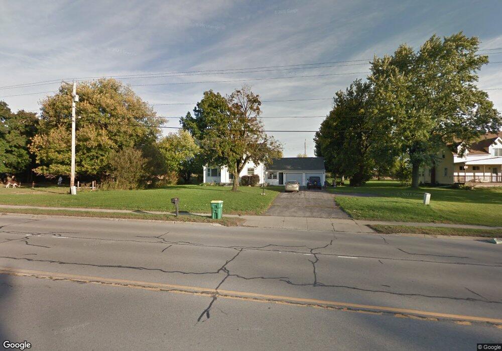
6043 Robinson Rd Lockport, NY 14094
South Lockport NeighborhoodEstimated Value: $181,000 - $349,000
3
Beds
1
Bath
1,428
Sq Ft
$180/Sq Ft
Est. Value
About This Home
This home is located at 6043 Robinson Rd, Lockport, NY 14094 and is currently estimated at $257,092, approximately $180 per square foot. 6043 Robinson Rd is a home located in Niagara County with nearby schools including Aaron Mossell Junior High School, Lockport High School, and Henrietta G Lewis Campus School.
Ownership History
Date
Name
Owned For
Owner Type
Purchase Details
Closed on
Apr 30, 2025
Sold by
Devine Patricia A
Bought by
Teeter Kyle
Current Estimated Value
Home Financials for this Owner
Home Financials are based on the most recent Mortgage that was taken out on this home.
Original Mortgage
$172,500
Outstanding Balance
$162,698
Interest Rate
6.67%
Mortgage Type
Seller Take Back
Estimated Equity
$94,394
Create a Home Valuation Report for This Property
The Home Valuation Report is an in-depth analysis detailing your home's value as well as a comparison with similar homes in the area
Home Values in the Area
Average Home Value in this Area
Purchase History
| Date | Buyer | Sale Price | Title Company |
|---|---|---|---|
| Teeter Kyle | $175,000 | Chicago Title |
Source: Public Records
Mortgage History
| Date | Status | Borrower | Loan Amount |
|---|---|---|---|
| Open | Teeter Kyle | $172,500 |
Source: Public Records
Tax History Compared to Growth
Tax History
| Year | Tax Paid | Tax Assessment Tax Assessment Total Assessment is a certain percentage of the fair market value that is determined by local assessors to be the total taxable value of land and additions on the property. | Land | Improvement |
|---|---|---|---|---|
| 2024 | $5,673 | $228,000 | $30,400 | $197,600 |
| 2023 | $5,336 | $207,000 | $25,400 | $181,600 |
| 2022 | $4,915 | $188,000 | $25,400 | $162,600 |
| 2021 | $4,397 | $128,000 | $16,500 | $111,500 |
| 2020 | $4,223 | $128,000 | $16,500 | $111,500 |
| 2019 | $2,711 | $128,000 | $16,500 | $111,500 |
| 2018 | $4,004 | $112,300 | $16,500 | $95,800 |
| 2017 | $4,053 | $112,300 | $16,500 | $95,800 |
| 2016 | $3,937 | $108,000 | $16,500 | $91,500 |
| 2015 | -- | $108,000 | $16,500 | $91,500 |
| 2014 | -- | $100,000 | $23,500 | $76,500 |
Source: Public Records
Map
Nearby Homes
- 6035 S Transit Rd
- 125 Sherwood Dr
- 6035 S Transit #288 Rd
- 287 Fox Hunt Dr
- 9 Crestwood Dr Unit 9
- 1132 Lockwood Dr Unit 1132
- 1045 Fernwood Dr
- 34 Del Ct W
- 6355 Robinson Rd
- 41 Del Ct W Unit 41
- 1227 Parkwood Dr
- 149 Crestwood Dr
- 1218 Maplewood Dr
- 1232 Maplewood Dr Unit 1232
- 145 Del Ct E Unit 145
- 263 Crestwood Ct E
- 92 Fox Cir Unit 92
- 109 B Elmhurst Dr
- 96 Elmhurst Dr Unit 96
- 1070 Fernwood Dr
- 6049 Robinson Rd
- 6027 Robinson Rd
- 6054 Robinson Rd
- 6060 Robinson Rd
- 6068 Robinson Rd
- 6030 Robinson Rd
- 1090 Robinson Rd
- 6064 Robinson Rd
- V/L Robinson
- 6023 Robinson Rd
- 6294 & 6298 Robinson Rd
- V/L Robinson Rd
- 5815 Robinson Rd
- 0 Robinson Rd
- 6016 Robinson Rd
- 6103 Robinson Rd
- 6108 Robinson Rd
- 6042 Robinson Rd
- 5994 Robinson Rd
- 6971 Kinne Rd