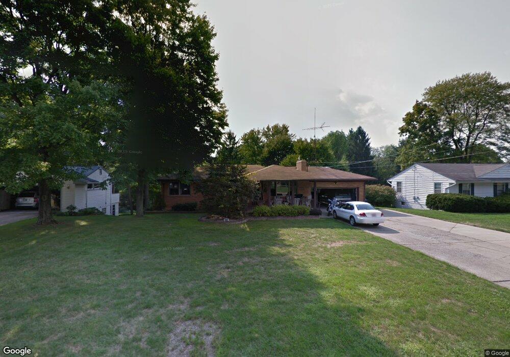
6047 Frontier Dr Youngstown, OH 44514
Estimated Value: $235,311 - $263,000
3
Beds
2
Baths
1,316
Sq Ft
$187/Sq Ft
Est. Value
About This Home
This home is located at 6047 Frontier Dr, Youngstown, OH 44514 and is currently estimated at $245,828, approximately $186 per square foot. 6047 Frontier Dr is a home located in Mahoning County with nearby schools including Poland Union Elementary School, Poland Middle School, and Poland Seminary High School.
Ownership History
Date
Name
Owned For
Owner Type
Purchase Details
Closed on
Jun 28, 2017
Sold by
Anderson Kris L and Anderson Marianne C
Bought by
Anderson Sheyna L and The Kris And Marianne Anderson Irrevocab
Current Estimated Value
Purchase Details
Closed on
Jun 3, 2016
Sold by
Hudy Sheyna L and Scott Anderson O
Bought by
Anderson Kris L and Anderson Marianne C
Purchase Details
Closed on
Mar 3, 2015
Sold by
Anderson Kris L and Anderson Marianne C
Bought by
Hudy Sheyn L and Scott Anderson O
Purchase Details
Closed on
May 30, 1986
Bought by
Anderson Kris L
Create a Home Valuation Report for This Property
The Home Valuation Report is an in-depth analysis detailing your home's value as well as a comparison with similar homes in the area
Purchase History
| Date | Buyer | Sale Price | Title Company |
|---|---|---|---|
| Anderson Sheyna L | -- | None Available | |
| Anderson Kris L | -- | Attorney | |
| Hudy Sheyn L | -- | Commonwealth Suburban Title | |
| Anderson Kris L | $59,500 | -- |
Source: Public Records
Tax History
| Year | Tax Paid | Tax Assessment Tax Assessment Total Assessment is a certain percentage of the fair market value that is determined by local assessors to be the total taxable value of land and additions on the property. | Land | Improvement |
|---|---|---|---|---|
| 2025 | $3,299 | $69,290 | $10,210 | $59,080 |
| 2024 | $3,397 | $69,290 | $10,210 | $59,080 |
| 2023 | $3,319 | $69,290 | $10,210 | $59,080 |
| 2022 | $2,777 | $48,450 | $10,210 | $38,240 |
| 2021 | $2,649 | $48,450 | $10,210 | $38,240 |
| 2020 | $2,660 | $48,450 | $10,210 | $38,240 |
| 2019 | $2,365 | $40,090 | $10,210 | $29,880 |
| 2018 | $2,216 | $40,090 | $10,210 | $29,880 |
| 2017 | $2,213 | $40,090 | $10,210 | $29,880 |
| 2016 | $2,415 | $41,580 | $10,210 | $31,370 |
| 2015 | $2,363 | $41,580 | $10,210 | $31,370 |
| 2014 | $2,372 | $41,580 | $10,210 | $31,370 |
| 2013 | $2,342 | $41,580 | $10,210 | $31,370 |
Source: Public Records
Map
Nearby Homes
- 6074 Frontier Dr
- 2751 Saginaw Dr
- 6534 Diana Dr
- 172 Lakeshore Dr
- 0 Clingan Rd Unit 4461196
- 3081 Heatherbrae Dr
- 6137 Acatello Place
- 2350 Hamilton Ave
- 118 N Main St
- 2301 Lyon Blvd
- 2370 Lyon Blvd
- 232 Edna St
- 50 College St
- 112 N Lima Rd
- 6695 Clingan Rd Unit 24
- 6695 Clingan Rd Unit 10
- 6695 Clingan Rd Unit 32
- 6695 Clingan Rd Unit 4
- 2035 Woodward Ave
- 43 Greystone
- 6033 Frontier Dr
- 6079 Frontier Dr
- 6189 Circle Dr
- 6199 Circle Dr
- 6009 Frontier Dr
- 6058 Frontier Dr
- 6042 Frontier Dr
- 6179 Circle Dr
- 6028 Frontier Dr
- 6095 Frontier Dr
- 6247 Duncan Dr
- 6235 Duncan Dr
- 6088 Frontier Dr
- 6261 Duncan Dr
- 6161 Circle Dr
- 6018 Frontier Dr
- 6221 Duncan Dr
- 6105 Circle Dr
- 6004 Frontier Dr
- 6190 Diana Dr
Your Personal Tour Guide
Ask me questions while you tour the home.