Estimated Value: $378,000 - $435,000
Studio
1
Bath
1,288
Sq Ft
$317/Sq Ft
Est. Value
About This Home
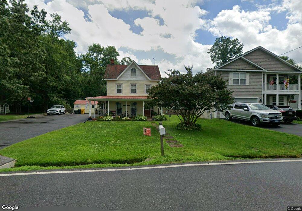
This home is located at 6049 Drum Point Rd, Deale, MD 20751 and is currently estimated at $408,832, approximately $317 per square foot. 6049 Drum Point Rd is a home located in Anne Arundel County with nearby schools including Deale Elementary School, Southern Middle School, and Southern High School.
Ownership History
Date
Name
Owned For
Owner Type
Purchase Details
Closed on
Mar 21, 2005
Sold by
3603 Partnership Llp
Bought by
Cowan Tina F
Current Estimated Value
Home Financials for this Owner
Home Financials are based on the most recent Mortgage that was taken out on this home.
Original Mortgage
$206,000
Outstanding Balance
$104,707
Interest Rate
5.75%
Mortgage Type
Adjustable Rate Mortgage/ARM
Estimated Equity
$304,125
Purchase Details
Closed on
Nov 19, 2003
Sold by
Girod Matthew B
Bought by
3603 Partnership Llp
Purchase Details
Closed on
Oct 5, 1992
Sold by
Whittington Elsie
Bought by
Girod Matthew B
Home Financials for this Owner
Home Financials are based on the most recent Mortgage that was taken out on this home.
Original Mortgage
$130,900
Interest Rate
7.93%
Create a Home Valuation Report for This Property
The Home Valuation Report is an in-depth analysis detailing your home's value as well as a comparison with similar homes in the area
Home Values in the Area
Average Home Value in this Area
Purchase History
| Date | Buyer | Sale Price | Title Company |
|---|---|---|---|
| Cowan Tina F | $257,500 | -- | |
| 3603 Partnership Llp | $300,000 | -- | |
| Girod Matthew B | $137,800 | -- |
Source: Public Records
Mortgage History
| Date | Status | Borrower | Loan Amount |
|---|---|---|---|
| Open | Cowan Tina F | $206,000 | |
| Closed | Cowan Tina F | $51,500 | |
| Previous Owner | Girod Matthew B | $130,900 |
Source: Public Records
Tax History
| Year | Tax Paid | Tax Assessment Tax Assessment Total Assessment is a certain percentage of the fair market value that is determined by local assessors to be the total taxable value of land and additions on the property. | Land | Improvement |
|---|---|---|---|---|
| 2025 | $2,275 | $243,600 | -- | -- |
| 2024 | $2,275 | $236,800 | $0 | $0 |
| 2023 | $2,204 | $230,000 | $172,100 | $57,900 |
| 2022 | $2,060 | $227,667 | $0 | $0 |
| 2020 | $1,960 | $223,000 | $172,100 | $50,900 |
| 2019 | $1,920 | $209,467 | $0 | $0 |
| 2018 | $1,987 | $195,933 | $0 | $0 |
| 2017 | $1,798 | $182,400 | $0 | $0 |
| 2016 | -- | $176,467 | $0 | $0 |
| 2015 | -- | $170,533 | $0 | $0 |
| 2014 | -- | $164,600 | $0 | $0 |
Source: Public Records
Map
Nearby Homes
- 6061 Drum Point Rd
- 703 Trapper Way
- 617 Ford Rd
- 610 E Marshall Ave
- 6069 Welch Ave
- 6040 Melbourne Ave
- 6065 Melbourne Ave
- 5931 Tyler Rd
- 5918 Sneed Dr
- 520 Ark Haven Rd
- 5930 Sneed Dr
- 6025 Franklin Gibson Rd
- 350 E Bay Front Rd
- 939 Main St
- 5741 Deale Churchton Rd
- 6370 Genoa Rd
- 962 Main St
- 964 Main St
- 968 Main St
- 6300 Town Point Rd
- 6047 Drum Point Rd
- 6051 Drum Point Rd
- 6045 Drum Point Rd
- 612 Whittington Place
- 610 Whittington Place
- 6058 Drum Point Rd
- 604 Whittington Place
- 6065 Drum Point Rd
- 6067 Drum Point Rd
- 611 Whittington Place
- 6050 Drum Point Rd
- 607 Whittington Place
- 6069 Drum Point Rd
- 6071 Drum Point Rd
- 605 Whittington Place
- 6042 Drum Point Rd
- 603 Whittington Place
- 614 Mann Rd
- 6140 Owings Beach Rd
- 616 Mann Rd
Your Personal Tour Guide
Ask me questions while you tour the home.