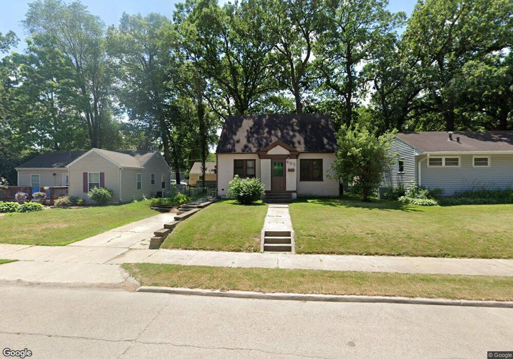
605 11th St NE Mason City, IA 50401
Estimated Value: $106,000 - $140,000
4
Beds
2
Baths
907
Sq Ft
$128/Sq Ft
Est. Value
About This Home
This home is located at 605 11th St NE, Mason City, IA 50401 and is currently estimated at $116,317, approximately $128 per square foot. 605 11th St NE is a home with nearby schools including Mason City High School, Mason City Seventh Day Adventi, and North Iowa Christian School.
Ownership History
Date
Name
Owned For
Owner Type
Purchase Details
Closed on
Oct 21, 2022
Sold by
Peterson Adam W
Bought by
Bms Storage Llc
Current Estimated Value
Home Financials for this Owner
Home Financials are based on the most recent Mortgage that was taken out on this home.
Original Mortgage
$35,838
Outstanding Balance
$27,460
Interest Rate
5.89%
Mortgage Type
New Conventional
Estimated Equity
$88,857
Purchase Details
Closed on
Sep 10, 2020
Sold by
Peterson William R
Bought by
Peterson Adam W
Create a Home Valuation Report for This Property
The Home Valuation Report is an in-depth analysis detailing your home's value as well as a comparison with similar homes in the area
Home Values in the Area
Average Home Value in this Area
Purchase History
| Date | Buyer | Sale Price | Title Company |
|---|---|---|---|
| Bms Storage Llc | $25,000 | -- | |
| Peterson Adam W | -- | None Available |
Source: Public Records
Mortgage History
| Date | Status | Borrower | Loan Amount |
|---|---|---|---|
| Open | Bms Storage Llc | $35,838 |
Source: Public Records
Tax History Compared to Growth
Tax History
| Year | Tax Paid | Tax Assessment Tax Assessment Total Assessment is a certain percentage of the fair market value that is determined by local assessors to be the total taxable value of land and additions on the property. | Land | Improvement |
|---|---|---|---|---|
| 2024 | $1,252 | $78,250 | $14,770 | $63,480 |
| 2023 | $1,548 | $78,250 | $14,770 | $63,480 |
| 2022 | $1,546 | $78,170 | $11,360 | $66,810 |
| 2021 | $1,538 | $75,090 | $11,360 | $63,730 |
| 2020 | $1,537 | $70,900 | $11,360 | $59,540 |
| 2019 | $1,390 | $0 | $0 | $0 |
| 2018 | $1,288 | $0 | $0 | $0 |
| 2017 | $1,318 | $0 | $0 | $0 |
| 2016 | $1,286 | $0 | $0 | $0 |
| 2015 | $1,286 | $0 | $0 | $0 |
| 2014 | $1,176 | $0 | $0 | $0 |
| 2013 | $1,132 | $0 | $0 | $0 |
Source: Public Records
Map
Nearby Homes
- 663 10th St NE
- 1008 N Hampshire Ave
- 726 11th St NE
- 807 10th St NE
- 311 10th St NE
- 1032 N Georgia Ave
- 1306 N Rhode Island Ave
- 716 15th St NE
- 705 15th Place NE
- 415 N Massachusetts Ave
- 938 12th St NE
- 1538 N Hampshire Ave
- 110 N Kentucky Ave
- 680 3rd St NE
- 682 3rd St NE
- 1416 N Kentucky Ave
- 1006 12th St NE
- 1021 12th St NE
- 1419 N Kentucky Ave
- 636 2nd St NE
- 601 11th St NE
- 609 11th St NE
- 549 11th St NE
- 545 11th St NE
- 617 11th St NE
- 1020 N Carolina Ave
- 1016 N Carolina Ave
- 606 11th St NE
- 604 11th St NE
- 1012 N Carolina Ave
- 610 11th St NE
- 548 11th St NE
- 602 10th St NE
- 606 10th St NE
- 548 10th St NE
- 616 10th St NE
- 544 10th St NE
- 540 11th St NE
- 1105 N Carolina Ave
- 1023 N Carolina Ave