Estimated Value: $87,000 - $143,000
3
Beds
1
Bath
1,092
Sq Ft
$117/Sq Ft
Est. Value
About This Home
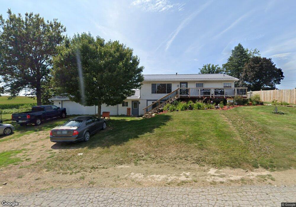
This home is located at 605 6th St, Union, IA 50258 and is currently estimated at $128,236, approximately $117 per square foot. 605 6th St is a home located in Hardin County with nearby schools including BCLUW Elementary School, BCLUW Middle School, and BCLUW High School.
Create a Home Valuation Report for This Property
The Home Valuation Report is an in-depth analysis detailing your home's value as well as a comparison with similar homes in the area
Home Values in the Area
Average Home Value in this Area
Tax History Compared to Growth
Tax History
| Year | Tax Paid | Tax Assessment Tax Assessment Total Assessment is a certain percentage of the fair market value that is determined by local assessors to be the total taxable value of land and additions on the property. | Land | Improvement |
|---|---|---|---|---|
| 2025 | $1,386 | $124,140 | $4,590 | $119,550 |
| 2024 | $1,386 | $96,340 | $4,590 | $91,750 |
| 2023 | $1,396 | $95,390 | $4,590 | $90,800 |
| 2022 | $1,322 | $91,720 | $4,590 | $87,130 |
| 2021 | $1,322 | $91,720 | $4,590 | $87,130 |
| 2020 | $1,210 | $82,130 | $6,300 | $75,830 |
| 2019 | $1,102 | $82,130 | $0 | $0 |
| 2018 | $1,102 | $74,670 | $0 | $0 |
| 2017 | $1,084 | $67,880 | $0 | $0 |
| 2016 | $1,084 | $67,880 | $0 | $0 |
| 2015 | $1,116 | $67,880 | $0 | $0 |
| 2014 | $1,112 | $67,880 | $0 | $0 |
Source: Public Records
Map
Nearby Homes
- 707 Commercial St
- 1002 Main St
- 205 Perry St
- 32031 Y Ave
- 28543 Uu Ave
- 28444 County Highway S62
- 28444 County Highway S62
- 00 County Highway D56 Hwy
- 01 County Highway D65 Hwy
- 01 County Highway D65
- 0 County Highway D56 Unit NOC6331410
- 305 Apple St
- 115 Walnut St
- 1967 140th St
- 27697 270th St
- 1267 113th St
- 0 148th St
- 1813 Jenny Ln
- 1358 140th St
- 1702 Washington St