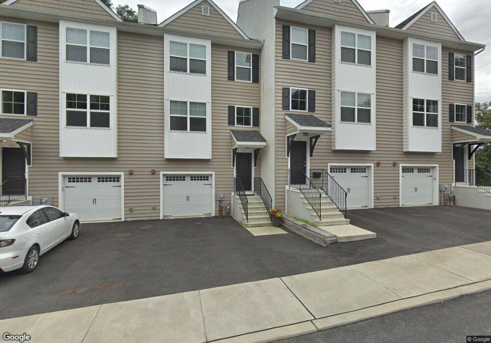
605 Apple St Unit 2 Conshohocken, PA 19428
Estimated Value: $493,937 - $522,000
3
Beds
3
Baths
2,100
Sq Ft
$239/Sq Ft
Est. Value
About This Home
This home is located at 605 Apple St Unit 2, Conshohocken, PA 19428 and is currently estimated at $502,484, approximately $239 per square foot. 605 Apple St Unit 2 is a home located in Montgomery County with nearby schools including Bridgeport Elementary School, Upper Merion Middle School, and Upper Merion High School.
Ownership History
Date
Name
Owned For
Owner Type
Purchase Details
Closed on
Aug 11, 2025
Sold by
Propst Andrew
Bought by
Sarkees Kevin
Current Estimated Value
Home Financials for this Owner
Home Financials are based on the most recent Mortgage that was taken out on this home.
Original Mortgage
$393,600
Outstanding Balance
$393,261
Interest Rate
6.75%
Mortgage Type
New Conventional
Estimated Equity
$109,223
Purchase Details
Closed on
Jul 12, 2017
Sold by
Acl Development Llc
Bought by
Propst Andrew
Purchase Details
Closed on
Jul 11, 2016
Sold by
Apple Moore Properties Lp
Bought by
Acl Development Llc
Home Financials for this Owner
Home Financials are based on the most recent Mortgage that was taken out on this home.
Original Mortgage
$1,260,000
Interest Rate
3.59%
Mortgage Type
Future Advance Clause Open End Mortgage
Create a Home Valuation Report for This Property
The Home Valuation Report is an in-depth analysis detailing your home's value as well as a comparison with similar homes in the area
Home Values in the Area
Average Home Value in this Area
Purchase History
| Date | Buyer | Sale Price | Title Company |
|---|---|---|---|
| Sarkees Kevin | $492,000 | Global Settlements | |
| Propst Andrew | $375,000 | None Available | |
| Acl Development Llc | $520,000 | None Available |
Source: Public Records
Mortgage History
| Date | Status | Borrower | Loan Amount |
|---|---|---|---|
| Open | Sarkees Kevin | $393,600 | |
| Previous Owner | Acl Development Llc | $1,260,000 |
Source: Public Records
Tax History Compared to Growth
Tax History
| Year | Tax Paid | Tax Assessment Tax Assessment Total Assessment is a certain percentage of the fair market value that is determined by local assessors to be the total taxable value of land and additions on the property. | Land | Improvement |
|---|---|---|---|---|
| 2025 | $3,840 | $135,410 | -- | -- |
| 2024 | $3,840 | $135,410 | -- | -- |
| 2023 | $3,693 | $135,410 | $0 | $0 |
| 2022 | $3,555 | $135,410 | $0 | $0 |
| 2021 | $3,516 | $135,410 | $0 | $0 |
| 2020 | $3,435 | $135,410 | $0 | $0 |
| 2019 | $3,374 | $135,410 | $0 | $0 |
| 2018 | $3,359 | $135,410 | $0 | $0 |
| 2017 | $389 | $16,000 | $0 | $0 |
Source: Public Records
Map
Nearby Homes
- 611 Ford St
- 607 Apple St
- 628 Ford St
- 205 Front St
- 1018 Riverview Ln
- 300 W Elm St Unit 2305
- 350 W Elm St Unit 3316
- 350 W Elm St Unit 3207
- 200 W Elm St Unit 1112
- 200 W Elm St Unit 1102
- 1445 Mount Pleasant Rd
- 1425 Mount Pleasant Rd
- 1115 Red Rose Ln
- 1196 Rebel Hill Rd
- 1212 Rebel Hill Rd
- 148 W 1st Ave
- 281 E Matsonford Rd
- 523 Old Elm St Unit 27
- 215 W 3rd Ave Unit 2
- 223 Rebel Hill Rd
- 605 Apple St
- 603 Apple St
- 607 Apple St Unit 1
- 549 Apple St Unit 2
- 549 Apple St Unit 1
- 549 Apple St
- 601 Apple St Unit 4
- 601 Apple St
- 547 Apple St
- 545 Apple St
- 537 Apple St Unit 103
- 537 Apple St Unit 104
- 537 Apple St Unit 102
- 537 Apple St Unit 1
- 537 Apple St Unit 203
- 537 Apple St Unit 101A
- 537 Apple St Unit 101A5
- 537 Apple St
- 537 Apple St Unit PH 02
- 537 Apple St Unit 303