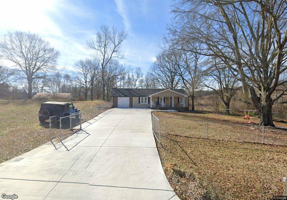
605 Brownlee Mountain Rd SW Adairsville, GA 30103
Estimated Value: $210,013 - $230,000
3
Beds
1
Bath
1,524
Sq Ft
$144/Sq Ft
Est. Value
About This Home
This home is located at 605 Brownlee Mountain Rd SW, Adairsville, GA 30103 and is currently estimated at $218,753, approximately $143 per square foot. 605 Brownlee Mountain Rd SW is a home located in Gordon County with nearby schools including Swain Elementary School, Ashworth Middle School, and Gordon Central High School.
Ownership History
Date
Name
Owned For
Owner Type
Purchase Details
Closed on
Apr 3, 2012
Sold by
Bank Of America
Bought by
Federal Home Loan Mortgage Corporation
Current Estimated Value
Purchase Details
Closed on
May 31, 2007
Sold by
Hollingsworth Brent
Bought by
Burnette Harold G
Purchase Details
Closed on
Oct 3, 2001
Sold by
King Dallas G
Bought by
Hollingsworth Brent
Create a Home Valuation Report for This Property
The Home Valuation Report is an in-depth analysis detailing your home's value as well as a comparison with similar homes in the area
Home Values in the Area
Average Home Value in this Area
Purchase History
| Date | Buyer | Sale Price | Title Company |
|---|---|---|---|
| Federal Home Loan Mortgage Corporation | $64,126 | -- | |
| Bank Of America | $64,126 | -- | |
| Burnette Harold G | $109,000 | -- | |
| Hollingsworth Brent | -- | -- |
Source: Public Records
Tax History Compared to Growth
Tax History
| Year | Tax Paid | Tax Assessment Tax Assessment Total Assessment is a certain percentage of the fair market value that is determined by local assessors to be the total taxable value of land and additions on the property. | Land | Improvement |
|---|---|---|---|---|
| 2024 | $1,274 | $50,148 | $2,400 | $47,748 |
| 2023 | $1,190 | $46,828 | $2,400 | $44,428 |
| 2022 | $1,188 | $43,988 | $2,400 | $41,588 |
| 2021 | $989 | $35,308 | $2,400 | $32,908 |
| 2020 | $1,025 | $35,788 | $2,400 | $33,388 |
| 2019 | $1,031 | $35,788 | $2,400 | $33,388 |
| 2018 | $955 | $33,148 | $2,400 | $30,748 |
Source: Public Records
Map
Nearby Homes
- 180 Honeysuckle Vine Rd
- 154 Honeysuckle Dr SW
- 3610 Rome Rd SW
- 2857 McDaniel Station Rd SW
- 3293 Rome Rd SW
- 332 Old Calhoun Rd SW
- 221 Hardin Rd SW
- 356 W Oak Grove Rd NW
- 0 Woody Rd NW Unit 10634615
- 1211 Franklin Rd SW
- 39 N Ridge Dr NW
- 50 Hopkins Farm Dr
- 69 Hopkins Farm Dr
- 238 Lighthouse Cove SW
- 365 Riverboat Dr
- 17 Chase Place
- 631 Brownlee Mountain Rd SW
- 640 Brownlee Mountain Rd SW
- 555 Brownlee Mountain Rd SW
- 672 Brownlee Mountain Rd SW
- 525 Brownlee Mountain Rd SW
- 712 Brownlee Mountain Rd SW
- 711 Brownlee Mountain Rd SW
- 777 Brownlee Mountain Rd SW
- 413 Brownlee Mountain Rd SW
- 843 Brownlee Mountain Rd SW
- 752 Brownlee Mountain Rd SW
- 372 Brownlee Mountain Rd SW
- 695 Brownlee Mountain Rd SW
- 381 Brownlee Mountain Rd SW
- 383 Brownlee Mountain Rd SW
- 387 Brownlee Mountain Rd SW
- 275 Rogers Rd SW
- 308 Brownlee Mountain Rd SW
- 385 Brownlee Mountain Rd
- 166 E Summit Dr SW