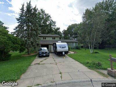
605 Dianne Ct Unit A Mahomet, IL 61853
Estimated Value: $121,000 - $191,000
--
Bed
2
Baths
672
Sq Ft
$221/Sq Ft
Est. Value
About This Home
This home is located at 605 Dianne Ct Unit A, Mahomet, IL 61853 and is currently estimated at $148,453, approximately $220 per square foot. 605 Dianne Ct Unit A is a home located in Champaign County with nearby schools including Middletown Prairie Elementary and First School.
Ownership History
Date
Name
Owned For
Owner Type
Purchase Details
Closed on
Nov 9, 2021
Sold by
Powell Lisa M
Bought by
The Cox Property Group Llc
Current Estimated Value
Home Financials for this Owner
Home Financials are based on the most recent Mortgage that was taken out on this home.
Original Mortgage
$200,600
Interest Rate
3.05%
Mortgage Type
Future Advance Clause Open End Mortgage
Purchase Details
Closed on
Nov 9, 2015
Sold by
Powell Britton E and Powell Lisa M
Bought by
Powell Lisa M
Home Financials for this Owner
Home Financials are based on the most recent Mortgage that was taken out on this home.
Original Mortgage
$63,750
Interest Rate
3.8%
Mortgage Type
New Conventional
Purchase Details
Closed on
Sep 28, 2005
Sold by
Turner Andrew and Turner Stephanie
Bought by
Powell Britton E and Powell Lisa M
Home Financials for this Owner
Home Financials are based on the most recent Mortgage that was taken out on this home.
Original Mortgage
$115,200
Interest Rate
5.93%
Mortgage Type
Fannie Mae Freddie Mac
Create a Home Valuation Report for This Property
The Home Valuation Report is an in-depth analysis detailing your home's value as well as a comparison with similar homes in the area
Home Values in the Area
Average Home Value in this Area
Purchase History
| Date | Buyer | Sale Price | Title Company |
|---|---|---|---|
| The Cox Property Group Llc | $100,000 | Attorney | |
| Powell Lisa M | -- | Attorney | |
| Powell Britton E | $144,000 | -- |
Source: Public Records
Mortgage History
| Date | Status | Borrower | Loan Amount |
|---|---|---|---|
| Closed | The Cox Property Group Llc | $200,600 | |
| Previous Owner | Powell Lisa M | $63,750 | |
| Previous Owner | Powell Britton E | $115,200 |
Source: Public Records
Tax History Compared to Growth
Tax History
| Year | Tax Paid | Tax Assessment Tax Assessment Total Assessment is a certain percentage of the fair market value that is determined by local assessors to be the total taxable value of land and additions on the property. | Land | Improvement |
|---|---|---|---|---|
| 2024 | $2,033 | $34,860 | $9,780 | $25,080 |
| 2023 | $2,033 | $31,690 | $8,890 | $22,800 |
| 2022 | $1,857 | $29,200 | $8,190 | $21,010 |
| 2021 | $1,740 | $27,600 | $7,740 | $19,860 |
| 2020 | $1,703 | $27,140 | $7,610 | $19,530 |
| 2019 | $1,655 | $26,710 | $7,490 | $19,220 |
| 2018 | $2,077 | $26,140 | $7,330 | $18,810 |
| 2017 | $1,520 | $24,890 | $6,980 | $17,910 |
| 2016 | $1,512 | $24,890 | $6,980 | $17,910 |
| 2015 | $1,522 | $24,890 | $6,980 | $17,910 |
| 2014 | $1,494 | $24,610 | $6,700 | $17,910 |
| 2013 | $1,972 | $24,610 | $6,700 | $17,910 |
Source: Public Records
Map
Nearby Homes
- 703 N Northridge Dr
- 206 Evergreen Ct
- 304 Timberview Dr
- 608 W Dunbar St
- 601 W Dunbar St
- 1304 Woodland Ct
- 204 W Dunbar St
- 1212 Edgeview Dr
- 214 Augusta St
- 308 S Division St
- 417 E State St
- 902 S Marietta Dr
- 1607 W Point Dr
- 1103 S Clapper Ct
- 1506 River Bluff Ct
- 203 N Eastwood Dr
- 2737 County Road 380 E
- 1511 River Bluff Ct
- 1007 Briarcliff Dr
- 1604 Morel Ct
- 605 Dianne Ct Unit A
- 605 Dianne Ct Unit B
- 605 Dianne Ct
- 605 Dianne Ct
- 603 Dianne Ct Unit A
- 603 Dianne Ct Unit B
- 603 Dianne Ct
- 606 Dianne Ct
- 601 Dianne Ct
- 601 Dianne Ct Unit A
- 502 Colony Grove
- 604 Dianne Ct
- 504 Colony Grove
- 501 N Raymond Dr
- 503 N Raymond Dr
- 603 N Craig Dr
- 401 N Raymond Dr
- 602 Colony Grove
- 605 N Craig Dr
- 503 Colony Grove