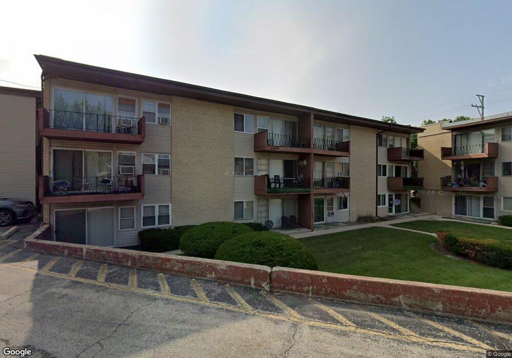
605 N Wolf Rd Unit B1 Hillside, IL 60162
Estimated Value: $76,000 - $109,000
1
Bed
1
Bath
400
Sq Ft
$223/Sq Ft
Est. Value
About This Home
This home is located at 605 N Wolf Rd Unit B1, Hillside, IL 60162 and is currently estimated at $89,331, approximately $223 per square foot. 605 N Wolf Rd Unit B1 is a home located in Cook County with nearby schools including Macarthur Intermediate School, Sunnyside Elementary School, and Proviso West High School.
Ownership History
Date
Name
Owned For
Owner Type
Purchase Details
Closed on
Jun 22, 2005
Sold by
Hjertstedt Gary and Hjertstedt Jeannine
Bought by
Rojas Oneida M
Current Estimated Value
Home Financials for this Owner
Home Financials are based on the most recent Mortgage that was taken out on this home.
Original Mortgage
$62,700
Outstanding Balance
$32,082
Interest Rate
5.75%
Mortgage Type
Fannie Mae Freddie Mac
Estimated Equity
$57,249
Purchase Details
Closed on
Jun 12, 2003
Sold by
Nevarez Alfredo
Bought by
Hjertstedt Gary and Hjertstedt Jeannine
Create a Home Valuation Report for This Property
The Home Valuation Report is an in-depth analysis detailing your home's value as well as a comparison with similar homes in the area
Home Values in the Area
Average Home Value in this Area
Purchase History
| Date | Buyer | Sale Price | Title Company |
|---|---|---|---|
| Rojas Oneida M | $66,000 | First American Title | |
| Hjertstedt Gary | $45,000 | -- |
Source: Public Records
Mortgage History
| Date | Status | Borrower | Loan Amount |
|---|---|---|---|
| Open | Rojas Oneida M | $62,700 |
Source: Public Records
Tax History
| Year | Tax Paid | Tax Assessment Tax Assessment Total Assessment is a certain percentage of the fair market value that is determined by local assessors to be the total taxable value of land and additions on the property. | Land | Improvement |
|---|---|---|---|---|
| 2025 | $2,168 | $5,236 | $545 | $4,691 |
| 2024 | $2,168 | $5,236 | $545 | $4,691 |
| 2023 | $1,678 | $5,236 | $545 | $4,691 |
| 2022 | $1,678 | $3,546 | $867 | $2,679 |
| 2021 | $1,682 | $3,545 | $867 | $2,678 |
| 2020 | $1,607 | $3,545 | $867 | $2,678 |
| 2019 | $1,252 | $2,707 | $792 | $1,915 |
| 2018 | $1,237 | $2,707 | $792 | $1,915 |
| 2017 | $1,186 | $2,707 | $792 | $1,915 |
| 2016 | $1,341 | $3,021 | $718 | $2,303 |
| 2015 | $1,312 | $3,021 | $718 | $2,303 |
| 2014 | $1,289 | $3,021 | $718 | $2,303 |
| 2013 | $1,856 | $4,746 | $718 | $4,028 |
Source: Public Records
Map
Nearby Homes
- 605 N Wolf Rd Unit B9
- 520 N Wolf Rd Unit 203
- 341 Iroquois Rd
- 768 N Rohde Ave
- 4530 Butterfield Rd
- 4904 W Hawthorne Ave
- 311 Buckthorn Ln
- 239 N Lind Ave
- 512 50th Ave
- 226 N Lind Ave
- 449 N Jackson Blvd
- 1463 Speechley Blvd
- 250 N Irving Ave
- 4342 Warren Ave
- 326 N Forest Ave
- 4338 Warren Ave
- 1915 Herbert Ave
- 319 49th Ave
- 1447 N Ashbel Ave
- 505 47th Ave
- 605 N Wolf Rd Unit C5
- 605 N Wolf Rd Unit D3
- 605 N Wolf Rd Unit C10
- 605 N Wolf Rd Unit A10
- 605 N Wolf Rd Unit E4
- 605 N Wolf Rd Unit B2
- 605 N Wolf Rd Unit F8
- 605 N Wolf Rd Unit D10
- 605 N Wolf Rd Unit C8
- 605 N Wolf Rd Unit C2
- 605 N Wolf Rd Unit A2
- 605 N Wolf Rd Unit A1
- 605 N Wolf Rd Unit B7
- 605 N Wolf Rd Unit B4
- 605 N Wolf Rd Unit E5
- 605 N Wolf Rd Unit A3
- 605 N Wolf Rd Unit D12
- 605 N Wolf Rd Unit C11
- 605 N Wolf Rd Unit D1
- 605 N Wolf Rd Unit D7
Your Personal Tour Guide
Ask me questions while you tour the home.