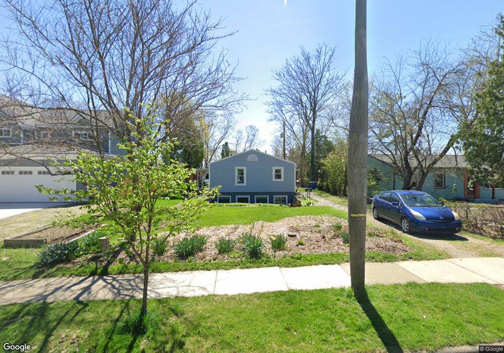
605 Robin Rd Ann Arbor, MI 48103
Water Hill NeighborhoodEstimated Value: $351,383 - $436,000
3
Beds
2
Baths
864
Sq Ft
$451/Sq Ft
Est. Value
About This Home
This home is located at 605 Robin Rd, Ann Arbor, MI 48103 and is currently estimated at $389,596, approximately $450 per square foot. 605 Robin Rd is a home located in Washtenaw County with nearby schools including Wines Elementary School, Forsythe Middle School, and Skyline High School.
Ownership History
Date
Name
Owned For
Owner Type
Purchase Details
Closed on
Mar 15, 2007
Sold by
Rastelli Mildred Alisa and Foster Alisa
Bought by
Good Christopher I and Beck Heidi M
Current Estimated Value
Home Financials for this Owner
Home Financials are based on the most recent Mortgage that was taken out on this home.
Original Mortgage
$164,250
Outstanding Balance
$100,178
Interest Rate
6.4%
Mortgage Type
Unknown
Estimated Equity
$289,418
Purchase Details
Closed on
Jul 1, 1997
Sold by
Siebs John A
Bought by
Foster Alisa
Home Financials for this Owner
Home Financials are based on the most recent Mortgage that was taken out on this home.
Original Mortgage
$88,150
Interest Rate
7.94%
Mortgage Type
New Conventional
Create a Home Valuation Report for This Property
The Home Valuation Report is an in-depth analysis detailing your home's value as well as a comparison with similar homes in the area
Home Values in the Area
Average Home Value in this Area
Purchase History
| Date | Buyer | Sale Price | Title Company |
|---|---|---|---|
| Good Christopher I | $182,500 | Ab | |
| Foster Alisa | $93,500 | -- |
Source: Public Records
Mortgage History
| Date | Status | Borrower | Loan Amount |
|---|---|---|---|
| Open | Good Christopher I | $164,250 | |
| Previous Owner | Foster Alisa | $88,150 |
Source: Public Records
Tax History Compared to Growth
Tax History
| Year | Tax Paid | Tax Assessment Tax Assessment Total Assessment is a certain percentage of the fair market value that is determined by local assessors to be the total taxable value of land and additions on the property. | Land | Improvement |
|---|---|---|---|---|
| 2025 | $4,701 | $156,300 | $0 | $0 |
| 2024 | $4,585 | $136,100 | $0 | $0 |
| 2023 | $4,228 | $124,400 | $0 | $0 |
| 2022 | $4,607 | $122,400 | $0 | $0 |
| 2021 | $4,498 | $119,400 | $0 | $0 |
| 2020 | $4,407 | $123,000 | $0 | $0 |
| 2019 | $4,195 | $119,100 | $119,100 | $0 |
| 2018 | $4,136 | $116,600 | $0 | $0 |
| 2017 | $4,023 | $104,800 | $0 | $0 |
| 2016 | $3,881 | $80,446 | $0 | $0 |
| 2015 | $3,696 | $80,206 | $0 | $0 |
| 2014 | $3,696 | $77,700 | $0 | $0 |
| 2013 | -- | $77,700 | $0 | $0 |
Source: Public Records
Map
Nearby Homes
- 601 Cressfield Ln
- 508 W Summit St
- 518 Hiscock St
- 207 Sunset Rd
- 1132 Longshore Dr Unit 2
- 118 W Summit St
- 408 Felch St
- 701 Pomona Rd
- 651 N 5th Ave
- 611 N 4th Ave
- 410 N 1st St Unit 301
- 408 Longshore Dr Unit C
- 408 Longshore Dr Unit A
- 121 W Kingsley St Unit 502
- 610 N 5th Ave
- 1128 Longshore Dr Unit 1
- 1128 Longshore Dr Unit 2
- 1136 Longshore Dr Unit 1
- 519 Longshore Dr Unit A
- 212 Miller Ave Unit 102
- 603 Robin Rd
- 607 Robin Rd
- 609 Robin Rd
- 1115 Fountain St
- 602 Cressfield Ln
- 606 Cressfield Ln
- 604 Cressfield Ln
- 604 Robin Rd
- 600 Cressfield Ln
- 1118 Bydding Rd
- 611 Robin Rd
- 610 Robin Rd
- 1116 Bydding Rd
- 608 Robin Rd
- 605 Cressfield Ln
- 1200 Bydding Rd
- 615 Cressfield Ln
- 603 Sunset Rd
- 1120 Fountain St
- 1116 Fountain St