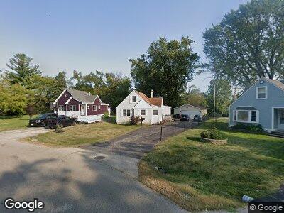
605 S Cedarwood Cir Round Lake Heights, IL 60073
Estimated Value: $193,619 - $218,000
--
Bed
1
Bath
1,239
Sq Ft
$165/Sq Ft
Est. Value
About This Home
This home is located at 605 S Cedarwood Cir, Round Lake Heights, IL 60073 and is currently estimated at $204,405, approximately $164 per square foot. 605 S Cedarwood Cir is a home located in Lake County with nearby schools including Indian Hill Elementary School, Round Lake Middle School, and Round Lake High School.
Ownership History
Date
Name
Owned For
Owner Type
Purchase Details
Closed on
May 26, 1999
Sold by
Deboer Hicholas E and Deboer Carolyn T
Bought by
Rockwell Robert Milton and Rockwell Donna Mae
Current Estimated Value
Home Financials for this Owner
Home Financials are based on the most recent Mortgage that was taken out on this home.
Original Mortgage
$90,746
Interest Rate
6.92%
Mortgage Type
FHA
Purchase Details
Closed on
Oct 29, 1997
Sold by
Mondus Gary V and Blotteaux Kristen R
Bought by
Deboer Nicholas E and Deboer Carolyn T
Home Financials for this Owner
Home Financials are based on the most recent Mortgage that was taken out on this home.
Original Mortgage
$89,571
Interest Rate
7.38%
Mortgage Type
FHA
Create a Home Valuation Report for This Property
The Home Valuation Report is an in-depth analysis detailing your home's value as well as a comparison with similar homes in the area
Home Values in the Area
Average Home Value in this Area
Purchase History
| Date | Buyer | Sale Price | Title Company |
|---|---|---|---|
| Rockwell Robert Milton | $91,500 | Chicago Title Insurance Co | |
| Deboer Nicholas E | $90,000 | -- |
Source: Public Records
Mortgage History
| Date | Status | Borrower | Loan Amount |
|---|---|---|---|
| Open | Rockwell Robert Milton | $116,000 | |
| Closed | Rockwell Robert Milton | $20,915 | |
| Closed | Rockwell Robert Milton | $90,746 | |
| Previous Owner | Deboer Nicholas E | $89,571 |
Source: Public Records
Tax History Compared to Growth
Tax History
| Year | Tax Paid | Tax Assessment Tax Assessment Total Assessment is a certain percentage of the fair market value that is determined by local assessors to be the total taxable value of land and additions on the property. | Land | Improvement |
|---|---|---|---|---|
| 2024 | $2,830 | $53,081 | $12,326 | $40,755 |
| 2023 | $2,897 | $46,396 | $10,773 | $35,623 |
| 2022 | $2,897 | $41,494 | $8,262 | $33,232 |
| 2021 | $2,653 | $36,082 | $7,941 | $28,141 |
| 2020 | $2,497 | $34,331 | $7,556 | $26,775 |
| 2019 | $2,407 | $32,937 | $7,249 | $25,688 |
| 2018 | $2,011 | $27,337 | $9,382 | $17,955 |
| 2017 | $1,936 | $25,714 | $8,825 | $16,889 |
| 2016 | $1,761 | $23,736 | $8,146 | $15,590 |
| 2015 | $1,597 | $21,685 | $7,442 | $14,243 |
| 2014 | $3,293 | $28,739 | $6,778 | $21,961 |
| 2012 | $3,308 | $30,015 | $7,079 | $22,936 |
Source: Public Records
Map
Nearby Homes
- 528 Meadow Green Ln
- 435 Meadow Green Ln
- 410 Meadow Green Ln Unit 9
- 800 Tomahawk Trail
- 347 Meadow Green Ln Unit 2
- 520 W Pheasant Ct
- 613 W Pheasant Ct
- 904 Warrior St
- 716 Lagoon Terrace
- 1520 Chestnut Dr
- 208 Sprucewood Ct
- 2272 Iroquois Ln
- 1528 N Pleasant Dr
- 1426 Sunset Dr
- 2146 Prairie Trail
- 2366 Lotus Dr
- 1428 Juneway Terrace
- 1998 N Karen Ln
- 1623 Beverly Dr
- 852 Black Cherry Ln
- 605 S Cedarwood Cir
- 1905 E Cedarwood Cir
- 609 S Cedarwood Cir
- 1909 E Cedarwood Cir
- 613 S Cedarwood Cir
- 1909 W Cedarwood Cir
- 1909 W Cedarwood Cir
- 612 Warrior St
- 545 Meadow Hill Ln
- 616 Warrior St
- 1908 E Cedarwood Cir
- 1913 E Cedarwood Cir
- 617 S Cedarwood Cir
- 543 Meadow Hill Ln
- 620 Warrior St
- 1912 E Cedarwood Cir
- 541 Meadow Hill Ln
- 621 W Cedarwood Cir
- 1917 E Cedarwood Cir
- 621 S Cedarwood Cir