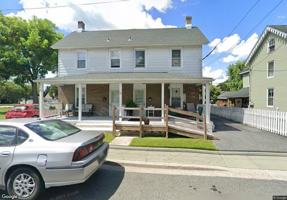
605 S Main St North East, MD 21901
Estimated Value: $207,000 - $229,000
--
Bed
1
Bath
1,092
Sq Ft
$200/Sq Ft
Est. Value
About This Home
This home is located at 605 S Main St, North East, MD 21901 and is currently estimated at $218,086, approximately $199 per square foot. 605 S Main St is a home located in Cecil County with nearby schools including North East Elementary School, North East Middle School, and North East High School.
Ownership History
Date
Name
Owned For
Owner Type
Purchase Details
Closed on
Aug 26, 2014
Sold by
Willcam Llc
Bought by
Fockler Edwin B and Vance Carl J
Current Estimated Value
Purchase Details
Closed on
Jun 29, 2007
Sold by
Fockler Edwin B L E
Bought by
Willcam Llc
Purchase Details
Closed on
Apr 18, 2007
Sold by
Fockler Edwin B L E
Bought by
Willcam Llc
Purchase Details
Closed on
Jun 28, 1996
Sold by
Fockler Karl H
Bought by
Fockler Bertha C
Create a Home Valuation Report for This Property
The Home Valuation Report is an in-depth analysis detailing your home's value as well as a comparison with similar homes in the area
Home Values in the Area
Average Home Value in this Area
Purchase History
| Date | Buyer | Sale Price | Title Company |
|---|---|---|---|
| Fockler Edwin B | $85,000 | None Available | |
| Willcam Llc | -- | -- | |
| Willcam Llc | -- | -- | |
| Fockler Bertha C | -- | -- |
Source: Public Records
Tax History Compared to Growth
Tax History
| Year | Tax Paid | Tax Assessment Tax Assessment Total Assessment is a certain percentage of the fair market value that is determined by local assessors to be the total taxable value of land and additions on the property. | Land | Improvement |
|---|---|---|---|---|
| 2025 | $3,781 | $199,400 | $0 | $0 |
| 2024 | $3,212 | $186,300 | $0 | $0 |
| 2023 | $2,663 | $173,200 | $51,000 | $122,200 |
| 2022 | $3,006 | $170,133 | $0 | $0 |
| 2021 | $2,946 | $167,067 | $0 | $0 |
| 2020 | $3,103 | $164,000 | $51,000 | $113,000 |
| 2019 | $3,061 | $162,200 | $0 | $0 |
| 2018 | $3,020 | $160,400 | $0 | $0 |
| 2017 | $2,981 | $158,600 | $0 | $0 |
| 2016 | $2,790 | $158,100 | $0 | $0 |
| 2015 | $2,790 | $157,700 | $0 | $0 |
| 2014 | $3,026 | $157,300 | $0 | $0 |
Source: Public Records
Map
Nearby Homes
- 6 Colonial Cir
- 15 S Mauldin Ave
- 122 NE Isle Dr
- 144 NE Isles Dr Unit 95A
- 73 NE Isle Dr
- 37 NE Isle Dr
- 15 Yarmouth Ln
- parcel # 66 Rolling Mill Ln
- 101 Belvue Rd
- 511 Deans Bank Rd
- 62 Rehill Ave
- 61 Dune Dr
- 61 Dune Dr
- 14 Mallory Way Unit WYNDHAM
- 0 Pulaski Hwy
- 2515 Pulaski Hwy
- 630 W Old Philadelphia Rd
- 13 Forest Dr
- 0 Mallory Way Unit MDCC2003990
- 0 Mallory Way Unit MDCC169342