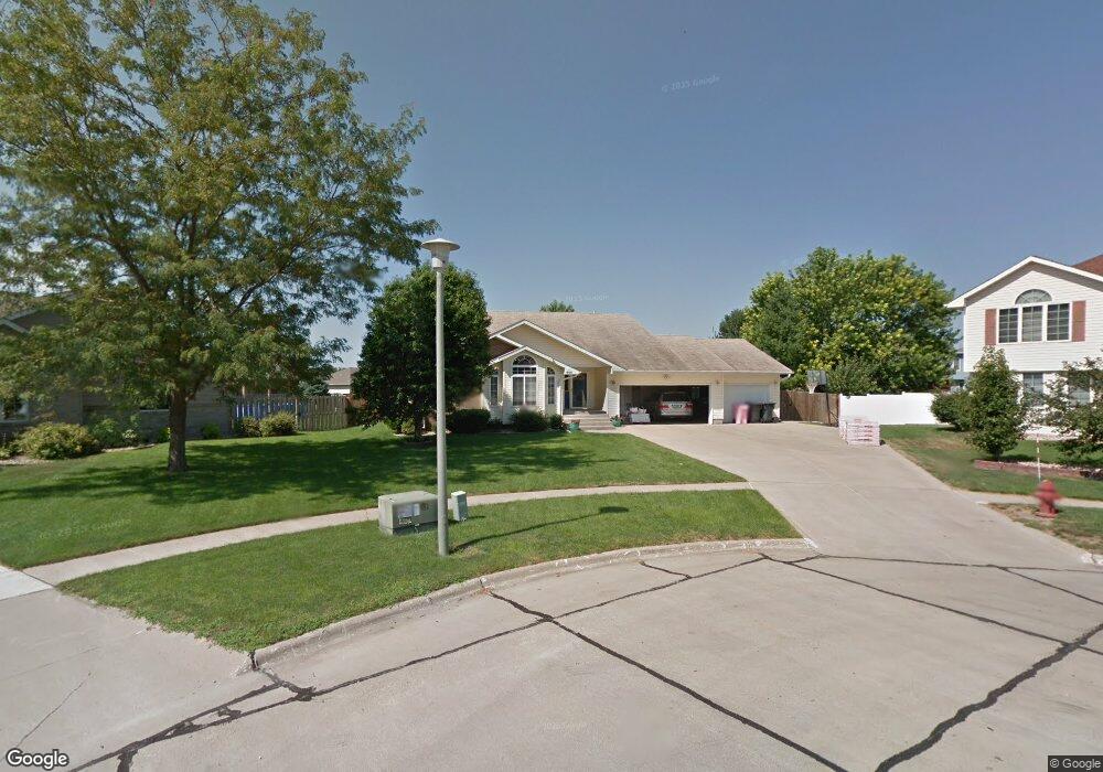
605 Stonegate Ct Sergeant Bluff, IA 51054
Estimated Value: $402,000 - $451,000
4
Beds
3
Baths
1,492
Sq Ft
$287/Sq Ft
Est. Value
About This Home
This home is located at 605 Stonegate Ct, Sergeant Bluff, IA 51054 and is currently estimated at $428,002, approximately $286 per square foot. 605 Stonegate Ct is a home located in Woodbury County with nearby schools including Sergeant Bluff-Luton Primary School, Sergeant Bluff-Luton Elementary School, and Sergeant Bluff-Luton Middle School.
Ownership History
Date
Name
Owned For
Owner Type
Purchase Details
Closed on
May 6, 2010
Sold by
Berrie Dustin J and Berrie Toni M
Bought by
Guntren Michael R and Guntren Leann
Current Estimated Value
Home Financials for this Owner
Home Financials are based on the most recent Mortgage that was taken out on this home.
Original Mortgage
$175,960
Outstanding Balance
$118,400
Interest Rate
5.13%
Mortgage Type
New Conventional
Estimated Equity
$309,602
Create a Home Valuation Report for This Property
The Home Valuation Report is an in-depth analysis detailing your home's value as well as a comparison with similar homes in the area
Home Values in the Area
Average Home Value in this Area
Purchase History
| Date | Buyer | Sale Price | Title Company |
|---|---|---|---|
| Guntren Michael R | $220,000 | -- |
Source: Public Records
Mortgage History
| Date | Status | Borrower | Loan Amount |
|---|---|---|---|
| Open | Guntren Michael R | $175,960 |
Source: Public Records
Tax History
| Year | Tax Paid | Tax Assessment Tax Assessment Total Assessment is a certain percentage of the fair market value that is determined by local assessors to be the total taxable value of land and additions on the property. | Land | Improvement |
|---|---|---|---|---|
| 2025 | $6,128 | $440,140 | $49,570 | $390,570 |
| 2024 | $59 | $407,510 | $40,220 | $367,290 |
| 2023 | $5,796 | $407,510 | $40,220 | $367,290 |
| 2022 | $5,746 | $338,710 | $40,220 | $298,490 |
| 2021 | $5,746 | $338,710 | $40,220 | $298,490 |
| 2020 | $4,312 | $317,760 | $43,040 | $274,720 |
| 2019 | $4,262 | $251,600 | $43,040 | $208,560 |
| 2018 | $4,156 | $245,140 | $36,580 | $208,560 |
| 2017 | $4,156 | $245,140 | $36,580 | $208,560 |
| 2016 | $4,762 | $245,140 | $0 | $0 |
| 2015 | $4,188 | $229,110 | $34,190 | $194,920 |
| 2014 | $3,951 | $209,620 | $34,190 | $175,430 |
Source: Public Records
Map
Nearby Homes
- 603 Stonegate Ct
- 606 Stonegate Ct
- 405 Embassy Ct
- 408 Baywood Dr
- 407 Embassy Ct
- 406 Baywood Dr
- 410 Baywood Dr
- 604 Stonegate Ct
- 412 Baywood Dr
- 409 Embassy Ct
- 602 Stonegate Ct
- 403 Embassy Ct
- 404 Baywood Dr
- 411 Embassy Ct
- 401 Embassy Ct
- 413 Embassy Ct
- 408 Bennington Dr
- 501 Stonegate Cir
- 411 Baywood Dr
- 306 Bennington Ct
Your Personal Tour Guide
Ask me questions while you tour the home.