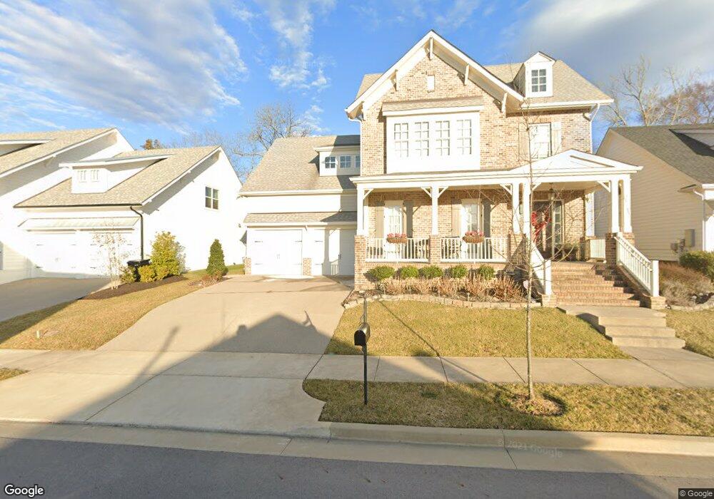
6050 Maysbrook Ln Franklin, TN 37064
McEwen NeighborhoodEstimated Value: $978,929 - $1,056,000
--
Bed
4
Baths
3,092
Sq Ft
$333/Sq Ft
Est. Value
About This Home
This home is located at 6050 Maysbrook Ln, Franklin, TN 37064 and is currently estimated at $1,029,482, approximately $332 per square foot. 6050 Maysbrook Ln is a home located in Williamson County with nearby schools including Creekside Elementary School, Fred J. Page Middle School, and Fred J. Page High School.
Ownership History
Date
Name
Owned For
Owner Type
Purchase Details
Closed on
Mar 22, 2019
Sold by
Mccorkle Betty J
Bought by
Mccorkle Timotiiy M
Current Estimated Value
Home Financials for this Owner
Home Financials are based on the most recent Mortgage that was taken out on this home.
Original Mortgage
$364,000
Outstanding Balance
$318,709
Interest Rate
4.3%
Mortgage Type
New Conventional
Estimated Equity
$710,773
Purchase Details
Closed on
Mar 14, 2017
Sold by
Mike Ford Custom Builders Llc
Bought by
Mccorkle Timothy M and Mccorkle Kristen E
Home Financials for this Owner
Home Financials are based on the most recent Mortgage that was taken out on this home.
Original Mortgage
$471,920
Interest Rate
4.19%
Mortgage Type
New Conventional
Create a Home Valuation Report for This Property
The Home Valuation Report is an in-depth analysis detailing your home's value as well as a comparison with similar homes in the area
Home Values in the Area
Average Home Value in this Area
Purchase History
| Date | Buyer | Sale Price | Title Company |
|---|---|---|---|
| Mccorkle Timotiiy M | -- | None Available | |
| Mccorkle Timothy M | $589,900 | Southland Title & Escrow Co |
Source: Public Records
Mortgage History
| Date | Status | Borrower | Loan Amount |
|---|---|---|---|
| Open | Mccorkle Timotiiy M | $364,000 | |
| Closed | Mccorkle Timothy M | $471,920 |
Source: Public Records
Tax History Compared to Growth
Tax History
| Year | Tax Paid | Tax Assessment Tax Assessment Total Assessment is a certain percentage of the fair market value that is determined by local assessors to be the total taxable value of land and additions on the property. | Land | Improvement |
|---|---|---|---|---|
| 2025 | $3,610 | $244,100 | $80,000 | $164,100 |
| 2024 | $3,610 | $167,425 | $40,000 | $127,425 |
| 2023 | $3,610 | $167,425 | $40,000 | $127,425 |
| 2022 | $3,610 | $167,425 | $40,000 | $127,425 |
| 2021 | $3,610 | $167,425 | $40,000 | $127,425 |
| 2020 | $3,388 | $131,425 | $30,000 | $101,425 |
| 2019 | $3,388 | $131,425 | $30,000 | $101,425 |
| 2018 | $3,296 | $131,425 | $30,000 | $101,425 |
| 2017 | $3,270 | $131,425 | $30,000 | $101,425 |
| 2016 | $737 | $30,000 | $30,000 | $0 |
| 2015 | -- | $0 | $0 | $0 |
Source: Public Records
Map
Nearby Homes
- 9020 Wenlock Ln
- 2067 Inland Dr
- 6043 Gracious Dr
- 9067 Headwaters Dr Unit 141
- 5025 Laughing Brook Ln
- 1055 Sweetleaf Dr
- 1032 Sweetleaf Dr
- 3014 Mainstream Dr
- 1044 Sweetleaf Dr
- 7019 Gracious Dr
- 7036 Gracious Dr
- 7060 Gracious Dr
- 3023 Moultrie Cir
- 312 Rafferty Ct
- 7168 Gracious Dr
- 3013 Singing Creek Dr
- 9055 Headwaters Dr Unit 140
- 4031 Singing Creek Dr
- 1009 Swanson Ln
- 1000 Swanson Ln
- 6050 Maysbrook Ln Unit 20
- 6050 Maysbrook Ln
- 6056 Maysbrook Ln
- 6056 Maysbrook Ln Unit 21
- 6044 Maysbrook Ln Unit 19
- 6044 Maysbrook Ln
- 6044 Maysbrook Ln
- 9056 Wenlock Ln Unit 68
- 9056 Wenlock Ln Unit 68
- 9056 Wenlock Ln
- 9056 Wenlock Ln Unit 68
- 9056 Wenlock Ln
- 6038 Maysbrook Ln Unit 18
- 6038 Maysbrook Ln
- 6060 Maysbrook Ln Unit 22
- 9050 Wenlock Ln Unit 67
- 9050 Wenlock Ln
- 6060 Maysbrook Ln
- 9044 Wenlock Ln Unit 66
- 9044 Wenlock Ln