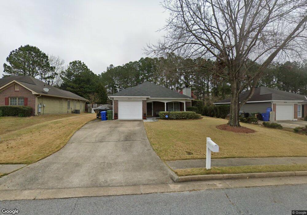
6052 N Pointe Dr Columbus, GA 31909
Northern Columbus NeighborhoodEstimated Value: $172,000 - $191,000
3
Beds
3
Baths
1,275
Sq Ft
$143/Sq Ft
Est. Value
About This Home
This home is located at 6052 N Pointe Dr, Columbus, GA 31909 and is currently estimated at $181,921, approximately $142 per square foot. 6052 N Pointe Dr is a home located in Muscogee County with nearby schools including Gentian Elementary School, Midland Middle School, and Hardaway High School.
Ownership History
Date
Name
Owned For
Owner Type
Purchase Details
Closed on
Feb 12, 2016
Sold by
Nelson Gary S
Bought by
Nelson Gary S and Nelson Jace Marlowe
Current Estimated Value
Purchase Details
Closed on
Jul 9, 2012
Sold by
Wilson Sandra Michelle
Bought by
Stowe Steven Armory
Purchase Details
Closed on
Jun 12, 2012
Sold by
Stowe Barbara Joyce
Bought by
Stowe Steven Armory and Wilson Sandra S
Create a Home Valuation Report for This Property
The Home Valuation Report is an in-depth analysis detailing your home's value as well as a comparison with similar homes in the area
Home Values in the Area
Average Home Value in this Area
Purchase History
| Date | Buyer | Sale Price | Title Company |
|---|---|---|---|
| Nelson Gary S | -- | -- | |
| Nelson Gary S | $112,300 | -- | |
| Stowe Steven Armory | -- | -- | |
| Stowe Steven Armory | -- | -- |
Source: Public Records
Tax History Compared to Growth
Tax History
| Year | Tax Paid | Tax Assessment Tax Assessment Total Assessment is a certain percentage of the fair market value that is determined by local assessors to be the total taxable value of land and additions on the property. | Land | Improvement |
|---|---|---|---|---|
| 2025 | $1,242 | $65,116 | $9,820 | $55,296 |
| 2024 | $1,241 | $65,116 | $9,820 | $55,296 |
| 2023 | $555 | $65,116 | $9,820 | $55,296 |
| 2022 | $1,294 | $53,476 | $9,820 | $43,656 |
| 2021 | $1,287 | $46,360 | $9,820 | $36,540 |
| 2020 | $1,288 | $46,360 | $9,820 | $36,540 |
| 2019 | $1,294 | $46,360 | $9,820 | $36,540 |
| 2018 | $1,294 | $46,360 | $9,820 | $36,540 |
| 2017 | $1,300 | $44,920 | $9,760 | $35,160 |
| 2016 | $1,810 | $43,887 | $9,600 | $34,287 |
| 2015 | $1,813 | $43,887 | $9,600 | $34,287 |
| 2014 | $1,815 | $43,887 | $9,600 | $34,287 |
| 2013 | -- | $43,887 | $9,600 | $34,287 |
Source: Public Records
Map
Nearby Homes
- 5517 Rodgers Dr
- 5540 Rodgers Dr
- 5216 Moon Rd
- 4832 Rowland Ave
- 4813 Rowland Ct
- 5224 Miller Rd
- 3872 E Britt David Rd
- 4709 Rowland Ave
- 5636 Webb Ave
- 4807 Fairview Dr
- 3618 Grier Ave
- 3710 Winkfield Place
- 4017 River Rock Way
- 3504 Vernon Dr
- 4520 Marci Ct
- 5829 Moon Rd
- 5921 Lawson St
- 5866 Morningside Dr
- 5915 Frazier Dr
- 4565 Prim Dr
- 6056 N Pointe Dr
- 6048 N Pointe Dr
- 6060 N Pointe Dr
- 6044 N Pointe Dr
- 6040 N Pointe Dr
- 6053 N Pointe Dr
- 6049 N Pointe Dr
- 6064 N Pointe Dr
- 6045 N Pointe Dr
- 6057 N Pointe Dr
- 6036 N Pointe Dr
- 6041 N Pointe Dr
- 6068 N Pointe Dr
- 6037 N Pointe Dr
- 6032 N Pointe Dr
- 6033 N Pointe Dr
- 5418 Rodgers Dr
- 5408 Rodgers Dr
- 5368 Rodgers Dr
- 5426 Rodgers Dr