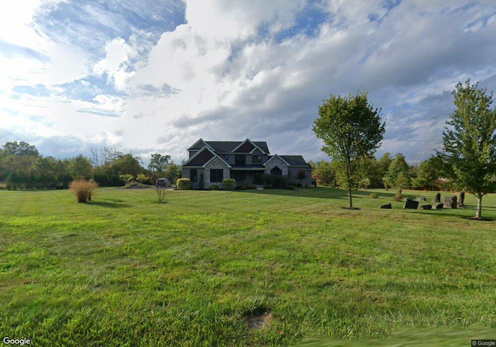
6055 Ferry Rd Doylestown, PA 18902
Plumstead NeighborhoodEstimated Value: $933,000 - $1,754,452
3
Beds
3
Baths
4,148
Sq Ft
$308/Sq Ft
Est. Value
About This Home
This home is located at 6055 Ferry Rd, Doylestown, PA 18902 and is currently estimated at $1,277,113, approximately $307 per square foot. 6055 Ferry Rd is a home with nearby schools including Gayman Elementary School, Tohickon Middle School, and Central Bucks High School - East.
Ownership History
Date
Name
Owned For
Owner Type
Purchase Details
Closed on
May 29, 2018
Sold by
Noftsger Michael D and Noftsger Ann H
Bought by
Ling Lorraine B and Morciglio Mary Christine
Current Estimated Value
Home Financials for this Owner
Home Financials are based on the most recent Mortgage that was taken out on this home.
Original Mortgage
$450,000
Outstanding Balance
$391,310
Interest Rate
4.37%
Mortgage Type
Adjustable Rate Mortgage/ARM
Estimated Equity
$885,803
Create a Home Valuation Report for This Property
The Home Valuation Report is an in-depth analysis detailing your home's value as well as a comparison with similar homes in the area
Home Values in the Area
Average Home Value in this Area
Purchase History
| Date | Buyer | Sale Price | Title Company |
|---|---|---|---|
| Ling Lorraine B | $200,000 | Sovereign Search & Abstract |
Source: Public Records
Mortgage History
| Date | Status | Borrower | Loan Amount |
|---|---|---|---|
| Open | Ling Lorraine B | $450,000 |
Source: Public Records
Tax History
| Year | Tax Paid | Tax Assessment Tax Assessment Total Assessment is a certain percentage of the fair market value that is determined by local assessors to be the total taxable value of land and additions on the property. | Land | Improvement |
|---|---|---|---|---|
| 2025 | $12,986 | $74,740 | $7,260 | $67,480 |
| 2024 | $12,986 | $74,740 | $7,260 | $67,480 |
| 2023 | $12,574 | $74,740 | $7,260 | $67,480 |
| 2022 | $12,433 | $74,740 | $7,260 | $67,480 |
| 2021 | $12,294 | $74,740 | $7,260 | $67,480 |
| 2020 | $12,294 | $74,740 | $7,260 | $67,480 |
| 2019 | $1,187 | $7,260 | $7,260 | $0 |
| 2018 | $1,187 | $7,260 | $7,260 | $0 |
| 2017 | $1,171 | $7,260 | $7,260 | $0 |
| 2016 | $1,171 | $7,260 | $7,260 | $0 |
| 2015 | -- | $7,260 | $7,260 | $0 |
| 2014 | -- | $7,260 | $7,260 | $0 |
Source: Public Records
Map
Nearby Homes
- 5987 Point Pleasant Pike
- 6246 Point Pleasant Pike
- 5382 Wismer Rd
- 5805 Ridgeview Dr
- 5829 Ridgeview Dr
- 5380 Point Pleasant Pike
- 6469 Groveland Rd
- Lot 1 Groveland Rd
- 6934 Greene Meadow Ln
- 0 Old Durham Rd
- 6680 Point Pleasant Pike
- 5182 Point Pleasant Pike
- 6163 Carversville Rd
- 7021 Swagger Rd
- 4990 Point Pleasant Pike
- 5491 Long Ln
- 5403 Stump Rd
- 7640 Tohickon Hill Rd
- 4745 Nottingham Way
- 4783 Landisville Rd
- 6047 Ferry Rd
- 6131 Ferry Rd
- 6102 Point Pleasant Pike
- 6127 Ferry Rd
- 6012 Ferry Rd
- 5979 Point Pleasant Pike
- 6151 Ferry Rd
- 6091 Point Pleasant Pike
- 5979 Point Pleasant Pike
- 6209 Ferry Rd
- 6202 Ferry Rd
- 5975 Point Pleasant Pike
- 4717 Mcneil Rd
- 6001 Point Pleasant Pike Unit LOT 2
- 6001 Point Pleasant Pike Unit LOT 3
- 6001 Point Pleasant Pike
- 6053 Point Pleasant Pike
- 5948 Ferry Rd
- 6214 Point Pleasant Pike
- 4716 Mcneil Rd
Your Personal Tour Guide
Ask me questions while you tour the home.