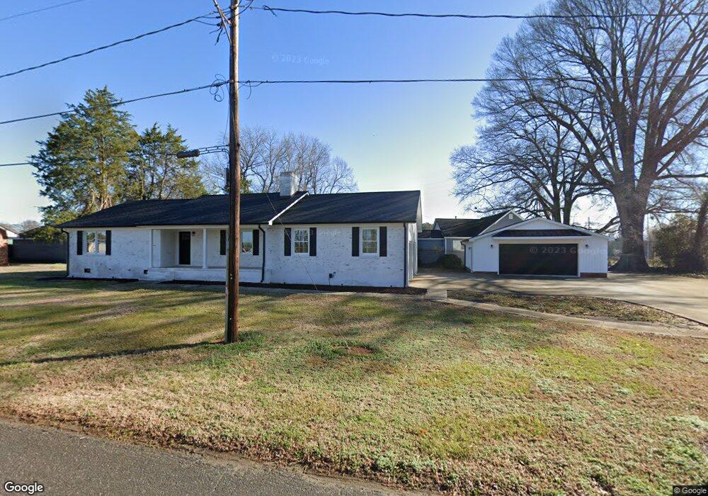
606 Ford Dr Lowell, NC 28098
Estimated Value: $222,000 - $283,000
2
Beds
1
Bath
1,348
Sq Ft
$188/Sq Ft
Est. Value
About This Home
This home is located at 606 Ford Dr, Lowell, NC 28098 and is currently estimated at $253,847, approximately $188 per square foot. 606 Ford Dr is a home located in Gaston County with nearby schools including Lowell Elementary School, Holbrook Middle School, and Ashbrook High School.
Ownership History
Date
Name
Owned For
Owner Type
Purchase Details
Closed on
Oct 1, 2018
Sold by
Dockery David N and Dockery Betty M
Bought by
Shields Richard A and Sheilds Crystal
Current Estimated Value
Home Financials for this Owner
Home Financials are based on the most recent Mortgage that was taken out on this home.
Original Mortgage
$60,000
Outstanding Balance
$52,324
Interest Rate
4.5%
Mortgage Type
Seller Take Back
Estimated Equity
$201,523
Create a Home Valuation Report for This Property
The Home Valuation Report is an in-depth analysis detailing your home's value as well as a comparison with similar homes in the area
Home Values in the Area
Average Home Value in this Area
Purchase History
| Date | Buyer | Sale Price | Title Company |
|---|---|---|---|
| Shields Richard A | $82,000 | None Available | |
| Dockery David N | $82,000 | None Available |
Source: Public Records
Mortgage History
| Date | Status | Borrower | Loan Amount |
|---|---|---|---|
| Open | Dockery David N | $60,000 |
Source: Public Records
Tax History
| Year | Tax Paid | Tax Assessment Tax Assessment Total Assessment is a certain percentage of the fair market value that is determined by local assessors to be the total taxable value of land and additions on the property. | Land | Improvement |
|---|---|---|---|---|
| 2025 | $2,242 | $209,740 | $102,910 | $106,830 |
| 2024 | $2,242 | $209,740 | $102,910 | $106,830 |
| 2023 | $2,485 | $202,550 | $102,910 | $99,640 |
| 2022 | $1,803 | $127,890 | $27,440 | $100,450 |
| 2021 | $1,688 | $127,890 | $27,440 | $100,450 |
| 2019 | $1,632 | $128,530 | $27,440 | $101,090 |
| 2018 | $1,814 | $139,506 | $18,295 | $121,211 |
| 2017 | $1,814 | $139,506 | $18,295 | $121,211 |
| 2016 | $1,814 | $139,506 | $0 | $0 |
| 2014 | $1,843 | $141,738 | $18,295 | $123,443 |
Source: Public Records
Map
Nearby Homes
- 116 Brymer Rd
- 211 Seigle St Unit 37-38
- 116 Kenworthy Ave
- 2016 Shadwell Ct
- 2640 Petersburg Ct
- 2017 Shadwell Ct
- 1100 Avondale Rd
- 3710 Gardner Park Dr
- 302 W 2nd St
- 2602 Jacobs Rd
- 2468 Shaw Ave
- 2010 Monticello Dr
- 2400 Amity Ave
- 720 Martha Ave
- 722 Martha Ave
- 2426 Redbud Dr
- 00 W 1st St
- 2318 Shaw Ave
- 2260 Wynbourne Dr
- 448 17th St
- 505 Ledwell St
- 4512 Wilkinson Blvd
- 509 Ledwell St
- 4502 Wilkinson Blvd
- 6313 Wilkinson Blvd
- 4526 Wilkinson Blvd
- 4526 Wilkinson Blvd Unit 1-4
- 4526 Wilkinson Blvd Unit 1-4 and 38
- 4511 Wilkinson Blvd
- 4517 Wilkinson Blvd
- 4503 Wilkinson Blvd
- 501 and 503 Mclain St
- 511 Mclean St
- 501 Mclean St
- 1521 Westover St
- 1514 Westover St
- 505 Mclean St
- 1512 Westover St
- 413 Mclean St
- 1515 Westover St