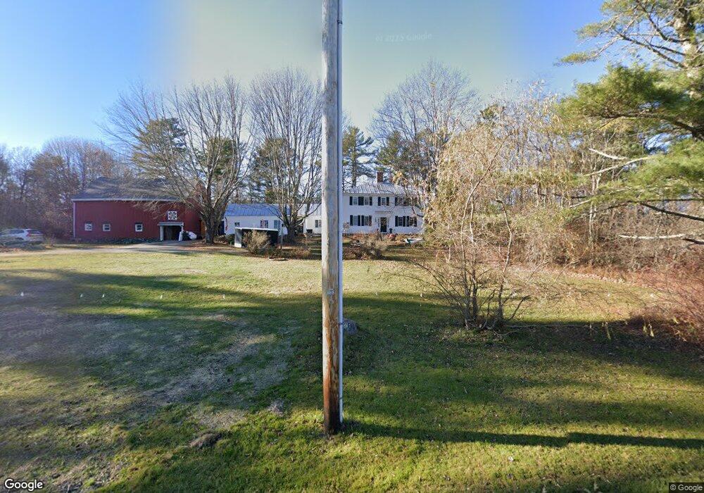
606 Foreside Rd Topsham, ME 04086
Estimated Value: $495,934 - $627,000
4
Beds
3
Baths
2,680
Sq Ft
$208/Sq Ft
Est. Value
About This Home
This home is located at 606 Foreside Rd, Topsham, ME 04086 and is currently estimated at $558,645, approximately $208 per square foot. 606 Foreside Rd is a home located in Sagadahoc County with nearby schools including Mt Ararat High School and St John's Catholic School.
Ownership History
Date
Name
Owned For
Owner Type
Purchase Details
Closed on
Dec 11, 2019
Sold by
Deschaine Heather R
Bought by
Oland John T and Oland Courtney D
Current Estimated Value
Home Financials for this Owner
Home Financials are based on the most recent Mortgage that was taken out on this home.
Original Mortgage
$75,000
Outstanding Balance
$65,838
Interest Rate
3.6%
Mortgage Type
New Conventional
Estimated Equity
$492,807
Purchase Details
Closed on
Jul 2, 2009
Sold by
Riddle Judith R Est and Rioux
Bought by
Oland John T and Oland Courtney D
Home Financials for this Owner
Home Financials are based on the most recent Mortgage that was taken out on this home.
Original Mortgage
$180,500
Interest Rate
4.86%
Mortgage Type
Purchase Money Mortgage
Create a Home Valuation Report for This Property
The Home Valuation Report is an in-depth analysis detailing your home's value as well as a comparison with similar homes in the area
Home Values in the Area
Average Home Value in this Area
Purchase History
| Date | Buyer | Sale Price | Title Company |
|---|---|---|---|
| Oland John T | -- | None Available | |
| Oland John T | -- | None Available | |
| Oland John T | -- | -- | |
| Oland John T | -- | -- |
Source: Public Records
Mortgage History
| Date | Status | Borrower | Loan Amount |
|---|---|---|---|
| Open | Oland John T | $75,000 | |
| Closed | Oland John T | $75,000 | |
| Previous Owner | Oland John T | $180,500 |
Source: Public Records
Tax History
| Year | Tax Paid | Tax Assessment Tax Assessment Total Assessment is a certain percentage of the fair market value that is determined by local assessors to be the total taxable value of land and additions on the property. | Land | Improvement |
|---|---|---|---|---|
| 2025 | $5,535 | $432,400 | $82,500 | $349,900 |
| 2024 | $5,345 | $427,600 | $77,700 | $349,900 |
| 2023 | $5,179 | $381,400 | $74,600 | $306,800 |
| 2022 | $5,220 | $362,000 | $72,400 | $289,600 |
| 2021 | $5,285 | $333,000 | $67,600 | $265,400 |
| 2020 | $5,238 | $293,300 | $67,600 | $225,700 |
| 2019 | $5,255 | $274,400 | $67,600 | $206,800 |
| 2018 | $5,066 | $270,500 | $62,000 | $208,500 |
| 2017 | $4,901 | $270,500 | $62,000 | $208,500 |
| 2016 | $4,897 | $272,200 | $62,000 | $210,200 |
| 2015 | $4,952 | $275,700 | $62,000 | $213,700 |
| 2014 | $4,866 | $280,800 | $62,000 | $218,800 |
| 2013 | $4,675 | $280,800 | $62,000 | $218,800 |
Source: Public Records
Map
Nearby Homes
- 62 Townsend Way
- 24 Theodore Dr
- 36 Franklin Pkwy
- 31 Franklin Pkwy
- 27 Tufton St
- 24 Dolloff Dr
- 17 Tufton St
- 53 Larry Ln
- 35 Deerfield Dr
- 545 Old Bath Rd
- 0 Peterson
- Lot#11&12 Farley Rd
- 75 Adams Landing Rd
- 31 Beacon Dr
- 28 Jade Dr
- 11 Beacon Dr
- Lot 23 Beacon Dr
- Lot 11 Beacon Dr
- 0 Allagash Dr
- Lot 18 Beacon Dr
- 15 Elliot Ln
- Lot 3 Foreside Rd
- Lot 2 Foreside Rd
- 592 Foreside Rd
- T B D Foreside Rd
- 628 Foreside Rd
- 24 Elliott Ln
- 631 Foreside Rd
- 40 Elliot Ln
- 0 Foreside Rd
- T B A Foreside Rd
- 0 Palmer
- 6 Palmer Ln
- 2 Palmer Ln
- 568 Foreside Rd
- 655 Foreside Rd
- 641 Foreside Rd
- 0 Larrabee Ln
- 609 Foreside Rd
- 609 Foreside Rd
Your Personal Tour Guide
Ask me questions while you tour the home.