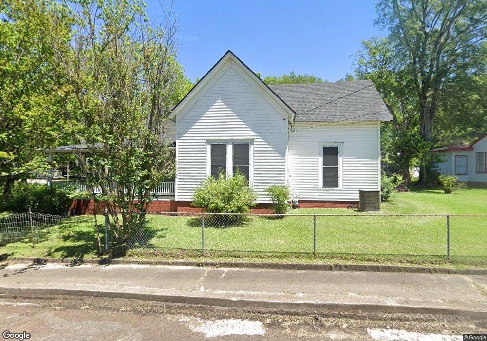
606 Grove St West Point, MS 39773
Estimated Value: $137,084 - $169,000
3
Beds
--
Bath
1,975
Sq Ft
$76/Sq Ft
Est. Value
About This Home
This home is located at 606 Grove St, West Point, MS 39773 and is currently estimated at $150,695, approximately $76 per square foot. 606 Grove St is a home located in Clay County with nearby schools including East Side Elementary School, West Clay Elementary School, and Church Hill Elementary School.
Ownership History
Date
Name
Owned For
Owner Type
Purchase Details
Closed on
Mar 3, 2025
Sold by
King James Bruce
Bought by
Burdine Elizabeth Jean
Current Estimated Value
Purchase Details
Closed on
Mar 23, 2023
Sold by
King John Edmund
Bought by
King James Bruce
Create a Home Valuation Report for This Property
The Home Valuation Report is an in-depth analysis detailing your home's value as well as a comparison with similar homes in the area
Purchase History
| Date | Buyer | Sale Price | Title Company |
|---|---|---|---|
| Burdine Elizabeth Jean | -- | None Listed On Document | |
| King James Bruce | -- | -- |
Source: Public Records
Tax History
| Year | Tax Paid | Tax Assessment Tax Assessment Total Assessment is a certain percentage of the fair market value that is determined by local assessors to be the total taxable value of land and additions on the property. | Land | Improvement |
|---|---|---|---|---|
| 2025 | $936 | $17,259 | $1,922 | $15,337 |
| 2024 | $936 | $17,259 | $1,922 | $15,337 |
| 2023 | $1,174 | $9,850 | $1,281 | $8,569 |
| 2022 | $391 | $9,850 | $1,281 | $8,569 |
| 2021 | $388 | $9,850 | $1,281 | $8,569 |
| 2020 | $392 | $9,850 | $1,281 | $8,569 |
| 2019 | $352 | $9,772 | $1,281 | $8,491 |
| 2018 | $332 | $9,772 | $1,281 | $8,491 |
| 2017 | $332 | $9,772 | $1,281 | $8,491 |
| 2016 | $322 | $9,772 | $1,281 | $8,491 |
| 2015 | $287 | $8,758 | $1,281 | $7,477 |
| 2014 | $232 | $8,758 | $1,281 | $7,477 |
| 2013 | $232 | $8,758 | $1,281 | $7,477 |
Source: Public Records
Map
Nearby Homes
- 98 Court St
- 228 S Division St
- 346 E Brame Ave
- 184 Tournament St
- 229 S Division St
- 238 Calhoun St
- 159 Washington St
- 479 E Westbrook St
- 480 E Westbrook St
- 485 E Westbrook St
- 26788 E Main St
- 551 E Westbrook St
- 26852 E Main St
- 1153 E Broad St
- 1180 E Broad St
- 26596 E Main St
- 0 Mississippi 50
- 1046 E Brame Ave
- 27045 E Main St
- 341 Mccord St