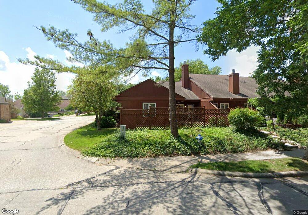
606 Huntridge Dr Unit 103D Columbia, MO 65201
Meadows NeighborhoodEstimated Value: $187,020 - $207,000
2
Beds
2
Baths
1,250
Sq Ft
$156/Sq Ft
Est. Value
About This Home
This home is located at 606 Huntridge Dr Unit 103D, Columbia, MO 65201 and is currently estimated at $195,255, approximately $156 per square foot. 606 Huntridge Dr Unit 103D is a home located in Boone County with nearby schools including Locust Street Expressive Arts Elementary School, Jefferson Middle School, and Rock Bridge High School.
Ownership History
Date
Name
Owned For
Owner Type
Purchase Details
Closed on
Jan 28, 2022
Sold by
Piper Mary J
Bought by
Earl & Mary Piper Living Trust
Current Estimated Value
Purchase Details
Closed on
Apr 18, 2011
Sold by
Strader Ralph L and Strader Paulette M
Bought by
Piper Mary J
Purchase Details
Closed on
Jan 13, 2007
Sold by
Heider Fred L and Heider Phillis J
Bought by
Strader Ralph L and Strader Paulette M
Home Financials for this Owner
Home Financials are based on the most recent Mortgage that was taken out on this home.
Original Mortgage
$82,800
Interest Rate
6.1%
Mortgage Type
New Conventional
Create a Home Valuation Report for This Property
The Home Valuation Report is an in-depth analysis detailing your home's value as well as a comparison with similar homes in the area
Home Values in the Area
Average Home Value in this Area
Purchase History
| Date | Buyer | Sale Price | Title Company |
|---|---|---|---|
| Earl & Mary Piper Living Trust | -- | None Listed On Document | |
| Piper Mary J | -- | Boone Central Title Company | |
| Strader Ralph L | -- | None Available |
Source: Public Records
Mortgage History
| Date | Status | Borrower | Loan Amount |
|---|---|---|---|
| Previous Owner | Strader Ralph L | $82,800 |
Source: Public Records
Tax History Compared to Growth
Tax History
| Year | Tax Paid | Tax Assessment Tax Assessment Total Assessment is a certain percentage of the fair market value that is determined by local assessors to be the total taxable value of land and additions on the property. | Land | Improvement |
|---|---|---|---|---|
| 2025 | $1,355 | $22,990 | $3,800 | $19,190 |
| 2024 | $1,355 | $20,083 | $3,800 | $16,283 |
| 2023 | $1,344 | $20,083 | $3,800 | $16,283 |
| 2022 | $1,243 | $18,601 | $3,800 | $14,801 |
| 2021 | $1,246 | $18,601 | $3,800 | $14,801 |
| 2020 | $1,227 | $17,215 | $3,800 | $13,415 |
| 2019 | $1,227 | $17,215 | $3,800 | $13,415 |
| 2018 | $1,144 | $0 | $0 | $0 |
| 2017 | $1,130 | $15,941 | $3,800 | $12,141 |
| 2016 | $1,128 | $15,941 | $3,800 | $12,141 |
| 2015 | $1,036 | $15,941 | $3,800 | $12,141 |
| 2014 | $1,039 | $15,941 | $3,800 | $12,141 |
Source: Public Records
Map
Nearby Homes
- 517 Huntridge Dr Unit 8B
- 479 Foxfire Dr Unit 71D
- 423 Foxfire Dr Unit 35C
- 305 Bennett Springs Ct
- 104 W Green Meadows Rd
- 104 W Green Meadows Rd Unit 18
- 2802 Melody Ln Unit 3A
- 8 E Alhambra Dr
- 3615 Madera Dr
- 603 N Brookline Dr
- 400 & 420 N Village Cir
- 0 N Village Cir
- 715 Columbine Ct
- 504 & 409 N S Village Cir
- 3310 Lynnwood Dr
- 500 S Village Cir
- 3604 Chatham Dr
- 2416 Cimarron Dr
- 2702 Lynnwood Dr
- 1601 Telluride Ln
- 604 Huntridge Dr Unit 103C
- 602 Huntridge Dr Unit 103B
- 660 Huntridge Dr
- 600 Huntridge Dr Unit 103A
- 658 Huntridge Dr
- 656 Huntridge Dr
- 654 Huntridge Dr
- 603 Huntridge Dr Unit 603
- 614 Huntridge Dr Unit 103H
- 628 Huntridge Dr Unit 103Z1
- 607 Huntridge Dr
- 628 Huntridge Dr-Uni Dr
- 630 Huntridge Dr Unit 103Z2
- 612 Huntridge Dr
- 612 Huntridge Dr Unit 103G
- 605 Huntridge Dr
- 632 Huntridge Dr Unit 103Z3
- 514 Huntridge Dr Unit 102D
- 652 Huntridge Dr
- 610 Huntridge Dr