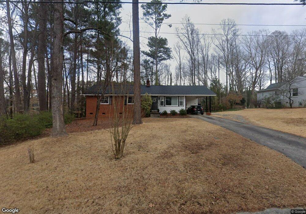
606 Normandy St Cary, NC 27511
South Cary NeighborhoodEstimated Value: $331,000 - $397,024
--
Bed
2
Baths
1,144
Sq Ft
$326/Sq Ft
Est. Value
About This Home
This home is located at 606 Normandy St, Cary, NC 27511 and is currently estimated at $373,506, approximately $326 per square foot. 606 Normandy St is a home located in Wake County with nearby schools including Cary Elementary, East Cary Middle School, and Cary High School.
Ownership History
Date
Name
Owned For
Owner Type
Purchase Details
Closed on
Jul 15, 2003
Sold by
Hobgood Roger Brent and Hobgood Betsy Allen
Bought by
Rasmus Amelia Jeanette
Current Estimated Value
Home Financials for this Owner
Home Financials are based on the most recent Mortgage that was taken out on this home.
Original Mortgage
$104,000
Outstanding Balance
$44,016
Interest Rate
5.2%
Mortgage Type
Purchase Money Mortgage
Estimated Equity
$329,490
Create a Home Valuation Report for This Property
The Home Valuation Report is an in-depth analysis detailing your home's value as well as a comparison with similar homes in the area
Home Values in the Area
Average Home Value in this Area
Purchase History
| Date | Buyer | Sale Price | Title Company |
|---|---|---|---|
| Rasmus Amelia Jeanette | $114,500 | -- |
Source: Public Records
Mortgage History
| Date | Status | Borrower | Loan Amount |
|---|---|---|---|
| Open | Rasmus Amelia Jeanette | $104,000 |
Source: Public Records
Tax History Compared to Growth
Tax History
| Year | Tax Paid | Tax Assessment Tax Assessment Total Assessment is a certain percentage of the fair market value that is determined by local assessors to be the total taxable value of land and additions on the property. | Land | Improvement |
|---|---|---|---|---|
| 2025 | $3,145 | $364,638 | $205,000 | $159,638 |
| 2024 | $3,077 | $364,638 | $205,000 | $159,638 |
| 2023 | $2,449 | $242,440 | $120,000 | $122,440 |
| 2022 | $2,358 | $242,440 | $120,000 | $122,440 |
| 2021 | $2,311 | $242,440 | $120,000 | $122,440 |
| 2020 | $2,323 | $242,440 | $120,000 | $122,440 |
| 2019 | $1,937 | $179,080 | $94,000 | $85,080 |
| 2018 | $1,819 | $179,080 | $94,000 | $85,080 |
| 2017 | $1,748 | $179,080 | $94,000 | $85,080 |
| 2016 | $1,722 | $179,080 | $94,000 | $85,080 |
| 2015 | $1,449 | $145,194 | $66,000 | $79,194 |
| 2014 | -- | $145,194 | $66,000 | $79,194 |
Source: Public Records
Map
Nearby Homes
- 511 Normandy St
- 119 Danforth Dr
- 111 Cimmaron Ct
- 206 Vista Creek Place
- 111 Strass Ct
- 906 Griffis St
- 100 Granby Ct
- 114 Granby Ct
- 404 SW Maynard Rd
- 322 S Dixon Ave Unit R
- 322 S Dixon Ave
- 1017 Frank Page Dr
- 514 S Harrison Ave
- 418 S West St
- 534 Matheson Place
- 710 Samuel Cary Dr
- 207 High House Rd
- 802 Prince St
- 209 High House Rd
- 119 Joanne Cir
- 602 Normandy St
- 610 Normandy St
- 518 Normandy St
- 609 Normandy St
- 613 Normandy St
- 514 Normandy St
- 521 Normandy St
- 608 Dorset Dr
- 801 Pamlico Dr
- 804 Union St
- 802 Union St
- 285 Vista Creek Place
- 510 Normandy St
- 808 Union St
- 283 Vista Creek Place
- 710 Union St
- 515 Normandy St
- 805 Pamlico Dr
- 612 Dorset Dr
- 607 Dorset Dr