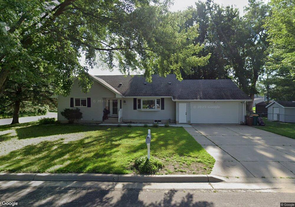
606 Sherwood St Albert Lea, MN 56007
Estimated Value: $258,000 - $287,000
3
Beds
1
Bath
1,674
Sq Ft
$162/Sq Ft
Est. Value
About This Home
This home is located at 606 Sherwood St, Albert Lea, MN 56007 and is currently estimated at $270,406, approximately $161 per square foot. 606 Sherwood St is a home located in Freeborn County with nearby schools including Hawthorne Elementary School, Southwest Middle School, and Albert Lea Senior High School.
Ownership History
Date
Name
Owned For
Owner Type
Purchase Details
Closed on
Oct 14, 2024
Sold by
Prana Holdings Llc
Bought by
Mortenson Ashley
Current Estimated Value
Purchase Details
Closed on
Jun 1, 2021
Sold by
Haakenson Lila M
Bought by
Htoo Eh Kaw and Paw Pree
Home Financials for this Owner
Home Financials are based on the most recent Mortgage that was taken out on this home.
Original Mortgage
$179,450
Interest Rate
2.9%
Mortgage Type
New Conventional
Purchase Details
Closed on
Sep 30, 2010
Sold by
Betty J Betty J
Bought by
Haakenson Travis O and Haakenson Lila M
Home Financials for this Owner
Home Financials are based on the most recent Mortgage that was taken out on this home.
Original Mortgage
$118,750
Interest Rate
4.26%
Mortgage Type
Purchase Money Mortgage
Create a Home Valuation Report for This Property
The Home Valuation Report is an in-depth analysis detailing your home's value as well as a comparison with similar homes in the area
Home Values in the Area
Average Home Value in this Area
Purchase History
| Date | Buyer | Sale Price | Title Company |
|---|---|---|---|
| Mortenson Ashley | $264,900 | -- | |
| Htoo Eh Kaw | $185,000 | North American Title | |
| Haakenson Travis O | -- | -- | |
| Htoo Eh Eh | $185,000 | -- |
Source: Public Records
Mortgage History
| Date | Status | Borrower | Loan Amount |
|---|---|---|---|
| Previous Owner | Htoo Eh Kaw | $179,450 | |
| Previous Owner | Haakenson Travis O | $118,750 | |
| Closed | Htoo Eh Eh | $179,450 |
Source: Public Records
Tax History Compared to Growth
Tax History
| Year | Tax Paid | Tax Assessment Tax Assessment Total Assessment is a certain percentage of the fair market value that is determined by local assessors to be the total taxable value of land and additions on the property. | Land | Improvement |
|---|---|---|---|---|
| 2025 | $2,428 | $229,600 | $22,800 | $206,800 |
| 2024 | $2,320 | $179,800 | $22,800 | $157,000 |
| 2023 | $2,388 | $169,500 | $22,800 | $146,700 |
| 2022 | $2,088 | $174,300 | $16,000 | $158,300 |
| 2021 | $1,904 | $137,400 | $16,000 | $121,400 |
| 2020 | $1,866 | $125,100 | $13,700 | $111,400 |
| 2019 | $1,462 | $104,900 | $11,400 | $93,500 |
| 2018 | $1,416 | $0 | $0 | $0 |
| 2016 | $1,388 | $0 | $0 | $0 |
| 2015 | $1,386 | $0 | $0 | $0 |
| 2014 | $1,154 | $0 | $0 | $0 |
| 2012 | $1,762 | $0 | $0 | $0 |
Source: Public Records
Map
Nearby Homes
- 505 Wayside Ave
- 611 Ulstad Ave
- 1715 SE Marshall St
- 1200 Crestview Rd
- 1916 E Main St
- 614 Garfield Ave
- 819 Pillsbury Ave
- 505 Pillsbury Ave
- 1321 Garfield Ave
- 1020 Saint Jacob Ave
- 602 Minnesota Ave
- 713 Minnesota Ave
- 2473 SE Marshall St
- 613 & 615 Giles Place
- 618 & 620 Giles Place
- 902 Clausen Ave
- 711 Clausen Ave
- 1626 Keystone Dr
- 314 Burr Oak Dr
- 313 Glenn Rd
- 606 Sherwood Ave
- 606 606 Shewood-Avenue-
- 1904 State St
- 1901 Johnson St
- 1906 State St
- 1905 Johnson St
- 607 Sherwood Ave
- 607 Sherwood St
- 1807 Johnson St
- 1908 State St
- 1913 Johnson St
- 1913 E Johnson St
- 1805 Johnson St
- 1910 State St
- 1915 Johnson St
- 1906 E Johnson St
- 1906 Johnson St
- 608 Cherry Ave
- 606 Cherry Ave
- 1902 Johnson St