Estimated Value: $365,000 - $667,000
6
Beds
4
Baths
1,111
Sq Ft
$449/Sq Ft
Est. Value
About This Home
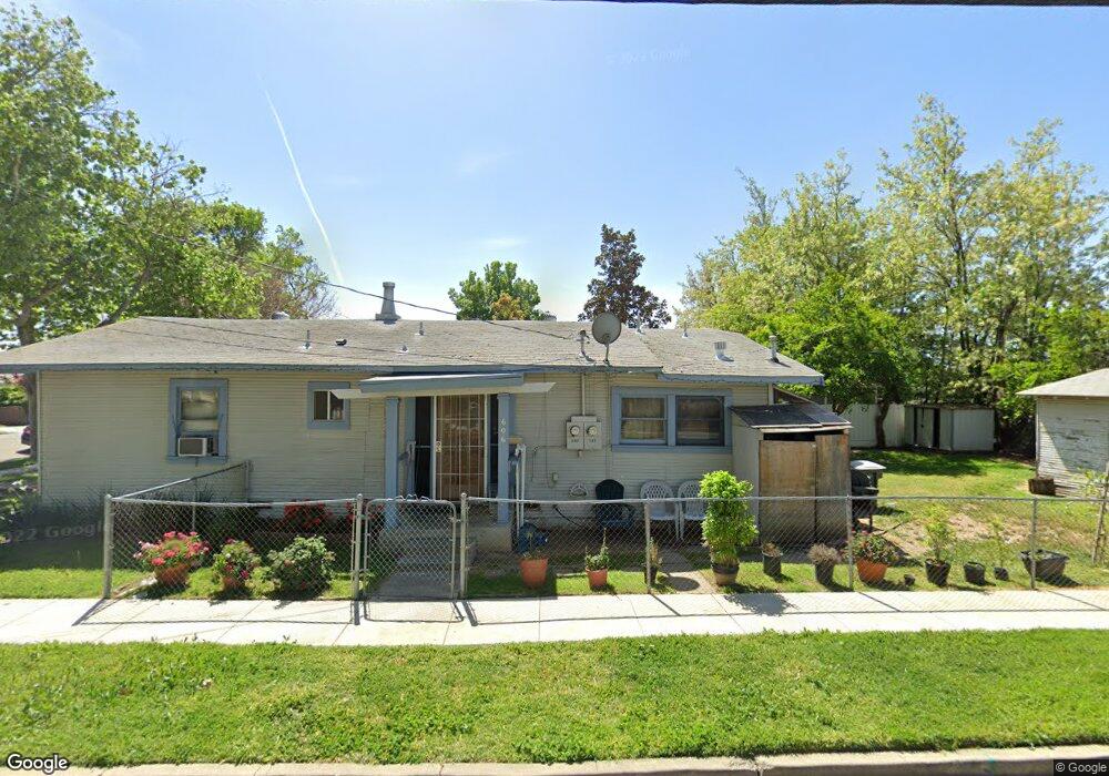
This home is located at 606 W 9th St, Tracy, CA 95376 and is currently estimated at $498,777, approximately $448 per square foot. 606 W 9th St is a home located in San Joaquin County with nearby schools including South/West Park Elementary School, Monte Vista Middle School, and Tracy High School.
Ownership History
Date
Name
Owned For
Owner Type
Purchase Details
Closed on
Sep 6, 2025
Sold by
Singal Raj
Bought by
Raj And Saroj Singal Family Trust and Singal
Current Estimated Value
Purchase Details
Closed on
Jan 31, 2002
Sold by
Singal Saroj
Bought by
Singal Raj
Home Financials for this Owner
Home Financials are based on the most recent Mortgage that was taken out on this home.
Original Mortgage
$90,000
Interest Rate
7.17%
Purchase Details
Closed on
Jun 7, 2000
Sold by
Holmes Jack R and C G
Bought by
Singal Raj
Home Financials for this Owner
Home Financials are based on the most recent Mortgage that was taken out on this home.
Original Mortgage
$100,050
Interest Rate
8.15%
Create a Home Valuation Report for This Property
The Home Valuation Report is an in-depth analysis detailing your home's value as well as a comparison with similar homes in the area
Home Values in the Area
Average Home Value in this Area
Purchase History
| Date | Buyer | Sale Price | Title Company |
|---|---|---|---|
| Raj And Saroj Singal Family Trust | -- | None Listed On Document | |
| Singal Raj | -- | Fidelity National Title Co | |
| Singal Raj | $136,500 | Chicago Title Co | |
| Singal Ray | -- | -- |
Source: Public Records
Mortgage History
| Date | Status | Borrower | Loan Amount |
|---|---|---|---|
| Previous Owner | Singal Raj | $90,000 | |
| Previous Owner | Singal Raj | $100,050 |
Source: Public Records
Tax History
| Year | Tax Paid | Tax Assessment Tax Assessment Total Assessment is a certain percentage of the fair market value that is determined by local assessors to be the total taxable value of land and additions on the property. | Land | Improvement |
|---|---|---|---|---|
| 2025 | $2,437 | $209,783 | $69,157 | $140,626 |
| 2024 | $2,246 | $205,670 | $67,801 | $137,869 |
| 2023 | $2,212 | $201,638 | $66,472 | $135,166 |
| 2022 | $2,167 | $197,685 | $65,169 | $132,516 |
| 2021 | $2,142 | $193,810 | $63,892 | $129,918 |
| 2020 | $2,128 | $191,823 | $63,237 | $128,586 |
| 2019 | $2,095 | $188,063 | $61,998 | $126,065 |
| 2018 | $2,060 | $184,377 | $60,783 | $123,594 |
| 2017 | $1,958 | $180,763 | $59,592 | $121,171 |
| 2016 | $1,981 | $177,219 | $58,424 | $118,795 |
| 2015 | $1,963 | $174,557 | $57,546 | $117,011 |
| 2014 | $1,622 | $150,000 | $37,000 | $113,000 |
Source: Public Records
Map
Nearby Homes
- 920 Taft Ave
- 740 Sequoia Blvd
- 319 W 12th St
- 389 Burlington Dr
- 1330 Bessie Ave
- 1241 Parker Ave Unit 1
- 448 Burlington Dr
- 1243 Parker Ave Unit 2
- 1245 Parker Ave Unit 3
- 206 W 12th St
- 18 W 8th St
- 1540 Meadow Lark Ln
- 1506 Madison Ave
- 1416 Audrey Dr
- 550 Fawn Glen Dr
- 1400 Divine Ln
- 50 S Hickory Ave
- 1636 Parker Ave
- 445 W Lowell Ave
- 539 W Lowell Ave
- 735 Roosevelt Ave
- 0 W Mt Oso Ave Unit 225012138
- 0 W Mt Oso Ave Unit ML81952688
- 0 W Mt Oso Ave Unit 222047859
- 0 W Mt Oso Ave Unit 222036916
- 607 W 6th St
- 903 Roosevelt Ave
- 725 Roosevelt Ave
- 909 Roosevelt Ave
- 576 W 9th St
- 740 Roosevelt Ave
- 730 Roosevelt Ave
- 575 W 9th St
- 915 Roosevelt Ave
- 914 Roosevelt Ave
- 712 Roosevelt Ave
- 564 W 9th St
- 929 Roosevelt Ave
- 918 Roosevelt Ave
- 737 Taft Ave
Your Personal Tour Guide
Ask me questions while you tour the home.