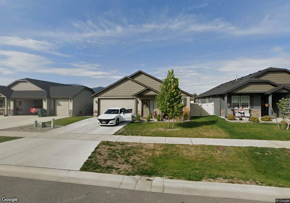
6061 Alliance Rathdrum, ID 83858
Estimated Value: $507,000
3
Beds
2
Baths
1,571
Sq Ft
$323/Sq Ft
Est. Value
About This Home
This home is located at 6061 Alliance, Rathdrum, ID 83858 and is currently estimated at $507,000, approximately $322 per square foot. 6061 Alliance is a home located in Kootenai County with nearby schools including Garwood Elementary School, Lakeland Middle School, and Lakeland Senior High School.
Ownership History
Date
Name
Owned For
Owner Type
Purchase Details
Closed on
Sep 9, 2022
Sold by
Widmer Vernon L and Widmer Rebecca L
Bought by
Hohman Jay B and Hohman Michelle L
Current Estimated Value
Purchase Details
Closed on
Dec 8, 2021
Sold by
Morgan Leland D and Morgan Ruth A
Bought by
Candor Llc
Purchase Details
Closed on
Jul 7, 2021
Sold by
Hayden Homes Llc
Bought by
Morgan Leland D and Morgan Ruth A
Home Financials for this Owner
Home Financials are based on the most recent Mortgage that was taken out on this home.
Original Mortgage
$268,993
Interest Rate
2.8%
Mortgage Type
New Conventional
Create a Home Valuation Report for This Property
The Home Valuation Report is an in-depth analysis detailing your home's value as well as a comparison with similar homes in the area
Home Values in the Area
Average Home Value in this Area
Purchase History
| Date | Buyer | Sale Price | Title Company |
|---|---|---|---|
| Hohman Jay B | -- | Alliance Title & Escrow | |
| Candor Llc | -- | None Listed On Document | |
| Morgan Leland D | -- | Alliance Ttl Coeur D Alene O |
Source: Public Records
Mortgage History
| Date | Status | Borrower | Loan Amount |
|---|---|---|---|
| Previous Owner | Morgan Leland D | $268,993 |
Source: Public Records
Tax History Compared to Growth
Tax History
| Year | Tax Paid | Tax Assessment Tax Assessment Total Assessment is a certain percentage of the fair market value that is determined by local assessors to be the total taxable value of land and additions on the property. | Land | Improvement |
|---|---|---|---|---|
| 2025 | $2,799 | $485,822 | $175,000 | $310,822 |
| 2024 | $2,799 | $449,780 | $160,000 | $289,780 |
| 2023 | $2,799 | $469,900 | $175,000 | $294,900 |
| 2022 | $3,280 | $538,880 | $185,000 | $353,880 |
| 2021 | $1,030 | $341,035 | $100,355 | $240,680 |
| 2020 | $0 | $100,355 | $100,355 | $0 |
Source: Public Records
Map
Nearby Homes
- 5994 W Alliance St
- 6062 W Lofty Ridge St
- 12981 Gondola
- 12175 N Meyer Rd
- 12772 N Cavanaugh Dr
- 12750 N Cavanaugh Dr
- 12721 N Krauss Cir
- 13017 N Cavanaugh Dr
- 5987 W Quinn Way
- 6481 W Daltrey Way
- 6632 W Portrush Dr
- 6722 W Portrush Dr
- 6860 W Elmberry
- 12398 N Cavanaugh Dr
- 12304 N Cavanaugh Dr
- 5542 W Irish Dr
- 12348 N Gipper Loop
- 6024 W Irish Cir
- 13395 N Shimmering Ct
- 6171 Bowmore Ln
- 6090 W Majestic Ave
- 6074 W Majestic Ave
- 6108 W Majestic Ave
- 6045 Alliance
- 6079 Alliance
- 6056 W Majestic Ave
- 6154 W Majestic Ave
- 6089 W Majestic Ave
- 6079 W Alliance St
- 6061 W Alliance St
- 6107 W Majestic Ave
- 6073 W Majestic Ave
- 6084 W Twister St
- 6045 W Alliance St
- 6095 W Alliance St
- 6040 W Majestic Ave
- 6095 Alliance
- 6055 W Majestic Ave
- 6109 W Alliance St
- 6155 W Majestic Ave