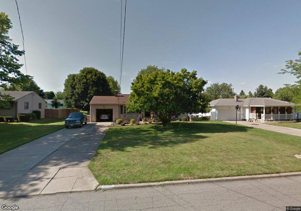
6062 Tam o Shanter Dr Youngstown, OH 44514
Estimated Value: $132,000 - $150,000
3
Beds
1
Bath
1,092
Sq Ft
$131/Sq Ft
Est. Value
About This Home
This home is located at 6062 Tam o Shanter Dr, Youngstown, OH 44514 and is currently estimated at $142,561, approximately $130 per square foot. 6062 Tam o Shanter Dr is a home located in Mahoning County with nearby schools including Paul C. Bunn Elementary School, Clear Horizons Early College High School, and Chaney High School.
Ownership History
Date
Name
Owned For
Owner Type
Purchase Details
Closed on
Jul 15, 2004
Sold by
Wasko Helen and Morger Janice M
Bought by
Ciavarella Anthony L and Ciavarella Tammy L
Current Estimated Value
Home Financials for this Owner
Home Financials are based on the most recent Mortgage that was taken out on this home.
Original Mortgage
$55,200
Interest Rate
5.74%
Mortgage Type
Purchase Money Mortgage
Purchase Details
Closed on
May 15, 2001
Sold by
Helen Wasko
Bought by
Wasko Helen and Morger Janice M
Purchase Details
Closed on
May 27, 1980
Bought by
Wasko Helen
Create a Home Valuation Report for This Property
The Home Valuation Report is an in-depth analysis detailing your home's value as well as a comparison with similar homes in the area
Home Values in the Area
Average Home Value in this Area
Purchase History
| Date | Buyer | Sale Price | Title Company |
|---|---|---|---|
| Ciavarella Anthony L | $69,000 | -- | |
| Wasko Helen | -- | Midland Title | |
| Wasko Helen | -- | -- |
Source: Public Records
Mortgage History
| Date | Status | Borrower | Loan Amount |
|---|---|---|---|
| Closed | Ciavarella Anthony L | $55,200 |
Source: Public Records
Tax History Compared to Growth
Tax History
| Year | Tax Paid | Tax Assessment Tax Assessment Total Assessment is a certain percentage of the fair market value that is determined by local assessors to be the total taxable value of land and additions on the property. | Land | Improvement |
|---|---|---|---|---|
| 2024 | $1,390 | $33,940 | $6,330 | $27,610 |
| 2023 | $1,416 | $33,940 | $6,330 | $27,610 |
| 2022 | $1,613 | $21,470 | $5,660 | $15,810 |
| 2021 | $1,614 | $21,470 | $5,660 | $15,810 |
| 2020 | $1,621 | $21,470 | $5,660 | $15,810 |
| 2019 | $1,626 | $18,510 | $4,880 | $13,630 |
| 2018 | $1,529 | $18,510 | $4,880 | $13,630 |
| 2017 | $1,556 | $18,510 | $4,880 | $13,630 |
| 2016 | $1,606 | $21,000 | $5,970 | $15,030 |
| 2015 | $1,577 | $21,000 | $5,970 | $15,030 |
| 2014 | $1,568 | $21,000 | $5,970 | $15,030 |
| 2013 | $1,549 | $21,000 | $5,970 | $15,030 |
Source: Public Records
Map
Nearby Homes
- 1913 Country Club Ave
- 1933 Brandon Ave
- 1720 Sequoya Dr
- 0 Lemoyne Ave
- 1828 Basil Ave
- 1919 Wingate Rd
- 1830 Halbert Dr
- 1645 Chattanooga Ave
- 1841 Wingate Rd
- 1543 Lynn Ave
- 576 W Harvey St
- 0 Woodlawn Ave
- 1514 Thalia Ave
- 550 Brandon Ave
- 2002 Bancroft Ave
- 0 Oles Ave
- 1661 Wakefield Ave
- 1633 Wakefield Ave
- 525 W Omar St
- 1553 Bancroft Ave
- 6070 Tam o Shanter Dr
- 6054 Tam o Shanter Dr
- 1929 Sequoya Dr
- 1937 Sequoya Dr
- 1921 Sequoya Dr
- 6044 Tam o Shanter Dr
- 6078 Tam o Shanter Dr
- 6061 Tam o Shanter Dr
- 6053 Tam o Shanter Dr
- 1945 Sequoya Dr
- 1913 Sequoya Dr
- 6069 Tam o Shanter Dr
- 6045 Tam o Shanter Dr
- 6036 Tam o Shanter Dr
- 6037 Tam o Shanter Dr
- 6077 Tam o Shanter Dr
- 5121 Sheridan Rd
- 5113 Sheridan Rd
- 1928 Sequoya Dr
- 1953 Sequoya Dr