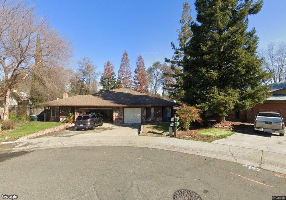
6063 Roloff Way Orangevale, CA 95662
Estimated Value: $377,000 - $638,000
5
Beds
3
Baths
2,242
Sq Ft
$242/Sq Ft
Est. Value
About This Home
This home is located at 6063 Roloff Way, Orangevale, CA 95662 and is currently estimated at $543,588, approximately $242 per square foot. 6063 Roloff Way is a home located in Sacramento County with nearby schools including Pershing Elementary School, Andrew Carnegie Middle School, and Bella Vista High School.
Ownership History
Date
Name
Owned For
Owner Type
Purchase Details
Closed on
May 5, 2014
Sold by
Beals Kirk S
Bought by
Beals Kirk S and The Kirk S Beals Family Trust
Current Estimated Value
Purchase Details
Closed on
Jul 7, 1997
Sold by
Basinet Family 1991 Revocable Trust and Patricia G
Bought by
Beals Kirk S
Home Financials for this Owner
Home Financials are based on the most recent Mortgage that was taken out on this home.
Original Mortgage
$106,000
Outstanding Balance
$15,298
Interest Rate
7.58%
Estimated Equity
$528,290
Create a Home Valuation Report for This Property
The Home Valuation Report is an in-depth analysis detailing your home's value as well as a comparison with similar homes in the area
Home Values in the Area
Average Home Value in this Area
Purchase History
| Date | Buyer | Sale Price | Title Company |
|---|---|---|---|
| Beals Kirk S | -- | None Available | |
| Beals Kirk S | $132,500 | Stewart Title |
Source: Public Records
Mortgage History
| Date | Status | Borrower | Loan Amount |
|---|---|---|---|
| Open | Beals Kirk S | $106,000 |
Source: Public Records
Tax History
| Year | Tax Paid | Tax Assessment Tax Assessment Total Assessment is a certain percentage of the fair market value that is determined by local assessors to be the total taxable value of land and additions on the property. | Land | Improvement |
|---|---|---|---|---|
| 2025 | $2,604 | $211,538 | $55,869 | $155,669 |
| 2024 | $2,604 | $207,391 | $54,774 | $152,617 |
| 2023 | $2,540 | $203,325 | $53,700 | $149,625 |
| 2022 | $2,528 | $199,340 | $52,648 | $146,692 |
| 2021 | $2,488 | $195,432 | $51,616 | $143,816 |
| 2020 | $2,443 | $193,429 | $51,087 | $142,342 |
| 2019 | $2,396 | $189,637 | $50,086 | $139,551 |
| 2018 | $2,365 | $185,919 | $49,104 | $136,815 |
| 2017 | $2,348 | $182,275 | $48,142 | $134,133 |
| 2016 | $2,200 | $178,702 | $47,199 | $131,503 |
| 2015 | $2,165 | $176,019 | $46,491 | $129,528 |
| 2014 | $2,122 | $172,572 | $45,581 | $126,991 |
Source: Public Records
Map
Nearby Homes
- 8770 Greenback Ln
- 8832 Canarsie Ave
- 8858 Kona Way
- 5817 Husker St
- 6013 Mcneely Way
- 8934 Oro Way
- 8641 Stratus Dr
- 8758 Corinne Dr
- 8928 Pershing Ave
- 8949 Genoa Ave
- 6422 Hazel Ave
- 9008 Clarissa Dr
- 6051 Kenneth Oak Way
- 5564 Fetz Ln
- 6600 Rosa Prado Ct
- 5556 Fetz Ln
- 5548 Fetz Ln
- 5596 Fetz Ln
- 5540 Fetz Ln
- 8433 N Star Way
- 6067 Roloff Way
- 6069 Roloff Way
- 6059 Roloff Way
- 8790 Mellowdawn Way
- 6081 Beech Ave
- 8786 Mellowdawn Way
- 6111 Beech Ave
- 6057 Roloff Way
- 6079 Beech Ave
- 6077 Beech Ave
- 8780 Mellowdawn Way
- 8794 Mellowdawn Way
- 8777 Sherry Dr
- 6055 Roloff Way
- 6066 Roloff Way
- 8781 Sherry Dr
- 8778 Mellowdawn Way
- 8783 Sherry Dr
- 8798 Mellowdawn Way
- 8785 Sherry Dr
Your Personal Tour Guide
Ask me questions while you tour the home.