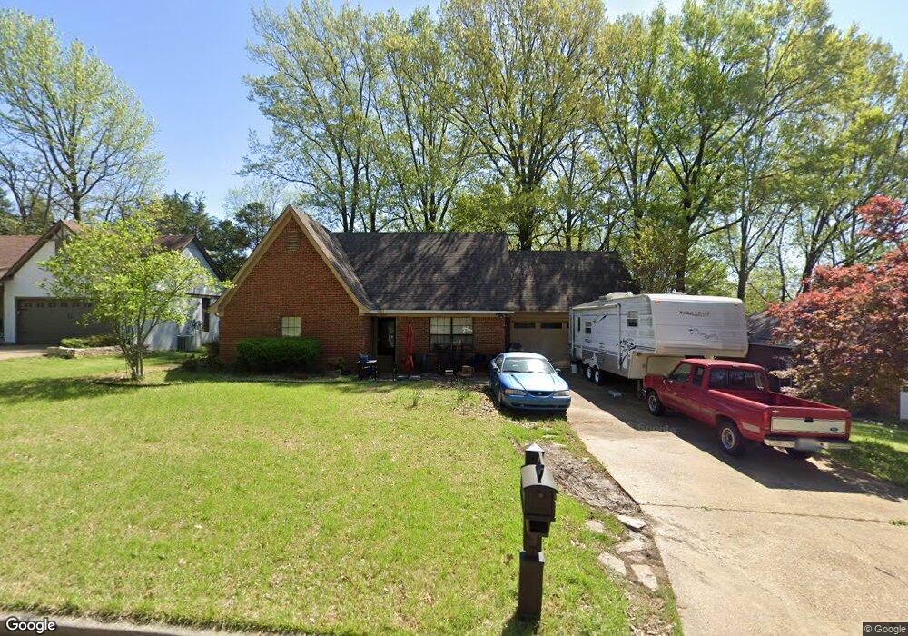
6064 Cherokee Dr Olive Branch, MS 38654
Estimated Value: $222,000 - $279,000
4
Beds
3
Baths
2,083
Sq Ft
$121/Sq Ft
Est. Value
About This Home
This home is located at 6064 Cherokee Dr, Olive Branch, MS 38654 and is currently estimated at $252,456, approximately $121 per square foot. 6064 Cherokee Dr is a home located in DeSoto County with nearby schools including Olive Branch Elementary School, Chickasaw Elementary School, and Olive Branch Middle School.
Ownership History
Date
Name
Owned For
Owner Type
Purchase Details
Closed on
Feb 18, 2009
Sold by
Federal Home Loan Mortgage Corporation
Bought by
Ward Jackie
Current Estimated Value
Purchase Details
Closed on
Jul 22, 2008
Sold by
Wells Fargo Bank Na
Bought by
Federal Home Loan Mortgage Corp
Purchase Details
Closed on
May 29, 2008
Sold by
Cook John Gowan and Cook Carol Armistead
Bought by
Wells Fargo Bank Na
Create a Home Valuation Report for This Property
The Home Valuation Report is an in-depth analysis detailing your home's value as well as a comparison with similar homes in the area
Home Values in the Area
Average Home Value in this Area
Purchase History
| Date | Buyer | Sale Price | Title Company |
|---|---|---|---|
| Ward Jackie | -- | None Available | |
| Federal Home Loan Mortgage Corp | -- | None Available | |
| Wells Fargo Bank Na | $81,407 | None Available |
Source: Public Records
Tax History
| Year | Tax Paid | Tax Assessment Tax Assessment Total Assessment is a certain percentage of the fair market value that is determined by local assessors to be the total taxable value of land and additions on the property. | Land | Improvement |
|---|---|---|---|---|
| 2025 | $1,573 | $16,179 | $1,500 | $14,679 |
| 2024 | $1,286 | $11,619 | $1,500 | $10,119 |
| 2023 | $1,286 | $11,619 | $0 | $0 |
| 2022 | $1,285 | $11,615 | $1,500 | $10,115 |
| 2021 | $1,285 | $11,615 | $1,500 | $10,115 |
| 2020 | $1,173 | $10,796 | $1,500 | $9,296 |
| 2019 | $1,173 | $10,796 | $1,500 | $9,296 |
| 2017 | $1,143 | $19,534 | $10,517 | $9,017 |
| 2016 | $1,143 | $10,517 | $1,500 | $9,017 |
| 2015 | $1,443 | $19,534 | $10,517 | $9,017 |
| 2014 | $1,080 | $10,057 | $0 | $0 |
| 2013 | $947 | $10,057 | $0 | $0 |
Source: Public Records
Map
Nearby Homes
- 5956 Eagleston Dr
- 6286 Seminole Dr
- 6073 Allen Pkwy E
- 5825 Southridge Dr
- 5806 Southbend Ln
- 9930 Sequoia Ln
- 9893 Cherokee Dr
- 7550 Old Highway 78
- 5750 Sparrow Run
- 5930 Lee's Crossing St
- 9743 Pigeon Roost Park Cir
- 9919 Adina Cove
- 5795 Brice Cove S
- 5295 Blocker St
- 9678 Stuart Cove
- 5696 Blocker St
- 9113 Rue Orleans Ln
- 9270 College St
- 2914 Cypress Lake Dr S
- 9077 Rue Orleans Ln
- 6088 Cherokee Dr
- 6040 Cherokee Dr
- 6035 Allen Pkwy W
- 6112 Cherokee Dr
- 6016 Cherokee Dr
- 6061 Cherokee Dr
- 9772 E Sandidge Rd
- 6085 Cherokee Dr
- 9813 Allen Pkwy S
- 6037 Cherokee Dr
- 6041 Allen Pkwy W
- 6107 Cherokee Dr
- 6136 Cherokee Dr
- 6015 Cherokee Dr
- 9790 E Sandidge Rd
- 6055 Allen Pkwy W
- 6131 Cherokee Dr
- 6088 Seminole Dr
- 9825 Allen Pkwy S
- 9682 E Sandidge Rd