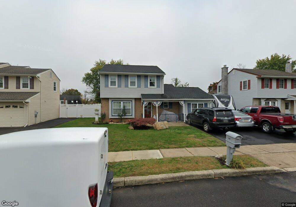
6065 Michael Dr Bensalem, PA 19020
Neshaminy Valley NeighborhoodEstimated Value: $399,000 - $477,000
3
Beds
2
Baths
1,319
Sq Ft
$327/Sq Ft
Est. Value
About This Home
This home is located at 6065 Michael Dr, Bensalem, PA 19020 and is currently estimated at $431,861, approximately $327 per square foot. 6065 Michael Dr is a home located in Bucks County with nearby schools including Valley Elementary School, St Ephrem School, and Bensalem Baptist School.
Ownership History
Date
Name
Owned For
Owner Type
Purchase Details
Closed on
Jun 11, 2002
Sold by
Bedoya German
Bought by
Bedoya German and Bedoya Myriam
Current Estimated Value
Home Financials for this Owner
Home Financials are based on the most recent Mortgage that was taken out on this home.
Original Mortgage
$125,900
Interest Rate
6.92%
Purchase Details
Closed on
Jun 23, 2000
Sold by
Scheske Darryn L and Scheske Loree A
Bought by
Bedoya German
Home Financials for this Owner
Home Financials are based on the most recent Mortgage that was taken out on this home.
Original Mortgage
$127,415
Interest Rate
8.55%
Purchase Details
Closed on
Jan 26, 1996
Sold by
Walsack Philip E
Bought by
Scheske Darryn L and Scheske Loree A
Home Financials for this Owner
Home Financials are based on the most recent Mortgage that was taken out on this home.
Original Mortgage
$107,730
Interest Rate
7.1%
Create a Home Valuation Report for This Property
The Home Valuation Report is an in-depth analysis detailing your home's value as well as a comparison with similar homes in the area
Home Values in the Area
Average Home Value in this Area
Purchase History
| Date | Buyer | Sale Price | Title Company |
|---|---|---|---|
| Bedoya German | -- | -- | |
| Bedoya German | $149,900 | T A Title Insurance Company | |
| Scheske Darryn L | $113,400 | -- |
Source: Public Records
Mortgage History
| Date | Status | Borrower | Loan Amount |
|---|---|---|---|
| Closed | Bedoya German | $125,900 | |
| Closed | Bedoya German | $127,415 | |
| Previous Owner | Scheske Darryn L | $107,730 |
Source: Public Records
Tax History
| Year | Tax Paid | Tax Assessment Tax Assessment Total Assessment is a certain percentage of the fair market value that is determined by local assessors to be the total taxable value of land and additions on the property. | Land | Improvement |
|---|---|---|---|---|
| 2025 | $4,872 | $22,320 | $5,920 | $16,400 |
| 2024 | $4,872 | $22,320 | $5,920 | $16,400 |
| 2023 | $4,735 | $22,320 | $5,920 | $16,400 |
| 2022 | $4,707 | $22,320 | $5,920 | $16,400 |
| 2021 | $4,707 | $22,320 | $5,920 | $16,400 |
| 2020 | $4,660 | $22,320 | $5,920 | $16,400 |
| 2019 | $4,556 | $22,320 | $5,920 | $16,400 |
| 2018 | $4,450 | $22,320 | $5,920 | $16,400 |
| 2017 | $4,423 | $22,320 | $5,920 | $16,400 |
| 2016 | $4,423 | $22,320 | $5,920 | $16,400 |
| 2015 | -- | $22,320 | $5,920 | $16,400 |
| 2014 | -- | $22,320 | $5,920 | $16,400 |
Source: Public Records
Map
Nearby Homes
- 5919 Michael Dr
- 6196 Washington Ln
- 6343 Craig Ave
- 0 Main St
- 301 Main St
- 1302 Gibson Rd Unit 152
- 1782 Gibson Rd Unit BLDG E
- 2472 Webster Ct
- 4400 Newportville Rd
- 2524 Valley View Rd
- L:003 Newportville Rd
- 1446 Gibson Rd Unit T C-36
- 1446 Gibson Rd
- 1446 Gibson Rd Unit D50
- 2548 Nashua Rd
- 5707 Keenan Ct
- 3820 Naples St
- 2718 Avenue C
- 107 Liberty Dr Unit 107
- 3307 Sheldon Ave
- 6057 Michael Dr
- 6073 Michael Dr
- 6081 Michael Dr
- 6049 Michael Dr
- 1224 Primrose Ln
- 6041 Michael Dr
- 1230 Primrose Ln
- 6137 Edge Ave
- 6084 Michael Dr
- 6066 Michael Dr
- 6074 Michael Dr
- 6058 Michael Dr
- 6014 Goldenrod Ln
- 6050 Michael Dr
- 6033 Michael Dr
- 6109 Edge Ave
- 1218 Primrose Ln
- 1236 Primrose Ln
- 6042 Michael Dr
- 6034 Michael Dr
Your Personal Tour Guide
Ask me questions while you tour the home.