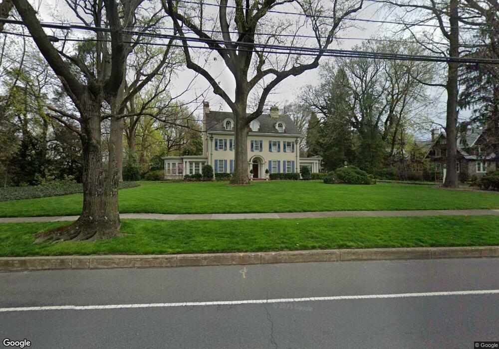
607 Chester Ave Moorestown, NJ 08057
Estimated Value: $2,125,000 - $2,887,000
--
Bed
--
Bath
7,847
Sq Ft
$306/Sq Ft
Est. Value
About This Home
This home is located at 607 Chester Ave, Moorestown, NJ 08057 and is currently estimated at $2,398,840, approximately $305 per square foot. 607 Chester Ave is a home located in Burlington County with nearby schools including George C. Baker Elementary School, Moorestown Upper Elementary School, and William Allen Middle School.
Ownership History
Date
Name
Owned For
Owner Type
Purchase Details
Closed on
Jul 12, 1996
Sold by
Baldwin Iii Joseph W and Baldwin Sandra T
Bought by
Waxman Earl and Bohn Sandra E
Current Estimated Value
Create a Home Valuation Report for This Property
The Home Valuation Report is an in-depth analysis detailing your home's value as well as a comparison with similar homes in the area
Home Values in the Area
Average Home Value in this Area
Purchase History
| Date | Buyer | Sale Price | Title Company |
|---|---|---|---|
| Waxman Earl | $880,000 | Fidelity Title |
Source: Public Records
Tax History Compared to Growth
Tax History
| Year | Tax Paid | Tax Assessment Tax Assessment Total Assessment is a certain percentage of the fair market value that is determined by local assessors to be the total taxable value of land and additions on the property. | Land | Improvement |
|---|---|---|---|---|
| 2025 | $42,555 | $1,500,000 | $337,400 | $1,162,600 |
| 2024 | $41,265 | $1,500,000 | $337,400 | $1,162,600 |
| 2023 | $41,265 | $1,500,000 | $337,400 | $1,162,600 |
| 2022 | $40,845 | $1,500,000 | $337,400 | $1,162,600 |
| 2021 | $40,305 | $1,500,000 | $337,400 | $1,162,600 |
| 2020 | $40,050 | $1,500,000 | $337,400 | $1,162,600 |
| 2019 | $39,345 | $1,500,000 | $337,400 | $1,162,600 |
| 2018 | $38,280 | $1,500,000 | $337,400 | $1,162,600 |
| 2017 | $37,773 | $1,500,000 | $337,400 | $1,162,600 |
| 2016 | $37,641 | $1,500,000 | $337,400 | $1,162,600 |
| 2015 | $37,186 | $1,500,000 | $337,400 | $1,162,600 |
| 2014 | $35,308 | $1,500,000 | $337,400 | $1,162,600 |
Source: Public Records
Map
Nearby Homes
- 601 Chester Ave
- 615 Chester Ave
- 117 E Maple Ave
- 517 Chester Ave
- 618 Chester Ave
- 620 Chester Ave
- 600 Chester Ave
- 119 E Maple Ave
- 621 Chester Ave
- 515 Chester Ave
- 622 Chester Ave
- 116 E Maple Ave
- 610 Chestnut St
- 123 E Maple Ave
- 632 Chester Ave
- 118 E Maple Ave
- 620 Chestnut St
- 509 Chester Ave
- 55 E Maple Ave
- 508 Chester Ave