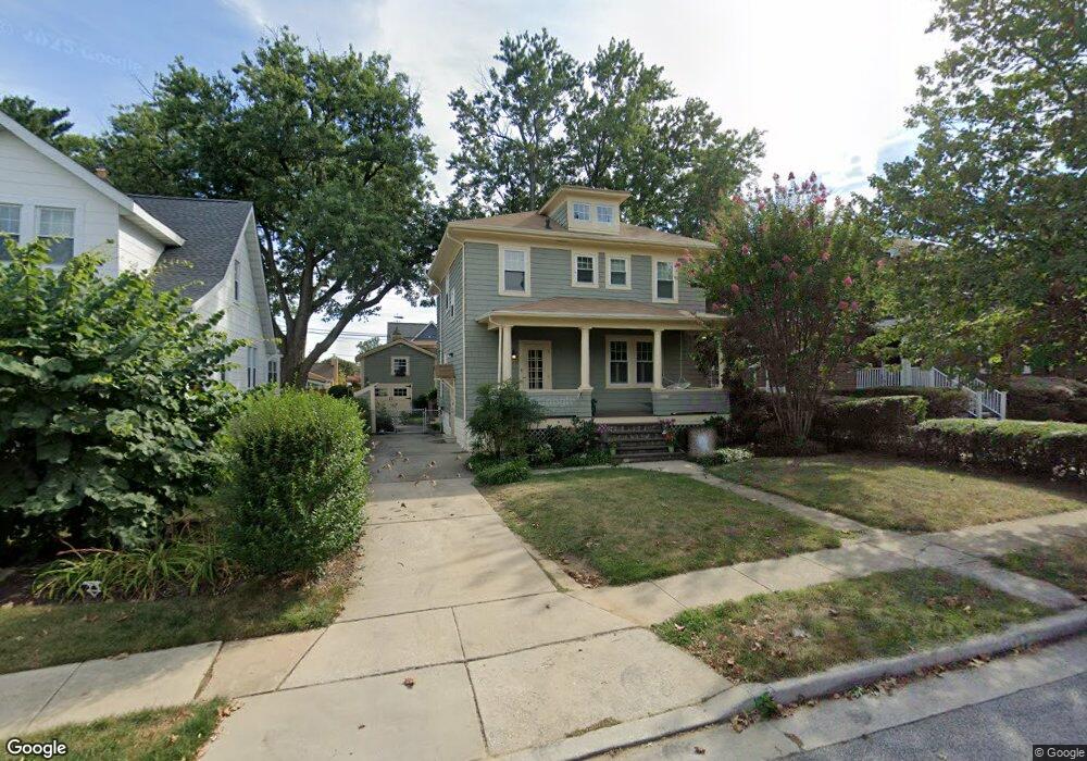
607 Dunkirk Rd Baltimore, MD 21212
Estimated Value: $428,000 - $650,000
Studio
1
Bath
1,344
Sq Ft
$409/Sq Ft
Est. Value
About This Home
This home is located at 607 Dunkirk Rd, Baltimore, MD 21212 and is currently estimated at $550,221, approximately $409 per square foot. 607 Dunkirk Rd is a home located in Baltimore County with nearby schools including Stoneleigh Elementary School, Dumbarton Middle School, and Towson High Law & Public Policy.
Ownership History
Date
Name
Owned For
Owner Type
Purchase Details
Closed on
Jun 30, 2021
Sold by
Romano Donald H and Romano Diana S
Bought by
Bigos Kristin Lynn
Current Estimated Value
Home Financials for this Owner
Home Financials are based on the most recent Mortgage that was taken out on this home.
Original Mortgage
$523,800
Outstanding Balance
$475,485
Interest Rate
2.93%
Mortgage Type
New Conventional
Estimated Equity
$74,736
Purchase Details
Closed on
Apr 8, 1993
Sold by
Boyle Paul J
Bought by
Romano Donald H and Romano Diana S
Purchase Details
Closed on
May 5, 1983
Sold by
Schmelz Teri L
Bought by
Boyle Paul J
Create a Home Valuation Report for This Property
The Home Valuation Report is an in-depth analysis detailing your home's value as well as a comparison with similar homes in the area
Home Values in the Area
Average Home Value in this Area
Purchase History
| Date | Buyer | Sale Price | Title Company |
|---|---|---|---|
| Bigos Kristin Lynn | $582,000 | Land Abstract & Escrow Llc | |
| Romano Donald H | $139,000 | -- | |
| Boyle Paul J | $73,000 | -- |
Source: Public Records
Mortgage History
| Date | Status | Borrower | Loan Amount |
|---|---|---|---|
| Open | Bigos Kristin Lynn | $523,800 |
Source: Public Records
Tax History
| Year | Tax Paid | Tax Assessment Tax Assessment Total Assessment is a certain percentage of the fair market value that is determined by local assessors to be the total taxable value of land and additions on the property. | Land | Improvement |
|---|---|---|---|---|
| 2025 | $4,791 | $365,300 | $99,700 | $265,600 |
| 2024 | $4,791 | $345,467 | $0 | $0 |
| 2023 | $2,269 | $325,633 | $0 | $0 |
| 2022 | $4,269 | $305,800 | $94,700 | $211,100 |
| 2021 | $3,601 | $293,267 | $0 | $0 |
| 2020 | $3,402 | $280,733 | $0 | $0 |
| 2019 | $3,251 | $268,200 | $94,700 | $173,500 |
| 2018 | $3,446 | $260,567 | $0 | $0 |
| 2017 | $3,244 | $252,933 | $0 | $0 |
| 2016 | $3,342 | $245,300 | $0 | $0 |
| 2015 | $3,342 | $245,300 | $0 | $0 |
| 2014 | $3,342 | $245,300 | $0 | $0 |
Source: Public Records
Map
Nearby Homes
- 633 Anneslie Rd
- 615 Overbrook Rd
- 529 Overbrook Rd
- 664 Regester Ave
- 722 Anneslie Rd
- 6504 Maplewood Rd
- 501 Stoneleigh Rd
- 820 Cedarcroft Rd
- 728 Highwood Dr
- 318 Hopkins Rd
- 726 Highwood Dr
- 6307 Clearspring Rd
- 12 Stone Ridge Ct
- 1111 Walker Ave
- 415 Schwartz Ave
- 111 Dunkirk Rd
- 150 Hopkins Rd
- 6910 Summit Cir
- 935 Litchfield Rd
- 123 Glen Argyle Rd
- 609 Dunkirk Rd
- 605 Dunkirk Rd
- 611 Dunkirk Rd
- 603 Dunkirk Rd
- 606 Anneslie Rd
- 604 Anneslie Rd
- 608 Anneslie Rd
- 613 Dunkirk Rd
- 601 Dunkirk Rd
- 610 Anneslie Rd
- 602 Anneslie Rd
- 614 Dunkirk Rd
- 616 Dunkirk Rd
- 618 Dunkirk Rd
- 612 Dunkirk Rd
- 612 Anneslie Rd
- 600 Anneslie Rd
- 620 Dunkirk Rd
- 610 Dunkirk Rd
- 614 Anneslie Rd
Your Personal Tour Guide
Ask me questions while you tour the home.