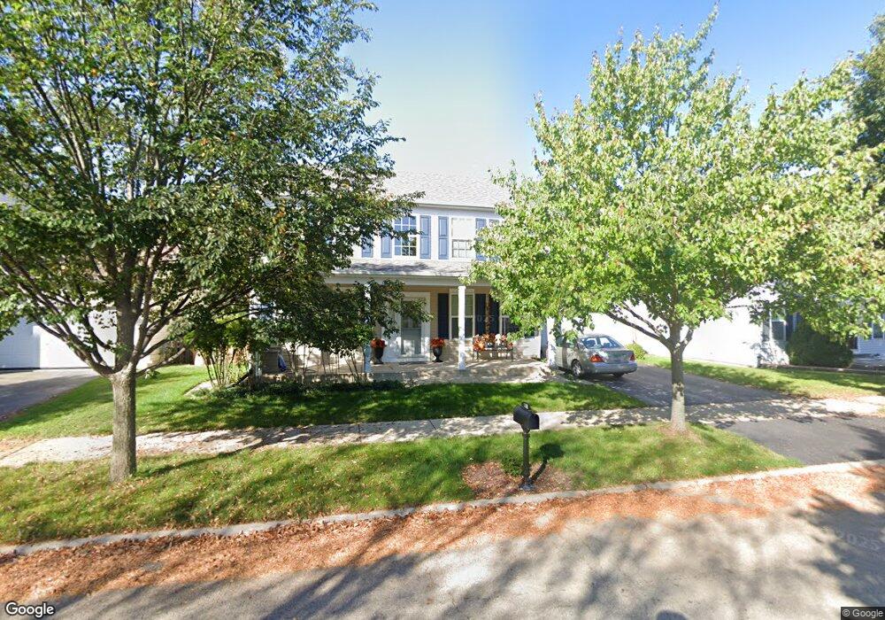
607 Roosevelt Dr Oswego, IL 60543
Northwest Oswego NeighborhoodEstimated Value: $399,000 - $424,000
4
Beds
3
Baths
2,360
Sq Ft
$174/Sq Ft
Est. Value
About This Home
This home is located at 607 Roosevelt Dr, Oswego, IL 60543 and is currently estimated at $411,736, approximately $174 per square foot. 607 Roosevelt Dr is a home located in Kendall County with nearby schools including Fox Chase Elementary School, Traughber Junior High School, and Oswego High School.
Ownership History
Date
Name
Owned For
Owner Type
Purchase Details
Closed on
Dec 6, 2004
Sold by
The Bigelow Group Inc
Bought by
Repes Seweryn J
Current Estimated Value
Home Financials for this Owner
Home Financials are based on the most recent Mortgage that was taken out on this home.
Original Mortgage
$242,600
Outstanding Balance
$116,531
Interest Rate
5.12%
Mortgage Type
Purchase Money Mortgage
Estimated Equity
$295,205
Purchase Details
Closed on
Dec 4, 2003
Sold by
Oswego Village Square L L C
Bought by
Bigelow Group Inc
Create a Home Valuation Report for This Property
The Home Valuation Report is an in-depth analysis detailing your home's value as well as a comparison with similar homes in the area
Home Values in the Area
Average Home Value in this Area
Purchase History
| Date | Buyer | Sale Price | Title Company |
|---|---|---|---|
| Repes Seweryn J | $255,500 | First American Title | |
| Bigelow Group Inc | $1,458,000 | First American Title |
Source: Public Records
Mortgage History
| Date | Status | Borrower | Loan Amount |
|---|---|---|---|
| Open | Repes Seweryn J | $242,600 |
Source: Public Records
Tax History Compared to Growth
Tax History
| Year | Tax Paid | Tax Assessment Tax Assessment Total Assessment is a certain percentage of the fair market value that is determined by local assessors to be the total taxable value of land and additions on the property. | Land | Improvement |
|---|---|---|---|---|
| 2024 | $8,326 | $109,468 | $21,615 | $87,853 |
| 2023 | $7,484 | $96,874 | $19,128 | $77,746 |
| 2022 | $7,484 | $88,876 | $17,549 | $71,327 |
| 2021 | $7,435 | $85,458 | $16,874 | $68,584 |
| 2020 | $7,273 | $82,969 | $16,383 | $66,586 |
| 2019 | $7,725 | $86,474 | $16,383 | $70,091 |
| 2018 | $7,046 | $78,719 | $14,914 | $63,805 |
| 2017 | $6,823 | $72,552 | $13,746 | $58,806 |
| 2016 | $6,529 | $68,769 | $13,029 | $55,740 |
| 2015 | $6,292 | $63,675 | $12,064 | $51,611 |
| 2014 | -- | $60,071 | $11,381 | $48,690 |
| 2013 | -- | $62,542 | $11,849 | $50,693 |
Source: Public Records
Map
Nearby Homes
- 411 Bayberry Dr
- 238 Willowwood Dr
- 466 Greenview Ln
- 435 Fawn Dr
- 505 Parkland Ct
- 409 Fawn Dr
- 403 Lake Ct
- LOT 10 SW Station Dr
- 114 Riverview Ct
- 5055 U S 34
- 173 Dolores St
- 102 Mary St
- 123 W Benton St
- 517 Meadowwood Ln Unit 3
- 1 S Orchard Rd
- 613 Murdock Place
- 421 Hathaway Ln
- 423 Hathaway Ln
- 377 Danforth Dr
- 1721 State Route 31
- 609 Roosevelt Dr Unit 4
- 605 Roosevelt Dr
- 611 Roosevelt Dr Unit 4
- 603 Roosevelt Dr
- 124 Clark Ave
- 606 Roosevelt Dr
- 613 Roosevelt Dr
- 604 Roosevelt Dr Unit 3
- 601 Roosevelt Dr Unit 3
- 711 Hoover Dr
- 544 Truman Dr Unit 3
- 615 Roosevelt Dr
- 550 Truman Dr Unit 3
- 110 Clark Ave
- 110 Clark Rd
- 709 Hoover Dr Unit 4
- 138 Clark Ave
- 542 Truman Dr Unit 2
- 617 Roosevelt Dr
- 552 Truman Dr Unit 3