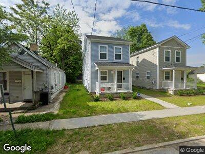
607 Walnut St Wyoming, OH 45215
Lockland NeighborhoodEstimated Value: $61,000 - $111,000
1
Bed
1
Bath
608
Sq Ft
$129/Sq Ft
Est. Value
About This Home
This home is located at 607 Walnut St, Wyoming, OH 45215 and is currently estimated at $78,235, approximately $128 per square foot. 607 Walnut St is a home located in Hamilton County with nearby schools including Lockland Elementary School, Lockland Middle School, and Lockland High School.
Ownership History
Date
Name
Owned For
Owner Type
Purchase Details
Closed on
Sep 23, 2019
Sold by
Tailor Limited Partnership
Bought by
Thorium Properties Llc
Current Estimated Value
Home Financials for this Owner
Home Financials are based on the most recent Mortgage that was taken out on this home.
Original Mortgage
$20,000
Outstanding Balance
$9,868
Interest Rate
3.5%
Mortgage Type
Future Advance Clause Open End Mortgage
Estimated Equity
$62,505
Purchase Details
Closed on
Mar 10, 2017
Sold by
Squeaky Lp
Bought by
Tailor Lp
Purchase Details
Closed on
Jun 29, 2001
Sold by
Hitt Douglas H and Hitt Cheri M
Bought by
Squeaky Ltd Partnership
Create a Home Valuation Report for This Property
The Home Valuation Report is an in-depth analysis detailing your home's value as well as a comparison with similar homes in the area
Home Values in the Area
Average Home Value in this Area
Purchase History
| Date | Buyer | Sale Price | Title Company |
|---|---|---|---|
| Thorium Properties Llc | $11,000 | None Available | |
| Tailor Lp | $11,000 | -- | |
| Squeaky Ltd Partnership | $22,500 | -- |
Source: Public Records
Mortgage History
| Date | Status | Borrower | Loan Amount |
|---|---|---|---|
| Open | Thorium Properties Llc | $20,000 | |
| Previous Owner | Squeaky Limited Partnership | $50,000 |
Source: Public Records
Tax History Compared to Growth
Tax History
| Year | Tax Paid | Tax Assessment Tax Assessment Total Assessment is a certain percentage of the fair market value that is determined by local assessors to be the total taxable value of land and additions on the property. | Land | Improvement |
|---|---|---|---|---|
| 2024 | $315 | $5,429 | $1,586 | $3,843 |
| 2023 | $312 | $5,429 | $1,586 | $3,843 |
| 2022 | $276 | $3,851 | $1,124 | $2,727 |
| 2021 | $279 | $3,851 | $1,124 | $2,727 |
| 2020 | $240 | $3,851 | $1,124 | $2,727 |
| 2019 | $257 | $3,851 | $1,124 | $2,727 |
| 2018 | $253 | $3,851 | $1,124 | $2,727 |
| 2017 | $242 | $3,851 | $1,124 | $2,727 |
| 2016 | $254 | $4,071 | $1,201 | $2,870 |
| 2015 | $236 | $4,071 | $1,201 | $2,870 |
| 2014 | $236 | $4,071 | $1,201 | $2,870 |
| 2013 | $226 | $3,990 | $1,176 | $2,814 |
Source: Public Records
Map
Nearby Homes
- 115 Washington Ave
- 213 S Wayne Ave
- 238 S Wayne Ave
- 405 Mcewing Dr
- 205 Wentworth Ave
- 329 Westview Ave
- 306 Pershing Ave
- 142 S Grove Ave
- 313 Jonte Ave
- 117 Stearns Ave
- 515 Westview Ave
- 112 Pershing Ave
- 1337 Shepherd Ln
- 615 Springfield Pike
- 12 Linden Dr
- 319 Beech Ave
- 0 Pleasant St Unit 1823724
- 8469 Anthony Wayne Ave
- 9 W Hill Ln
- 63 Chestnut Ave
- 607 Walnut St
- 609 Walnut St
- 115 N Wayne Ave
- 113 N Wayne Ave
- 111 N Wayne Ave
- 611 Walnut St
- 109 N Wayne Ave
- 109 S Wayne Ave
- 606 Walnut St
- 612 Walnut St
- 608 Walnut St
- 615 Walnut St
- 614 Walnut St
- 614 W Wyoming Ave
- 526 Arcola St
- 612 W Wyoming Ave
- 118 N Wayne Ave
- 200 N Wayne Ave
- 623 Walnut St
- 618 W Wyoming Ave