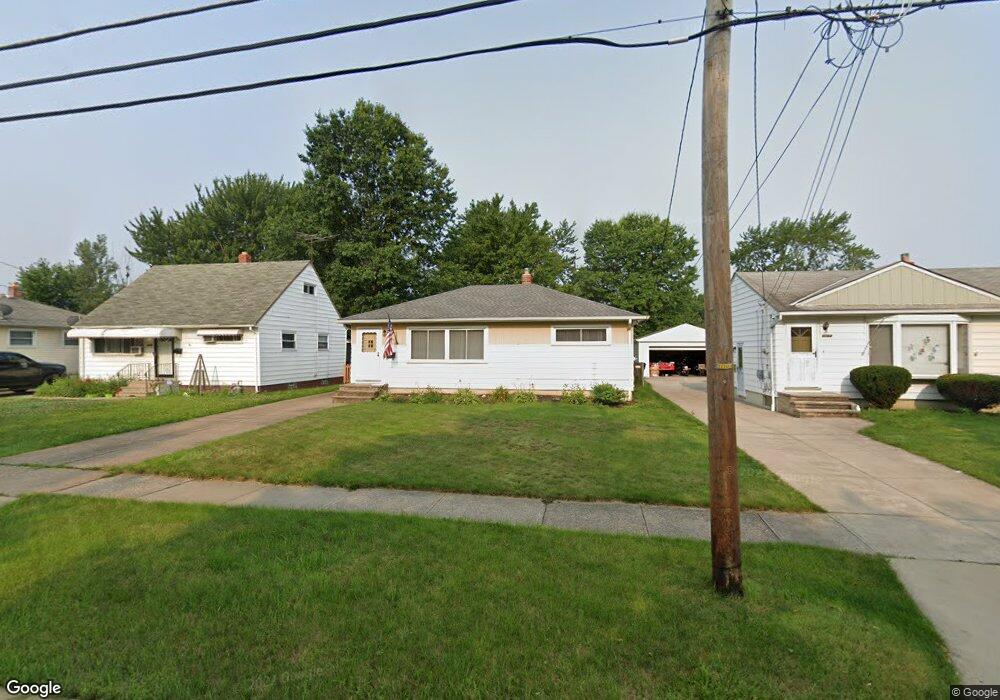
6070 Michael Dr Brookpark, OH 44142
Estimated Value: $183,777 - $219,000
3
Beds
1
Bath
936
Sq Ft
$218/Sq Ft
Est. Value
About This Home
This home is located at 6070 Michael Dr, Brookpark, OH 44142 and is currently estimated at $203,694, approximately $217 per square foot. 6070 Michael Dr is a home located in Cuyahoga County with nearby schools including Berea-Midpark Middle School, Berea-Midpark High School, and Huber Heights Preparatory Academy Parma Academy.
Ownership History
Date
Name
Owned For
Owner Type
Purchase Details
Closed on
Mar 8, 2021
Sold by
Siskovic William and Estate Of Joyce A Siskovic
Bought by
Siskovic Kenneth
Current Estimated Value
Home Financials for this Owner
Home Financials are based on the most recent Mortgage that was taken out on this home.
Original Mortgage
$106,700
Outstanding Balance
$94,336
Interest Rate
2.7%
Mortgage Type
New Conventional
Estimated Equity
$109,358
Purchase Details
Closed on
Sep 15, 2003
Sold by
Estate Of Valentine S Siskovic
Bought by
Siskovic Joyce A
Purchase Details
Closed on
Jan 1, 1975
Bought by
Siskovic Valentine S and J A
Create a Home Valuation Report for This Property
The Home Valuation Report is an in-depth analysis detailing your home's value as well as a comparison with similar homes in the area
Home Values in the Area
Average Home Value in this Area
Purchase History
| Date | Buyer | Sale Price | Title Company |
|---|---|---|---|
| Siskovic Kenneth | $110,000 | Ohio Real Title | |
| Siskovic Joyce A | -- | -- | |
| Siskovic Valentine S | -- | -- |
Source: Public Records
Mortgage History
| Date | Status | Borrower | Loan Amount |
|---|---|---|---|
| Open | Siskovic Kenneth | $106,700 |
Source: Public Records
Tax History
| Year | Tax Paid | Tax Assessment Tax Assessment Total Assessment is a certain percentage of the fair market value that is determined by local assessors to be the total taxable value of land and additions on the property. | Land | Improvement |
|---|---|---|---|---|
| 2025 | $2,696 | $53,760 | $12,075 | $41,685 |
| 2024 | $2,712 | $53,760 | $12,075 | $41,685 |
| 2023 | $2,804 | $46,030 | $9,280 | $36,750 |
| 2022 | $2,784 | $46,030 | $9,280 | $36,750 |
| 2021 | $2,768 | $46,030 | $9,280 | $36,750 |
| 2020 | $1,896 | $36,510 | $7,350 | $29,160 |
| 2019 | $1,840 | $104,300 | $21,000 | $83,300 |
| 2018 | $1,832 | $36,510 | $7,350 | $29,160 |
| 2017 | $1,718 | $32,800 | $6,900 | $25,900 |
| 2016 | $1,704 | $32,800 | $6,900 | $25,900 |
| 2015 | $1,599 | $32,800 | $6,900 | $25,900 |
| 2014 | $1,599 | $32,800 | $6,900 | $25,900 |
Source: Public Records
Map
Nearby Homes
- 6095 Stark Dr
- 6103 Westbrook Dr
- 6024 Brook Ct
- 6065 Mercer Dr
- 6014 Westbrook Dr
- 14761 Larkfield Dr
- 14801 Larkfield Dr
- 14242 Holland Rd
- 14024 Donald Dr
- 14396 Park Dr
- 13442 Havendale Dr
- 13602 Holland Rd
- 13670 Middlebrook Blvd
- 5952 Delores Blvd
- 15995 Paulding Blvd
- 6330 Sandfield Dr
- 6386 Sandfield Dr
- 6330 Ledgebrook Dr
- 6377 Ledgebrook Dr
- 6330 Stonecrest Dr
- 6064 Michael Dr
- 6076 Michael Dr
- 6058 Michael Dr
- 6082 Michael Dr
- 6052 Michael Dr
- 6088 Michael Dr
- 6071 Morrow Dr
- 6065 Morrow Dr
- 6077 Morrow Dr
- 6059 Morrow Dr
- 6083 Morrow Dr
- 6069 Michael Dr
- 6046 Michael Dr
- 6094 Michael Dr
- 6063 Michael Dr
- 6053 Morrow Dr
- 6089 Morrow Dr
- 6059 Michael Dr
- 6040 Michael Dr
- 6100 Michael Dr
Your Personal Tour Guide
Ask me questions while you tour the home.