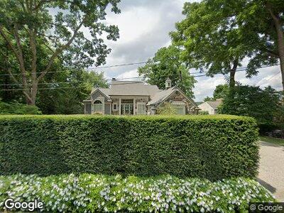
6072 Wing Lake Rd Bloomfield Hills, MI 48301
Estimated Value: $791,000 - $2,251,000
4
Beds
6
Baths
2,869
Sq Ft
$562/Sq Ft
Est. Value
About This Home
This home is located at 6072 Wing Lake Rd, Bloomfield Hills, MI 48301 and is currently estimated at $1,613,797, approximately $562 per square foot. 6072 Wing Lake Rd is a home located in Oakland County with nearby schools including Conant Elementary School, South Hills Middle School, and Bloomfield Hills High School.
Ownership History
Date
Name
Owned For
Owner Type
Purchase Details
Closed on
May 14, 2020
Sold by
Brown Thomas E and Brown Pamela Anne
Bought by
Brown Thomas E and Brown Pamela Anne
Current Estimated Value
Home Financials for this Owner
Home Financials are based on the most recent Mortgage that was taken out on this home.
Original Mortgage
$1,180,000
Interest Rate
2.87%
Mortgage Type
New Conventional
Create a Home Valuation Report for This Property
The Home Valuation Report is an in-depth analysis detailing your home's value as well as a comparison with similar homes in the area
Home Values in the Area
Average Home Value in this Area
Purchase History
| Date | Buyer | Sale Price | Title Company |
|---|---|---|---|
| Brown Thomas E | -- | None Available |
Source: Public Records
Mortgage History
| Date | Status | Borrower | Loan Amount |
|---|---|---|---|
| Closed | Brown Thomas E | $1,162,000 | |
| Closed | Brown Thomas E | $1,180,000 | |
| Closed | Brown Thomas E | $1,304,500 | |
| Closed | Brown Thomas E | $1,302,508 | |
| Closed | Brown Thomas E | $485,700 | |
| Closed | Brown Thomas E | $662,365 | |
| Closed | Brown Thomas E | $310,000 | |
| Closed | Brown Pamela A | $995,000 | |
| Closed | Brown Thomas E | $150,000 | |
| Closed | Brown Thomas E | $700,000 | |
| Closed | Brown Thomas E | $175,000 |
Source: Public Records
Tax History Compared to Growth
Tax History
| Year | Tax Paid | Tax Assessment Tax Assessment Total Assessment is a certain percentage of the fair market value that is determined by local assessors to be the total taxable value of land and additions on the property. | Land | Improvement |
|---|---|---|---|---|
| 2024 | $12,586 | $970,160 | $0 | $0 |
| 2023 | $12,180 | $934,940 | $0 | $0 |
| 2022 | $22,841 | $857,420 | $0 | $0 |
| 2021 | $22,677 | $816,080 | $0 | $0 |
| 2020 | $11,116 | $847,310 | $0 | $0 |
| 2019 | $21,338 | $820,430 | $0 | $0 |
| 2018 | $21,435 | $811,870 | $0 | $0 |
| 2017 | $21,281 | $805,790 | $0 | $0 |
| 2016 | $21,321 | $734,630 | $0 | $0 |
| 2015 | -- | $667,210 | $0 | $0 |
| 2014 | -- | $582,810 | $0 | $0 |
| 2011 | -- | $513,280 | $0 | $0 |
Source: Public Records
Map
Nearby Homes
- 650 Trailwood Path Unit C
- 450 Billingsgate Ct Unit C
- 250 Billingsgate Court Apt D Ct
- 4456 W Maple Rd
- 6572 Spruce Dr
- 4511 Lakeview Ct
- 4421 W Maple Rd
- 4074 Cranbrook Ct
- 4047 Cranbrook Ct
- 4510 W Maple Rd
- 6670 Cathedral Dr
- 5385 Bywood Rd
- 4550 W Maple Rd
- 5799 Blandford Ct
- 5372 Forest Way
- 6868 Vachon Dr
- 5626 Shadow Ln
- 1616 Mark Hopkins Rd
- 1322 Lake Crescent Dr
- 6760 Orinoco Cir
- 6072 Wing Lake Rd
- 6058 Wing Lake Rd
- 6044 Wing Lake Rd
- 6100 Wing Lake Rd
- 6065 Wing Lake Rd
- 6085 Wing Lake Rd
- 6000 Wing Lake Rd
- 6116 Wing Lake Rd
- 6035 Wing Lake Rd
- 6115 Wing Lake Rd
- 6080 Worlington Rd
- 6104 Worlington Rd
- 6005 Wing Lake Rd
- 5990 Wing Lake Rd
- 6138 Worlington Rd
- 6130 Wing Lake Rd
- 6060 Worlington Rd
- 5970 Wing Lake Rd
- 6044 Worlington Rd
- 5975 Wing Lake Rd