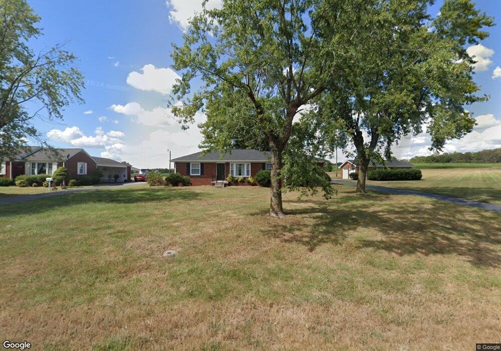
6074 Highway 49 E Springfield, TN 37172
Estimated Value: $360,000 - $1,438,014
Studio
1
Bath
1,452
Sq Ft
$435/Sq Ft
Est. Value
About This Home
This home is located at 6074 Highway 49 E, Springfield, TN 37172 and is currently estimated at $631,754, approximately $435 per square foot. 6074 Highway 49 E is a home located in Robertson County with nearby schools including Krisle Elementary School, Innovation Academy, and Springfield High School.
Ownership History
Date
Name
Owned For
Owner Type
Purchase Details
Closed on
Dec 17, 2021
Sold by
Crain Rickey J and Crain Sharon G
Bought by
Historic Beeches Llc
Current Estimated Value
Home Financials for this Owner
Home Financials are based on the most recent Mortgage that was taken out on this home.
Original Mortgage
$1,950,000
Interest Rate
3.09%
Mortgage Type
Construction
Purchase Details
Closed on
Dec 15, 2021
Sold by
Crain Rickey J and Crain Sharon G
Bought by
Historic Beeches Llc
Home Financials for this Owner
Home Financials are based on the most recent Mortgage that was taken out on this home.
Original Mortgage
$1,950,000
Interest Rate
3.09%
Mortgage Type
Construction
Purchase Details
Closed on
Jul 12, 2017
Sold by
Crain Royce and Crain Lynette
Bought by
Taylor Wall Partners
Home Financials for this Owner
Home Financials are based on the most recent Mortgage that was taken out on this home.
Original Mortgage
$92,000
Interest Rate
3.94%
Mortgage Type
Unknown
Purchase Details
Closed on
Mar 21, 1960
Bought by
Ellis Carl and Ellis Dorothy
Create a Home Valuation Report for This Property
The Home Valuation Report is an in-depth analysis detailing your home's value as well as a comparison with similar homes in the area
Home Values in the Area
Average Home Value in this Area
Purchase History
| Date | Buyer | Sale Price | Title Company |
|---|---|---|---|
| Historic Beeches Llc | $1,300,000 | None Available | |
| Historic Beeches Llc | -- | None Listed On Document | |
| Taylor Wall Partners | $115,000 | None Available | |
| Ellis Carl | -- | -- |
Source: Public Records
Mortgage History
| Date | Status | Borrower | Loan Amount |
|---|---|---|---|
| Closed | Historic Beeches Llc | $1,950,000 | |
| Previous Owner | Taylor Wall Partners | $92,000 |
Source: Public Records
Tax History
| Year | Tax Paid | Tax Assessment Tax Assessment Total Assessment is a certain percentage of the fair market value that is determined by local assessors to be the total taxable value of land and additions on the property. | Land | Improvement |
|---|---|---|---|---|
| 2025 | $990 | $55,025 | $16,250 | $38,775 |
| 2024 | $990 | $55,025 | $16,250 | $38,775 |
| 2023 | $990 | $55,025 | $16,250 | $38,775 |
| 2022 | $668 | $25,950 | $6,200 | $19,750 |
| 2021 | $668 | $25,950 | $6,200 | $19,750 |
| 2020 | $668 | $25,950 | $6,200 | $19,750 |
| 2019 | $668 | $25,950 | $6,200 | $19,750 |
| 2018 | $668 | $25,950 | $6,200 | $19,750 |
| 2017 | $560 | $18,150 | $4,500 | $13,650 |
| 2016 | $560 | $18,150 | $4,500 | $13,650 |
| 2015 | $537 | $18,150 | $4,500 | $13,650 |
| 2014 | $537 | $18,150 | $4,500 | $13,650 |
Source: Public Records
Map
Nearby Homes
- 1 Tom Austin Hwy
- 6241 Highway 49 E
- 813 5th Ave E
- 703 Hayes St
- 54 Hunters Ln
- 415 Durrett St
- 0 William Woodard Rd
- 1055 Mustang Ct
- 1183 Hangar Rd
- 805 8th Ave E
- 600 5th Ave E
- 401 S Pawnee Dr
- 305 S Pawnee Dr
- 938 Hunters Ln
- 952 N Brown St
- 942 Hunters Ln
- 965 Hunters Ln
- 946 Hunters Ln
- 950 Hunters Ln
- 954 Hunters Ln
- 6074 Highway 49 E
- 6070 Highway 49 E
- 6114 Highway 49 E
- 0 Hunters Lane Lot 23 Unit RTC2096024
- 4049 Wilks Rd
- 4043 Wilks Rd
- 0 Wilks Rd Unit RTC2620229
- 4067 Wilkes Rd
- 4027 Wilks Rd
- 4081 Wilks Rd
- 4021 Wilks Rd
- 4087 Wilks Rd
- 4028 Wilks Rd
- 6014 Highway 49 E
- 0 Deer Run Dr
- 6142 Highway 49 E
- 6168 Highway 49 E
- 6163 Highway 49 E
- 5207 Wilks Rd
- 6188 Highway 49 E
Your Personal Tour Guide
Ask me questions while you tour the home.