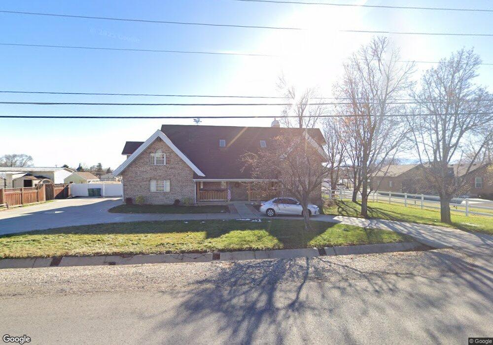
6077 W 9600 N Highland, UT 84003
Estimated Value: $1,145,000 - $1,386,000
6
Beds
3
Baths
5,509
Sq Ft
$220/Sq Ft
Est. Value
About This Home
This home is located at 6077 W 9600 N, Highland, UT 84003 and is currently estimated at $1,211,827, approximately $219 per square foot. 6077 W 9600 N is a home located in Utah County with nearby schools including Legacy Elementary School, Mountain Ridge Junior High School, and American Fork High School.
Ownership History
Date
Name
Owned For
Owner Type
Purchase Details
Closed on
Nov 6, 2020
Sold by
Pletsch Erich
Bought by
Sandberg Pletsch Sarah Jane
Current Estimated Value
Purchase Details
Closed on
Nov 3, 2009
Sold by
Gray Gary L and Gray Shellie J
Bought by
Pletsch Erich and Pletsch Sarah
Home Financials for this Owner
Home Financials are based on the most recent Mortgage that was taken out on this home.
Original Mortgage
$145,000
Outstanding Balance
$94,776
Interest Rate
5.02%
Mortgage Type
Seller Take Back
Estimated Equity
$1,117,051
Create a Home Valuation Report for This Property
The Home Valuation Report is an in-depth analysis detailing your home's value as well as a comparison with similar homes in the area
Home Values in the Area
Average Home Value in this Area
Purchase History
| Date | Buyer | Sale Price | Title Company |
|---|---|---|---|
| Sandberg Pletsch Sarah Jane | -- | None Available | |
| Pletsch Erich | -- | Select Title Insurance Agen |
Source: Public Records
Mortgage History
| Date | Status | Borrower | Loan Amount |
|---|---|---|---|
| Open | Pletsch Erich | $145,000 |
Source: Public Records
Tax History Compared to Growth
Tax History
| Year | Tax Paid | Tax Assessment Tax Assessment Total Assessment is a certain percentage of the fair market value that is determined by local assessors to be the total taxable value of land and additions on the property. | Land | Improvement |
|---|---|---|---|---|
| 2025 | $3,985 | $525,470 | $339,700 | $615,700 |
| 2024 | $3,985 | $492,195 | $0 | $0 |
| 2023 | $3,731 | $497,145 | $0 | $0 |
| 2022 | $3,522 | $455,070 | $0 | $0 |
| 2021 | $3,108 | $598,200 | $192,600 | $405,600 |
| 2020 | $2,954 | $557,500 | $167,500 | $390,000 |
| 2019 | $2,566 | $506,600 | $167,500 | $339,100 |
| 2018 | $2,443 | $458,300 | $163,400 | $294,900 |
| 2017 | $2,270 | $227,315 | $0 | $0 |
| 2016 | $2,386 | $223,355 | $0 | $0 |
| 2015 | $2,496 | $221,430 | $0 | $0 |
| 2014 | $2,263 | $198,990 | $0 | $0 |
Source: Public Records
Map
Nearby Homes