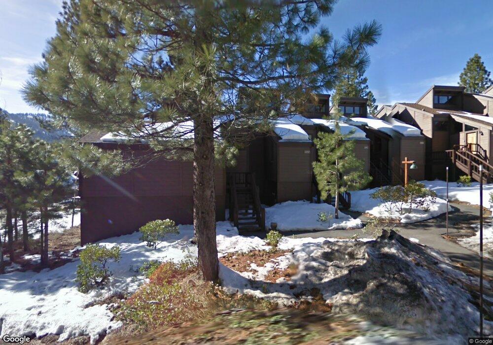
6079 Rocky Point Cir Truckee, CA 96161
South Truckee NeighborhoodEstimated Value: $677,000 - $868,000
3
Beds
2
Baths
1,212
Sq Ft
$643/Sq Ft
Est. Value
About This Home
This home is located at 6079 Rocky Point Cir, Truckee, CA 96161 and is currently estimated at $778,782, approximately $642 per square foot. 6079 Rocky Point Cir is a home located in Placer County with nearby schools including Truckee Elementary School, Alder Creek Middle School, and Tahoe Truckee High School.
Ownership History
Date
Name
Owned For
Owner Type
Purchase Details
Closed on
Nov 21, 2024
Sold by
Apple Jacqueline R
Bought by
Apple Family Trust- and Apple
Current Estimated Value
Purchase Details
Closed on
May 5, 2011
Sold by
The 2005 George & Norma Rescalvo Revocab
Bought by
Apple Jacqueline R
Purchase Details
Closed on
Jun 4, 2008
Sold by
Rescalvo George and Rescalvo Norma
Bought by
Rescalvo George and Rescalvo Norma
Create a Home Valuation Report for This Property
The Home Valuation Report is an in-depth analysis detailing your home's value as well as a comparison with similar homes in the area
Home Values in the Area
Average Home Value in this Area
Purchase History
| Date | Buyer | Sale Price | Title Company |
|---|---|---|---|
| Apple Family Trust- | -- | None Listed On Document | |
| Apple Jacqueline R | $400,000 | None Available | |
| Rescalvo George | -- | None Available |
Source: Public Records
Tax History Compared to Growth
Tax History
| Year | Tax Paid | Tax Assessment Tax Assessment Total Assessment is a certain percentage of the fair market value that is determined by local assessors to be the total taxable value of land and additions on the property. | Land | Improvement |
|---|---|---|---|---|
| 2025 | $5,955 | $319,216 | $95,580 | $223,636 |
| 2023 | $5,955 | $306,821 | $91,869 | $214,952 |
| 2022 | $5,680 | $300,806 | $90,068 | $210,738 |
| 2021 | $5,237 | $294,908 | $88,302 | $206,606 |
| 2020 | $5,212 | $291,885 | $87,397 | $204,488 |
| 2019 | $5,203 | $286,163 | $85,684 | $200,479 |
| 2018 | $4,989 | $280,553 | $84,004 | $196,549 |
| 2017 | $4,883 | $275,053 | $82,357 | $192,696 |
| 2016 | $4,837 | $269,661 | $80,743 | $188,918 |
| 2015 | $4,711 | $265,612 | $79,531 | $186,081 |
| 2014 | $5,282 | $260,410 | $77,974 | $182,436 |
Source: Public Records
Map
Nearby Homes
- 6133 Feather Ridge
- 6070 Rocky Point Cir
- 6138 Feather Ridge
- 1055 Martis Landing Unit B
- 2790 Cross Cut Ct
- 2785 Cross Cut Ct
- 2640 Mill Site Rd
- 1723 Grouse Ridge Rd Unit 4
- 5053 Gold Bend
- 5107 Gold Bend
- 5030 Gold Bend
- 5080 Gold Bend
- 1937 Gray Wolf
- 253 Basque Dr Unit Share 2
- 2344 Overlook Place
- 1750 Grouse Ridge Rd
- 2301 Overlook Place
- 7201 Larkspur Ln Unit 4
- 7401 Larkspur Ln Unit 1
- 237 Basque Dr Unit 2
- 6080 Rocky Point Cir
- 6081 Rocky Point Cir
- 6082 Rocky Point Cir
- 6083 Rocky Point Cir
- 6084 Rocky Point Cir
- 6058 Rocky Point Cir
- 6059 Rocky Point Cir
- 6060 Rocky Point Cir
- 6063 Rocky Point Cir
- 6061 Rocky Point Cir
- 6062 Rocky Point Cir
- 6125 Rocky Point Cir
- 6064 Rocky Point Cir
- 6126 Rocky Point Cir
- 6128 Rocky Point Cir
- 6129 Rocky Point Cir
- 6127 Rocky Point Cir
- 6065 Rocky Point Cir
- 6087 Rocky Point Cir
- 6066 Rocky Point Cir