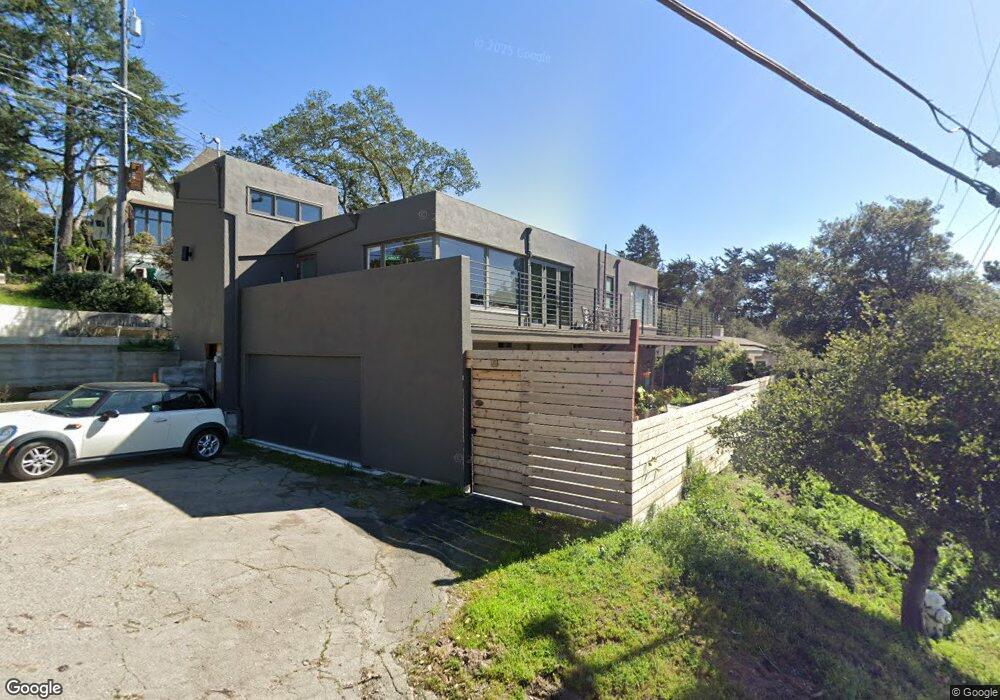
6082 Colton Blvd Oakland, CA 94611
Montclair NeighborhoodEstimated Value: $1,047,000 - $1,353,000
2
Beds
2
Baths
1,595
Sq Ft
$727/Sq Ft
Est. Value
About This Home
This home is located at 6082 Colton Blvd, Oakland, CA 94611 and is currently estimated at $1,160,258, approximately $727 per square foot. 6082 Colton Blvd is a home located in Alameda County with nearby schools including Montclair Elementary School, Montera Middle School, and Skyline High School.
Ownership History
Date
Name
Owned For
Owner Type
Purchase Details
Closed on
Apr 8, 1996
Sold by
Kelley Deborah J
Bought by
Moore Brent C and Morrison Wendy M
Current Estimated Value
Home Financials for this Owner
Home Financials are based on the most recent Mortgage that was taken out on this home.
Original Mortgage
$207,000
Outstanding Balance
$9,799
Interest Rate
7.41%
Estimated Equity
$1,150,459
Purchase Details
Closed on
Jul 20, 1994
Sold by
Newman Catherine E I and Newman Mary Mansfield
Bought by
Kelley Deborah J
Home Financials for this Owner
Home Financials are based on the most recent Mortgage that was taken out on this home.
Original Mortgage
$251,900
Interest Rate
4.75%
Create a Home Valuation Report for This Property
The Home Valuation Report is an in-depth analysis detailing your home's value as well as a comparison with similar homes in the area
Home Values in the Area
Average Home Value in this Area
Purchase History
| Date | Buyer | Sale Price | Title Company |
|---|---|---|---|
| Moore Brent C | $265,000 | -- | |
| Kelley Deborah J | $280,000 | Chicago Title Company |
Source: Public Records
Mortgage History
| Date | Status | Borrower | Loan Amount |
|---|---|---|---|
| Open | Moore Brent C | $207,000 | |
| Previous Owner | Kelley Deborah J | $251,900 |
Source: Public Records
Tax History Compared to Growth
Tax History
| Year | Tax Paid | Tax Assessment Tax Assessment Total Assessment is a certain percentage of the fair market value that is determined by local assessors to be the total taxable value of land and additions on the property. | Land | Improvement |
|---|---|---|---|---|
| 2025 | $7,291 | $433,207 | $132,062 | $308,145 |
| 2024 | $7,291 | $424,575 | $129,472 | $302,103 |
| 2023 | $7,593 | $423,114 | $126,934 | $296,180 |
| 2022 | $7,363 | $407,820 | $124,446 | $290,374 |
| 2021 | $6,985 | $399,687 | $122,006 | $284,681 |
| 2020 | $6,905 | $402,518 | $120,755 | $281,763 |
| 2019 | $6,610 | $394,627 | $118,388 | $276,239 |
| 2018 | $8,550 | $386,891 | $116,067 | $270,824 |
| 2017 | $6,210 | $379,307 | $113,792 | $265,515 |
| 2016 | $5,971 | $371,871 | $111,561 | $260,310 |
| 2015 | $5,935 | $366,287 | $109,886 | $256,401 |
| 2014 | $5,917 | $359,114 | $107,734 | $251,380 |
Source: Public Records
Map
Nearby Homes
- 5909 Colton Blvd
- 0 Colton Blvd
- 1801 Gouldin Rd
- 6425 Zinn Dr
- 6687 Thornhill Dr
- 5716 Merriewood Dr
- 0 Woodrow Dr Unit 41109468
- 0 Thornhill Dr
- 7580 Skyline Blvd
- 7030 Snake Rd
- 3 West Cir
- 6861 Saroni Dr
- 0 Bullard Dr
- 6115 Doncaster Place
- 2066 Drake Dr
- 7116 Hemlock St
- 0 Gouldin Rd Unit 41077349
- 5969 Bruns Ct
- 5673 Florence Terrace
- 5663 Florence Terrace
- 6078 Colton Blvd
- 6344 Snake Rd
- 6071 Colton Blvd
- 6079 Colton Blvd
- 6406 Colton Blvd
- 6075 Colton Blvd
- 6070 Colton Blvd
- 6085 Colton Blvd
- 6091 Colton Blvd
- 6043 Colton Blvd
- 6412 Colton Blvd
- 6097 Colton Blvd
- 6066 Colton Blvd
- 6324 Snake Rd
- 6401 Snake Rd
- 6027 Colton Blvd
- 6064 Colton Blvd
- 6241 Snake Rd
- 6405 Colton Blvd
- 5901 Mazuela Dr