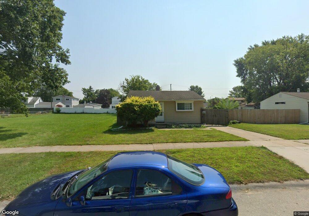
6083 Michael St Taylor, MI 48180
Estimated Value: $113,000 - $139,000
2
Beds
1
Bath
696
Sq Ft
$181/Sq Ft
Est. Value
About This Home
This home is located at 6083 Michael St, Taylor, MI 48180 and is currently estimated at $126,310, approximately $181 per square foot. 6083 Michael St is a home located in Wayne County with nearby schools including Taylor Parks Elementary School, Hoover Middle School, and Quest Charter Academy.
Ownership History
Date
Name
Owned For
Owner Type
Purchase Details
Closed on
Mar 17, 2006
Sold by
Hud
Bought by
Excel Home Improvement Inc
Current Estimated Value
Purchase Details
Closed on
Aug 18, 2005
Sold by
Mortgage Electronic Registration Systems
Bought by
Hud
Purchase Details
Closed on
Feb 9, 2005
Sold by
Spears Roger L
Bought by
Mortgage Electronic Registration Systems
Create a Home Valuation Report for This Property
The Home Valuation Report is an in-depth analysis detailing your home's value as well as a comparison with similar homes in the area
Home Values in the Area
Average Home Value in this Area
Purchase History
| Date | Buyer | Sale Price | Title Company |
|---|---|---|---|
| Excel Home Improvement Inc | $43,200 | None Available | |
| Hud | -- | None Available | |
| Mortgage Electronic Registration Systems | $97,228 | -- |
Source: Public Records
Tax History
| Year | Tax Paid | Tax Assessment Tax Assessment Total Assessment is a certain percentage of the fair market value that is determined by local assessors to be the total taxable value of land and additions on the property. | Land | Improvement |
|---|---|---|---|---|
| 2025 | $1,336 | $51,400 | $0 | $0 |
| 2024 | $1,298 | $46,800 | $0 | $0 |
| 2023 | $1,470 | $39,900 | $0 | $0 |
| 2022 | $1,221 | $36,900 | $0 | $0 |
| 2021 | $972 | $31,300 | $0 | $0 |
| 2020 | $962 | $27,300 | $0 | $0 |
| 2019 | $162,520 | $23,600 | $0 | $0 |
| 2018 | $752 | $18,600 | $0 | $0 |
| 2017 | $1,228 | $18,300 | $0 | $0 |
| 2016 | $1,366 | $17,800 | $0 | $0 |
| 2015 | $1,700 | $17,000 | $0 | $0 |
| 2013 | $1,980 | $20,400 | $0 | $0 |
| 2012 | $874 | $19,900 | $7,800 | $12,100 |
Source: Public Records
Map
Nearby Homes
- 6065 Vivian St
- 5936 Westlake St
- 5904 Janet St
- 5842 Janet St
- 5845 Beech Daly Rd
- 25541 Hanover St
- 6055 Bailey St
- 6143 Mcguire St
- 6363 Mcguire St
- 5880 Burr St
- 25908 Beverly Rd
- 5367 Vivian St
- 6420 Burr St
- 6041 Fellrath St
- 6042 Banner St
- 000 Currier St
- 5952 Banner St
- 6605 Bailey St
- 25965 Currier St
- 5871 Banner St
- 6123 Michael St
- 6143 Michael St
- 6080 Vivian St
- 6070 Vivian St
- 6062 Vivian St
- 6054 Vivian St
- 6122 Vivian St
- 6163 Michael St
- 6082 Michael St
- 6150 Vivian St
- 6074 Michael St
- 6122 Michael St
- 6031 Michael St
- 6066 Michael St
- 6130 Michael St
- 6056 Michael St
- 6175 Michael St
- 6046 Vivian St
- 6048 Michael St
- 6162 Vivian St
Your Personal Tour Guide
Ask me questions while you tour the home.