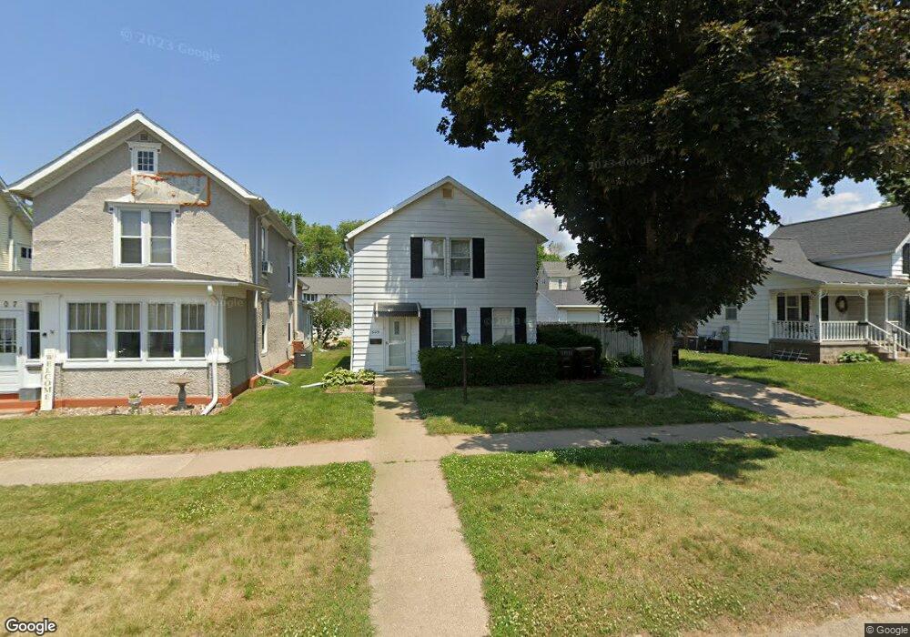
609 12th Ave Fulton, IA 61252
Estimated Value: $96,189 - $157,000
--
Bed
2
Baths
--
Sq Ft
5,358
Sq Ft Lot
About This Home
This home is located at 609 12th Ave, Fulton, IA 61252 and is currently estimated at $123,797. 609 12th Ave is a home located in Whiteside County with nearby schools including Fulton Elementary School, River Bend Middle School, and Fulton High School.
Ownership History
Date
Name
Owned For
Owner Type
Purchase Details
Closed on
Sep 27, 2024
Sold by
Lehne Veronica M and Miller Adam
Bought by
Fountain Robert D
Current Estimated Value
Purchase Details
Closed on
Jan 28, 2008
Sold by
Pestka James J and Pestka Valerie L
Bought by
Lehne Veronica M
Home Financials for this Owner
Home Financials are based on the most recent Mortgage that was taken out on this home.
Original Mortgage
$61,200
Interest Rate
6.17%
Mortgage Type
New Conventional
Create a Home Valuation Report for This Property
The Home Valuation Report is an in-depth analysis detailing your home's value as well as a comparison with similar homes in the area
Home Values in the Area
Average Home Value in this Area
Purchase History
| Date | Buyer | Sale Price | Title Company |
|---|---|---|---|
| Fountain Robert D | $48,500 | First American Title | |
| Lehne Veronica M | $76,500 | None Available |
Source: Public Records
Mortgage History
| Date | Status | Borrower | Loan Amount |
|---|---|---|---|
| Previous Owner | Lehne Veronica M | $61,200 |
Source: Public Records
Tax History Compared to Growth
Tax History
| Year | Tax Paid | Tax Assessment Tax Assessment Total Assessment is a certain percentage of the fair market value that is determined by local assessors to be the total taxable value of land and additions on the property. | Land | Improvement |
|---|---|---|---|---|
| 2024 | $2,830 | $35,300 | $3,561 | $31,739 |
| 2023 | $2,621 | $32,661 | $3,295 | $29,366 |
| 2022 | $2,490 | $29,945 | $3,021 | $26,924 |
| 2021 | $2,444 | $29,229 | $2,949 | $26,280 |
| 2020 | $2,527 | $30,254 | $3,052 | $27,202 |
| 2019 | $2,564 | $30,206 | $3,047 | $27,159 |
| 2018 | $1,947 | $29,346 | $2,960 | $26,386 |
| 2017 | $1,950 | $29,224 | $2,948 | $26,276 |
| 2016 | $1,904 | $28,572 | $2,882 | $25,690 |
| 2015 | $1,761 | $27,543 | $2,778 | $24,765 |
| 2014 | $1,794 | $27,868 | $2,811 | $25,057 |
| 2013 | $1,761 | $27,543 | $2,778 | $24,765 |
Source: Public Records
Map
Nearby Homes