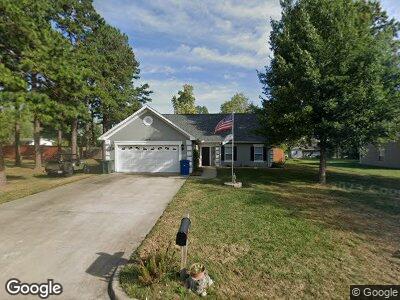
609 Canterbury Dr Fulton, MO 65251
Estimated Value: $248,000 - $284,000
3
Beds
2
Baths
1,641
Sq Ft
$158/Sq Ft
Est. Value
About This Home
This home is located at 609 Canterbury Dr, Fulton, MO 65251 and is currently estimated at $260,051, approximately $158 per square foot. 609 Canterbury Dr is a home located in Callaway County with nearby schools including Fulton Senior High School, St. Peter Catholic School, and Kingdom Christian Academy.
Ownership History
Date
Name
Owned For
Owner Type
Purchase Details
Closed on
Aug 5, 2019
Sold by
Smith L Patrick and Smith Gloria J
Bought by
Colgrove Philip B and Colgrove Susan K
Current Estimated Value
Home Financials for this Owner
Home Financials are based on the most recent Mortgage that was taken out on this home.
Original Mortgage
$140,350
Outstanding Balance
$124,997
Interest Rate
3.8%
Mortgage Type
Stand Alone Refi Refinance Of Original Loan
Estimated Equity
$129,203
Purchase Details
Closed on
Jan 5, 2006
Sold by
Batrano Christopher J and Batrano Patricia E
Bought by
Smith L Patrick L and Smith Gloria
Home Financials for this Owner
Home Financials are based on the most recent Mortgage that was taken out on this home.
Original Mortgage
$61,000
Interest Rate
6.15%
Mortgage Type
Credit Line Revolving
Create a Home Valuation Report for This Property
The Home Valuation Report is an in-depth analysis detailing your home's value as well as a comparison with similar homes in the area
Home Values in the Area
Average Home Value in this Area
Purchase History
| Date | Buyer | Sale Price | Title Company |
|---|---|---|---|
| Colgrove Philip B | -- | -- | |
| Smith L Patrick L | -- | -- |
Source: Public Records
Mortgage History
| Date | Status | Borrower | Loan Amount |
|---|---|---|---|
| Open | Colgrove Philip B | $67,747 | |
| Open | Smith L Patrick | $140,350 | |
| Previous Owner | Smith L Patrick | $61,000 |
Source: Public Records
Tax History Compared to Growth
Tax History
| Year | Tax Paid | Tax Assessment Tax Assessment Total Assessment is a certain percentage of the fair market value that is determined by local assessors to be the total taxable value of land and additions on the property. | Land | Improvement |
|---|---|---|---|---|
| 2024 | $1,656 | $26,775 | $0 | $0 |
| 2023 | $1,656 | $26,300 | $0 | $0 |
| 2022 | $1,619 | $26,300 | $2,417 | $23,883 |
| 2021 | $1,617 | $26,300 | $2,417 | $23,883 |
| 2020 | $1,640 | $26,300 | $2,417 | $23,883 |
| 2019 | $1,586 | $26,300 | $2,417 | $23,883 |
| 2018 | $1,641 | $26,300 | $2,417 | $23,883 |
| 2017 | $1,459 | $26,300 | $2,417 | $23,883 |
| 2016 | $1,404 | $24,260 | $0 | $0 |
| 2015 | $1,373 | $24,260 | $0 | $0 |
| 2014 | -- | $24,260 | $0 | $0 |
Source: Public Records
Map
Nearby Homes
- 751 E Street Eunice Rd
- 751 E Saint Eunice Rd
- 910 E Street Eunice Rd
- 493 Sabre Cir
- 105 Glover St
- 3300 Richland Heights Rd
- 0 William Woods Ave
- 1705 Westminster Ave
- TBD Haddley Lee Dr
- 4 Halley Ct
- 0 Haddley Lee Dr
- 301 W 14th St
- 1404 Westminster Ave
- 1012 N Bluff St
- 1010 Wood St
- 1311 Sioux Dr
- 1103 Sioux Dr
- 109 Bartley Ln
- 609 Canterbury Dr
- 613 Canterbury Dr
- 605 Canterbury Dr
- 608 E Saint Eunice Rd
- 608 E Street Eunice Rd
- 612 E Saint Eunice Rd
- 604 E Saint Eunice Rd
- 607 Mcneal Ln
- 612 Canterbury Dr
- 2531 Essex Dr
- 601 Canterbury Dr
- 614 Canterbury Dr
- 616 E Street Eunice Rd
- 616 E Saint Eunice Rd
- 606 Mcneal Ln
- 600 E Saint Eunice Rd
- #43 Canterbury Dr
- 611 Mcneal Ln
- 616 Canterbury Dr
- 610 Mcneal Ln