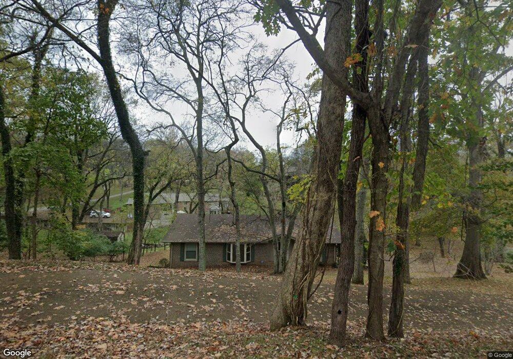
609 Confederate Cir Old Hickory, TN 37138
Estimated Value: $484,000 - $614,000
--
Bed
2
Baths
1,763
Sq Ft
$309/Sq Ft
Est. Value
About This Home
This home is located at 609 Confederate Cir, Old Hickory, TN 37138 and is currently estimated at $545,485, approximately $309 per square foot. 609 Confederate Cir is a home located in Wilson County with nearby schools including Lakeview Elementary School, Mt. Juliet Middle School, and Green Hill High School.
Ownership History
Date
Name
Owned For
Owner Type
Purchase Details
Closed on
Aug 23, 2000
Sold by
William Anderson James
Bought by
Anderson James W
Current Estimated Value
Purchase Details
Closed on
Jan 13, 2000
Sold by
Harward Diana L
Bought by
Chase Manhattan Bank
Purchase Details
Closed on
Oct 20, 1997
Sold by
Tate Ann J
Bought by
Harward and Randall
Purchase Details
Closed on
Mar 9, 1990
Bought by
Tate Ann J
Purchase Details
Closed on
Apr 19, 1989
Bought by
Fultz Jack A and Fultz Joyce A
Purchase Details
Closed on
Apr 26, 1972
Bought by
Tate Ann J
Create a Home Valuation Report for This Property
The Home Valuation Report is an in-depth analysis detailing your home's value as well as a comparison with similar homes in the area
Home Values in the Area
Average Home Value in this Area
Purchase History
| Date | Buyer | Sale Price | Title Company |
|---|---|---|---|
| Anderson James W | $80,000 | -- | |
| Chase Manhattan Bank | $169,901 | -- | |
| Harward | $125,500 | -- | |
| Tate Ann J | -- | -- | |
| Fultz Jack A | $153,900 | -- | |
| Tate Ann J | -- | -- |
Source: Public Records
Tax History Compared to Growth
Tax History
| Year | Tax Paid | Tax Assessment Tax Assessment Total Assessment is a certain percentage of the fair market value that is determined by local assessors to be the total taxable value of land and additions on the property. | Land | Improvement |
|---|---|---|---|---|
| 2024 | $1,845 | $96,650 | $43,750 | $52,900 |
| 2022 | $1,845 | $96,650 | $43,750 | $52,900 |
| 2021 | $1,845 | $96,650 | $43,750 | $52,900 |
| 2020 | $2,055 | $96,650 | $43,750 | $52,900 |
| 2019 | $2,055 | $81,575 | $38,525 | $43,050 |
| 2018 | $2,055 | $81,575 | $38,525 | $43,050 |
| 2017 | $2,055 | $81,575 | $38,525 | $43,050 |
| 2016 | $2,055 | $81,575 | $38,525 | $43,050 |
| 2015 | $2,097 | $81,575 | $38,525 | $43,050 |
| 2014 | $1,881 | $73,168 | $0 | $0 |
Source: Public Records
Map
Nearby Homes
- 313 Hollywood Dr
- 521 General Kershaw Dr
- 4815 Quail Hollow Dr
- 4826 Quail Hollow Dr
- 4858 Quail Run
- 231 Green Harbor Rd Unit 69
- 231 Green Harbor Rd Unit 6F
- 231 Green Harbor Rd Unit 113A
- 4157 Brandywine Pointe Blvd
- 4610 Woodside Dr
- 1001 Williams Way
- 208 Lowell Ct
- 240 Green Harbor Rd
- 5128 Brittany Dr
- 2105 Chels Way
- 366 Green Harbor Rd
- 1320 Autumn Springs Ln
- 1033 Wyntergrace Farm Rd
- 4016 Brandywine Pointe Blvd
- 116 Greenwich Ct
- 700 General Kershaw Dr
- 607 Confederate Cir
- 614 Confederate Cir
- 612 Confederate Cir
- 704 General Kershaw Dr
- 613 Confederate Cir
- 620 Confederate Cir
- 600 Bedford Forest Ct
- 604 Bedford Forest Ct
- 615 Confederate Cir
- 606 Confederate Cir
- 606 Bedford Forest Ct
- 622 Confederate Cir
- 611 Confederate Cir
- 609 Bedford Forest Ct
- 608 Bedford Forest Ct
- 600 Confederate Cir
- 635 Rebel Rd
- 625 Rebel Rd
- 607 Rebel Rd