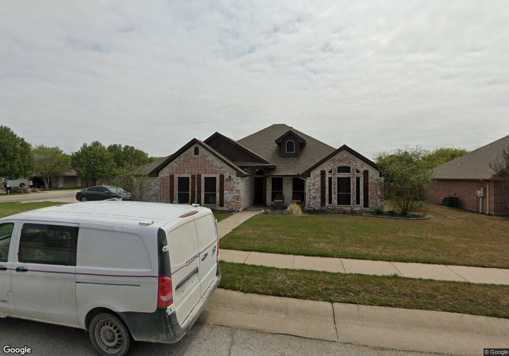
609 Maple Dr Pilot Point, TX 76258
Estimated Value: $338,000 - $387,000
3
Beds
2
Baths
1,842
Sq Ft
$195/Sq Ft
Est. Value
About This Home
This home is located at 609 Maple Dr, Pilot Point, TX 76258 and is currently estimated at $359,400, approximately $195 per square foot. 609 Maple Dr is a home located in Denton County with nearby schools including Pilot Point Early Childhood Center, Pilot Point Elementary School, and Pilot Point Middle School.
Ownership History
Date
Name
Owned For
Owner Type
Purchase Details
Closed on
Dec 12, 2017
Sold by
Jones Connie
Bought by
Helton Eric and Helton Tonia
Current Estimated Value
Home Financials for this Owner
Home Financials are based on the most recent Mortgage that was taken out on this home.
Original Mortgage
$172,000
Outstanding Balance
$144,809
Interest Rate
3.94%
Mortgage Type
New Conventional
Estimated Equity
$214,591
Purchase Details
Closed on
Sep 10, 2014
Sold by
Marlau Investments Inc
Bought by
Jones Jerry and Jones Connie
Purchase Details
Closed on
Jun 6, 2014
Sold by
Nationstar Mortgage Llc
Bought by
Marlau Investments Inc
Purchase Details
Closed on
Feb 4, 2014
Sold by
Koerner Charlotte and Koerner Leroy
Bought by
Nationstar Mortgage Llc
Purchase Details
Closed on
Aug 31, 2001
Sold by
Evans Edgar
Bought by
Koerner Charlotte and Koerner Leroy
Home Financials for this Owner
Home Financials are based on the most recent Mortgage that was taken out on this home.
Original Mortgage
$112,000
Interest Rate
12.7%
Create a Home Valuation Report for This Property
The Home Valuation Report is an in-depth analysis detailing your home's value as well as a comparison with similar homes in the area
Home Values in the Area
Average Home Value in this Area
Purchase History
| Date | Buyer | Sale Price | Title Company |
|---|---|---|---|
| Helton Eric | -- | Lawyers Title | |
| Jones Jerry | -- | None Available | |
| Marlau Investments Inc | -- | None Available | |
| Nationstar Mortgage Llc | $196,804 | None Available | |
| Koerner Charlotte | -- | First American Title Co |
Source: Public Records
Mortgage History
| Date | Status | Borrower | Loan Amount |
|---|---|---|---|
| Open | Helton Eric | $172,000 | |
| Previous Owner | Koerner Charlotte | $112,000 |
Source: Public Records
Tax History
| Year | Tax Paid | Tax Assessment Tax Assessment Total Assessment is a certain percentage of the fair market value that is determined by local assessors to be the total taxable value of land and additions on the property. | Land | Improvement |
|---|---|---|---|---|
| 2025 | $5,063 | $349,559 | $94,860 | $254,699 |
| 2024 | $6,099 | $338,764 | $0 | $0 |
| 2023 | $4,691 | $307,967 | $94,860 | $286,970 |
| 2022 | $5,756 | $279,970 | $83,700 | $227,630 |
| 2021 | $5,251 | $254,518 | $60,822 | $193,696 |
| 2020 | $5,042 | $242,688 | $60,822 | $181,866 |
| 2019 | $5,325 | $248,570 | $60,822 | $187,748 |
| 2018 | $5,029 | $231,784 | $60,822 | $170,962 |
| 2017 | $4,226 | $194,238 | $48,546 | $159,639 |
| 2016 | $3,842 | $176,580 | $39,060 | $137,520 |
| 2015 | $2,868 | $166,957 | $39,060 | $127,897 |
| 2013 | -- | $155,373 | $39,060 | $116,313 |
Source: Public Records
Map
Nearby Homes
- 1301 N Saint Charles Ave
- 604 Cedar Dr
- 792 E Northside Dr
- 561 Randys Way
- 710 Primrose Ln
- 0000 N Washington St
- 597 Mb's Way
- 589 Mb's Way
- 729 Amelia Ct
- 626 Ruthye Ln
- 723 Primrose Ln
- 551 Ruthye Ln
- 829 Primrose Ln
- 467 Mb's Way
- 736 Carson Ln
- 754 Carson Ln
- 449 Mb's Way
- 443 Mb's Way
- 812 Primrose Ln
- 437 Mb's Way
Your Personal Tour Guide
Ask me questions while you tour the home.