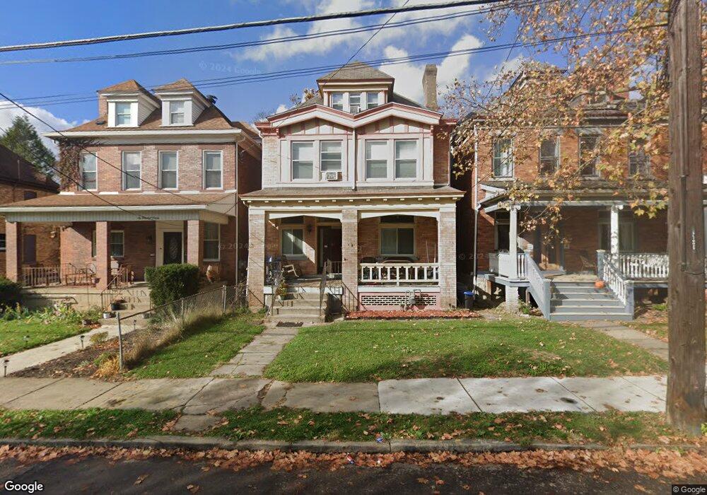
609 N Euclid Ave Pittsburgh, PA 15206
East Liberty NeighborhoodEstimated Value: $114,464 - $753,000
6
Beds
3
Baths
2,470
Sq Ft
$184/Sq Ft
Est. Value
About This Home
This home is located at 609 N Euclid Ave, Pittsburgh, PA 15206 and is currently estimated at $455,366, approximately $184 per square foot. 609 N Euclid Ave is a home with nearby schools including Colfax K-8, Westinghouse High School, and Environmental Charter School.
Ownership History
Date
Name
Owned For
Owner Type
Purchase Details
Closed on
May 2, 2005
Sold by
Byrd Larry
Bought by
Latimore Shelley
Current Estimated Value
Home Financials for this Owner
Home Financials are based on the most recent Mortgage that was taken out on this home.
Original Mortgage
$48,000
Outstanding Balance
$25,204
Interest Rate
5.95%
Mortgage Type
New Conventional
Estimated Equity
$430,162
Purchase Details
Closed on
Aug 11, 1995
Sold by
Lavalle Robert B and Lavelle Gwendolyn H
Bought by
Byrd Larry
Create a Home Valuation Report for This Property
The Home Valuation Report is an in-depth analysis detailing your home's value as well as a comparison with similar homes in the area
Home Values in the Area
Average Home Value in this Area
Purchase History
| Date | Buyer | Sale Price | Title Company |
|---|---|---|---|
| Latimore Shelley | $49,000 | -- | |
| Byrd Larry | $35,000 | -- |
Source: Public Records
Mortgage History
| Date | Status | Borrower | Loan Amount |
|---|---|---|---|
| Open | Latimore Shelley | $48,000 |
Source: Public Records
Tax History Compared to Growth
Tax History
| Year | Tax Paid | Tax Assessment Tax Assessment Total Assessment is a certain percentage of the fair market value that is determined by local assessors to be the total taxable value of land and additions on the property. | Land | Improvement |
|---|---|---|---|---|
| 2025 | $3,030 | $131,500 | $38,800 | $92,700 |
| 2024 | $3,030 | $131,500 | $38,800 | $92,700 |
| 2023 | $3,030 | $131,500 | $38,800 | $92,700 |
| 2022 | $2,990 | $131,500 | $38,800 | $92,700 |
| 2021 | $2,926 | $131,500 | $38,800 | $92,700 |
| 2020 | $2,976 | $131,500 | $38,800 | $92,700 |
| 2019 | $2,976 | $131,500 | $38,800 | $92,700 |
| 2018 | $2,294 | $131,500 | $38,800 | $92,700 |
| 2017 | $2,976 | $131,500 | $38,800 | $92,700 |
| 2016 | $622 | $131,500 | $38,800 | $92,700 |
| 2015 | $622 | $131,500 | $38,800 | $92,700 |
| 2014 | $2,910 | $131,500 | $38,800 | $92,700 |
Source: Public Records
Map
Nearby Homes
- 5712 Hays St
- 613 N Beatty St
- 609 N Beatty St
- 715 N Beatty St
- 528 Mellon St
- 521 Mellon St
- 624 N Negley Ave
- 630 N Negley Ave
- 731 Mellon St
- 00 Mellon Mellon St
- 5620 Stanton Ave
- 5548 Hays St Unit 1
- 822 N Euclid Ave
- 406 N Beatty St
- 835 N Saint Clair St
- 5611 Stanton Ave
- 5822 Rippey St
- 6026 Stanton Ave
- 828 Mellon St
- 811 Farragut St
- 607 N Euclid Ave
- 611 N Euclid Ave
- 613 N Euclid Ave
- 615 N Euclid Ave
- 603 N Euclid Ave
- 601 N Euclid Ave
- 617 N Euclid Ave
- 608 N Saint Clair St
- 610 N Saint Clair St
- 606 N Saint Clair St
- 619 N Euclid Ave
- 612 N Saint Clair St
- 604 N Euclid Ave
- 604 N Saint Clair St
- 533 N Euclid Ave
- 614 N Saint Clair St
- 606 N Euclid Ave
- 602 N Saint Clair St
- 602 N Euclid Ave
- 610 N Euclid Ave