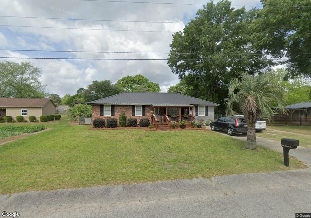
609 Robson St Manning, SC 29102
Estimated Value: $113,996 - $171,000
Studio
--
Bath
1,440
Sq Ft
$95/Sq Ft
Est. Value
About This Home
This home is located at 609 Robson St, Manning, SC 29102 and is currently estimated at $137,499, approximately $95 per square foot. 609 Robson St is a home with nearby schools including Laurence Manning Academy.
Ownership History
Date
Name
Owned For
Owner Type
Purchase Details
Closed on
Aug 28, 2023
Sold by
Gamble Tony L
Bought by
Duke Richard E
Current Estimated Value
Purchase Details
Closed on
Feb 28, 2018
Sold by
Joseph George L and Joseph Kaye C
Bought by
Duke Richard E
Create a Home Valuation Report for This Property
The Home Valuation Report is an in-depth analysis detailing your home's value as well as a comparison with similar homes in the area
Home Values in the Area
Average Home Value in this Area
Purchase History
| Date | Buyer | Sale Price | Title Company |
|---|---|---|---|
| Duke Richard E | $1,000 | None Listed On Document | |
| Duke Richard E | $55,000 | -- |
Source: Public Records
Tax History
| Year | Tax Paid | Tax Assessment Tax Assessment Total Assessment is a certain percentage of the fair market value that is determined by local assessors to be the total taxable value of land and additions on the property. | Land | Improvement |
|---|---|---|---|---|
| 2025 | $699 | $2,184 | $360 | $1,824 |
| 2024 | $699 | $2,184 | $360 | $1,824 |
| 2023 | $672 | $2,184 | $360 | $1,824 |
| 2022 | $666 | $2,184 | $360 | $1,824 |
| 2021 | $646 | $2,192 | $360 | $1,832 |
| 2020 | $646 | $2,192 | $360 | $1,832 |
| 2019 | $617 | $2,192 | $360 | $1,832 |
| 2018 | $1,824 | $4,026 | $0 | $0 |
| 2017 | $1,802 | $4,026 | $0 | $0 |
| 2016 | $1,794 | $4,026 | $0 | $0 |
| 2015 | $1,764 | $4,164 | $540 | $3,624 |
| 2014 | $1,754 | $4,164 | $540 | $3,624 |
| 2013 | -- | $2,776 | $360 | $2,416 |
Source: Public Records
Map
Nearby Homes
- 126 Hillcrest St
- TBD S Carolina 260
- 610 Gib Dr
- 408 Toccoa Dr
- 138 Nelson Cir
- 617 Pickwood Dr
- 623 Pickwood Dr
- 202 E Huggins St
- 1480 Country Club Cir
- 250 Dyson St
- 200 W Boyce St
- 5301 Cypress Pointe #D301
- 1121 Mulligan Dr
- 1107 Mulligan Dr
- 1085 Birdie Ct
- 1162 Mulligan Dr
- 1156 Mulligan Dr
- 633 Sykes St
- 1022 Mulligan Dr
- 1076 Mulligan Dr
- 605 Robson St
- 101 Hillcrest St
- 105 Hillcrest St
- 108 Gibbons St
- 109 Hillcrest St
- 601 Robson St
- 112 Gibbons St
- 114 Gibbons St
- 619 S Mill St
- 111 Hillcrest St
- 102 Hillcrest St
- 104 Hillcrest St
- 617 S Mill St
- 106 Hillcrest St
- 118 Gibbons St
- 113 Hillcrest St
- 108 Hillcrest St
- 545 S Boundary St
- 539 Furling Ave
- 122 Gibbons St
Your Personal Tour Guide
Ask me questions while you tour the home.